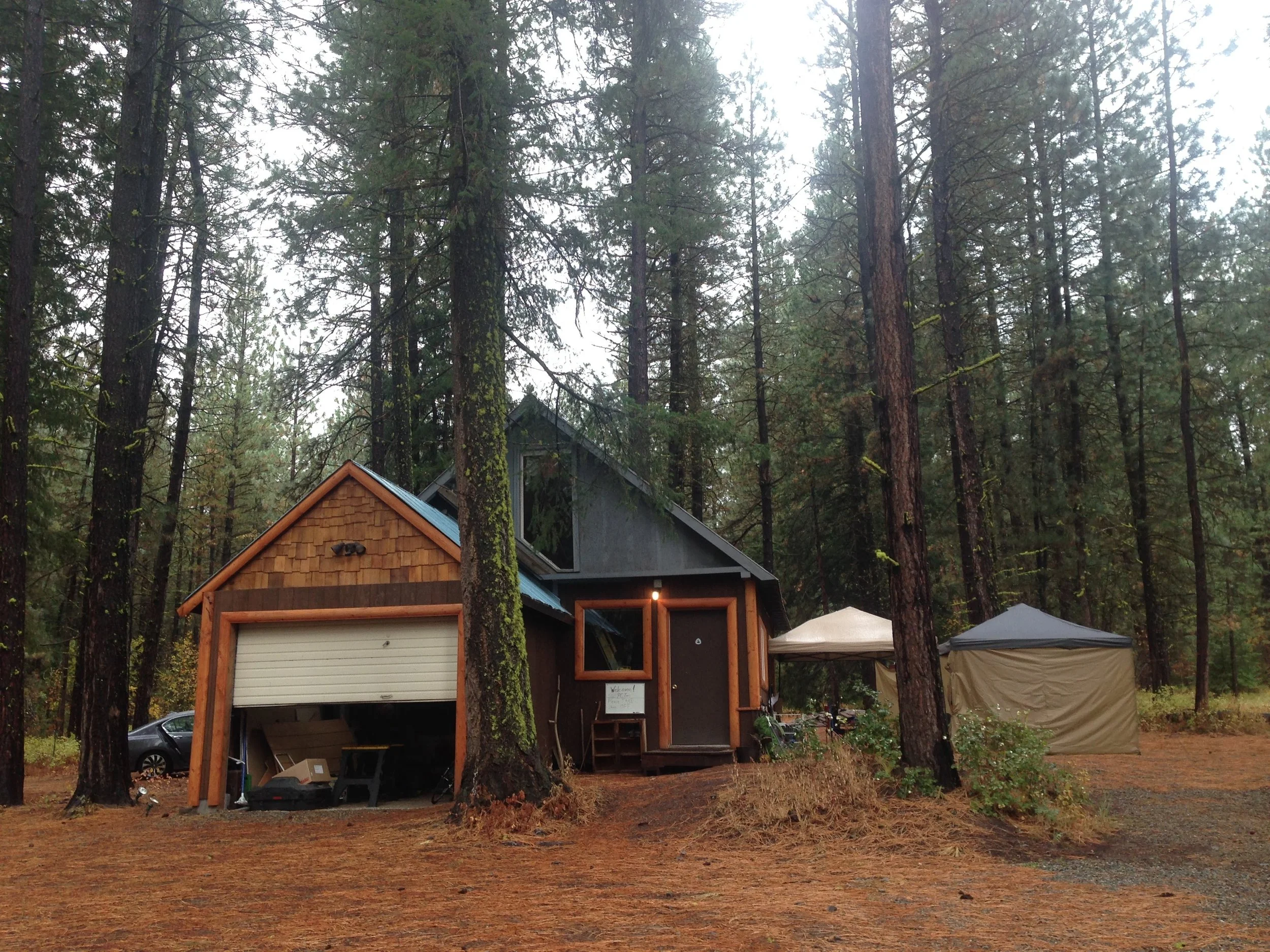
Etna to Ashland
Hitching out of Edna in the morning is not as easy as we thought. After almost one hour standing in front of the Hiker Hut hostel…
DAY 115 (August 25)
To Marble Valley Campground
24.1 miles
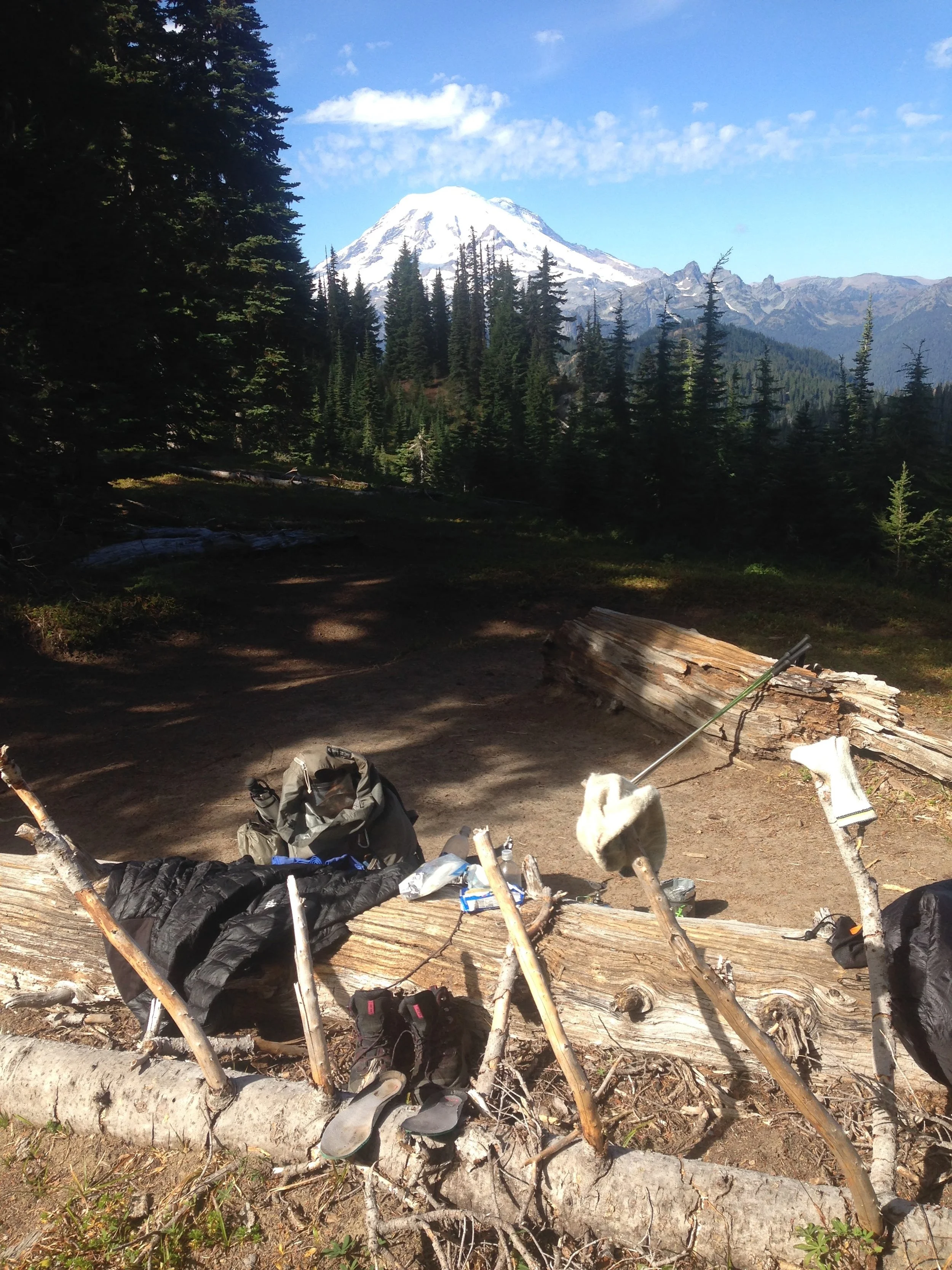
Hitching out of Edna in the morning is not as easy as we thought. After almost one hour standing in front of the Hiker Hut hostel, 2 young guys stop and give us a ride back to the summit. They are doing a study on one of the rivers in the area and are on the way “into the field”.
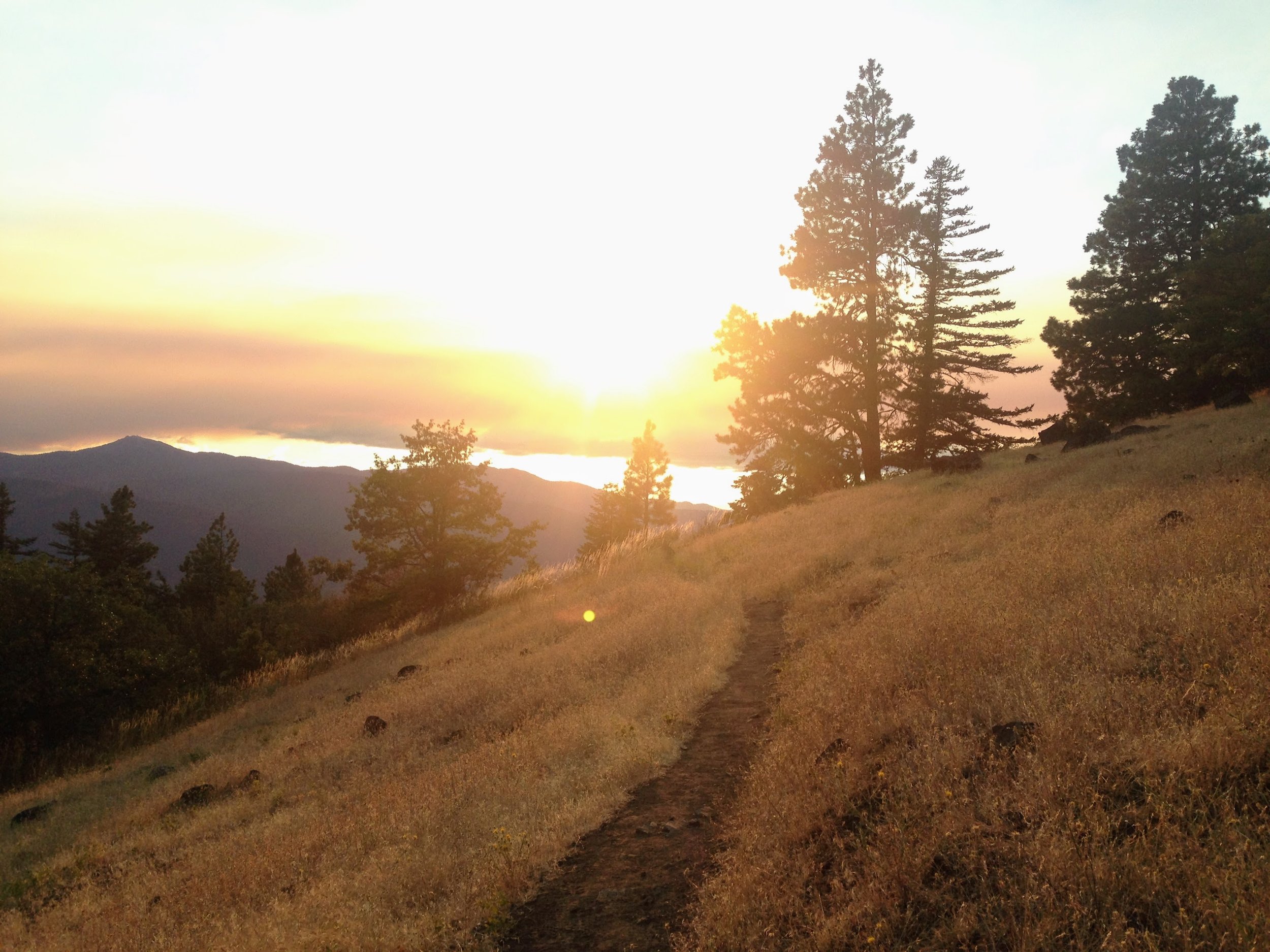
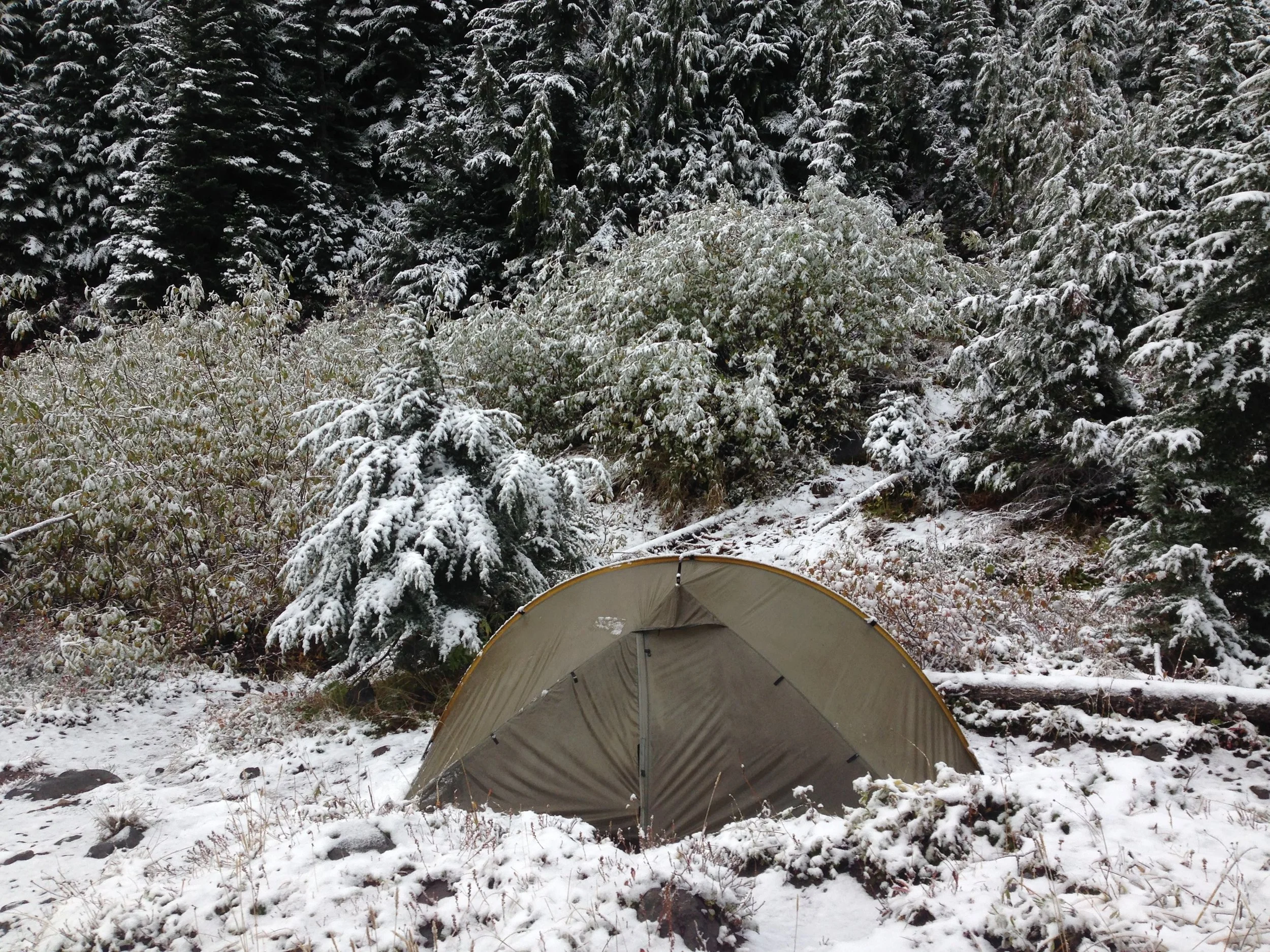
Although I often find it hard to get into the rhythm after a town day, the first 10 miles pass by relatively rapidly. The afternoon is not that easy: a lot of steep up and downs over rocks and stairs. Very exhausting but we manage to do 24 miles in the end. Not bad for a day with a late start! And we see mama bear and a cub down in the meadow on the last 2 miles before arriving at camp!
DAY 116 (August 26) | Oregon I can feel you
To Grider Creek Campground
25.7 miles
The day starts with a few ups and downs and then a steeper climb before it gets pretty flat. It is a beautiful walk - partly shady, partly sunny - and I suddenly feel very happy to be on this trail still. From now on it will be gradually going downhill until Seiad Valley.
Walking is very easy and I decide to have breakfast after not more than 10 miles under a giant tree. A female southbound hiker joins and I ask her about the steep climb coming up after Seiad Valley. She had done it both ways already (did trail northbound last year) and says it's “hell both ways” but doable.
Leapfrogging with Mishap and Jazzman all afternoon. The trail follows the Grider Creek all afternoon and while Mishap decides to stay a bit further up the river (and I guess Bubble Boy might too), I decide to go to the last campground before Seiad Valley where I met King Arthur again and a few Southbounders. Still, 7 miles to go into town including quite a bit of road walking.
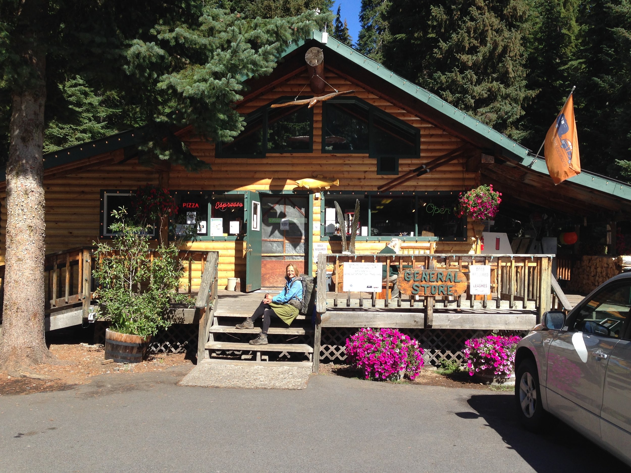
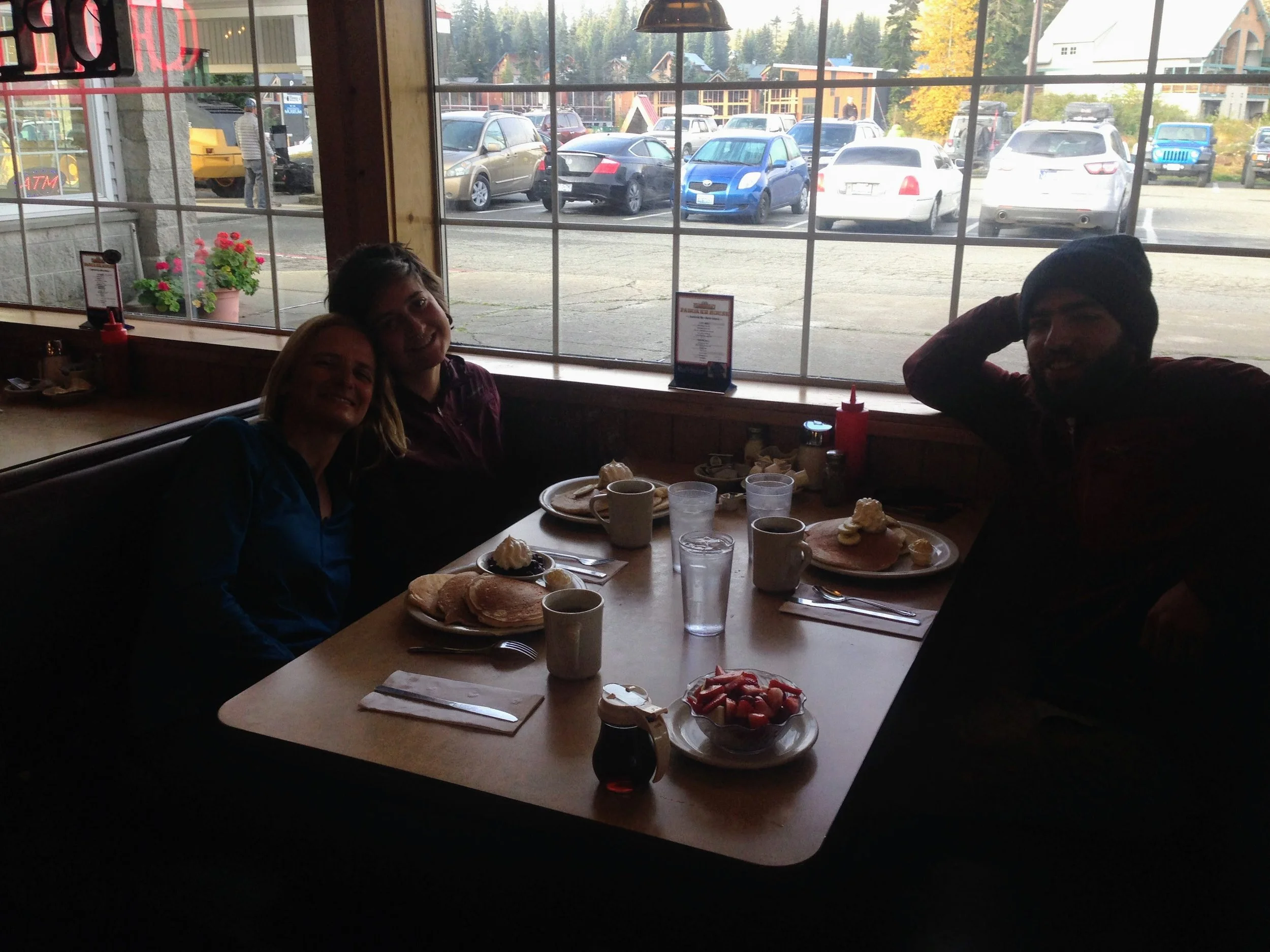
DAY 117 (August 27) | Seiad Valley
To Tentsite mile 1671
24.1 miles
Easy walk into Seiad Valley. I leave camp at 6.15 and get there by 8 am. The last 1.5 miles are road walk on a highway without much traffic at that time. When I reach the bridge over the Klamath River, I hear a car approaching and turn around. A guy with a pickup truck (and a big dog on the passenger seat) stops and with his hand makes a gesture inviting me to hop on in the back. I do so and within 5 minutes I am in town at the RV park which is right next to the general store and post office. Some hikers hang out there; Sunshine and Jammin whom I haven't seen since Reds Meadows and a few others.
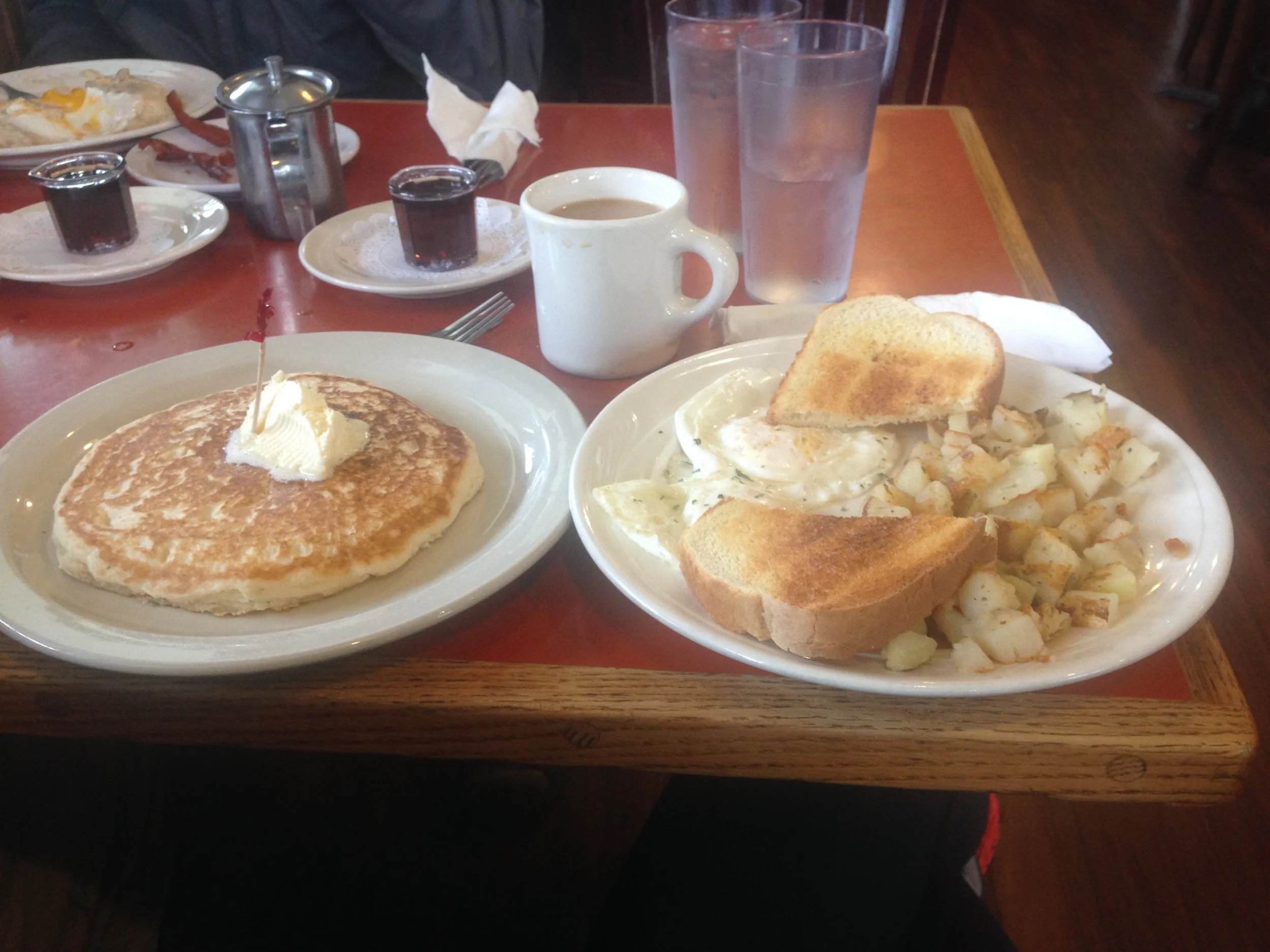
It is Seiad day today, some kind of festival in the tiny town. With some other hikers, I head to the fire station where there is breakfast: pancakes and coffee for just 1 dollar.
I want to leave as soon as possible in order to start the upcoming big climb before it gets very hot but I chat here and there with some hikers and locals and I finally leave town at 11.
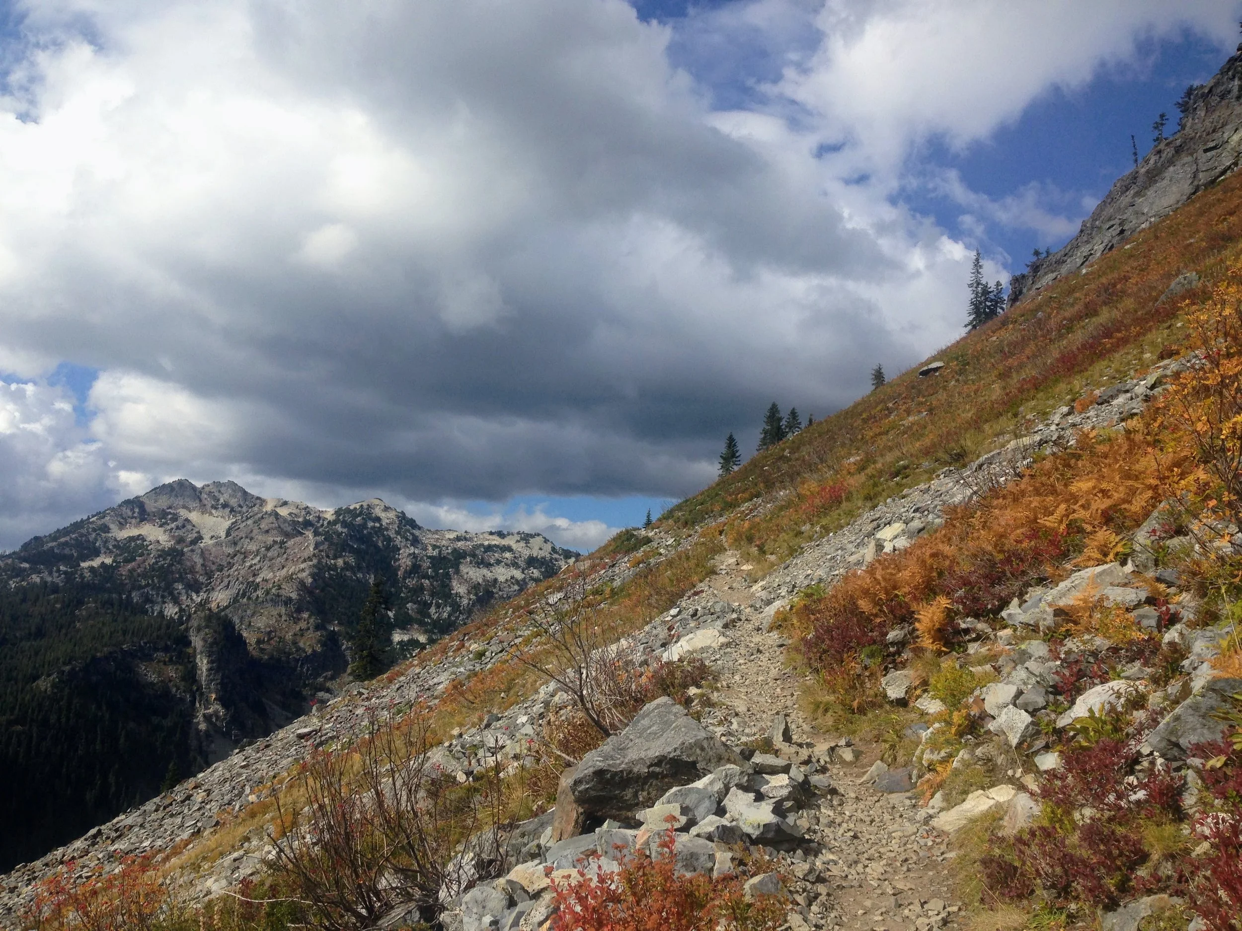
It is a long and partly steep climb, 5.000ft elevation gain over 5 miles, but not as hard as initially expected. I arrive at the top at 3 p.m. and then continue to walk another 12 miles.
When I set up my tent, I notice the difference in temperature: yesterday so hot that I did not want to use either my sleeping bag or sleeping clothes, today I gladly use both.

DAY 117 (August 28) | Oregon Calling
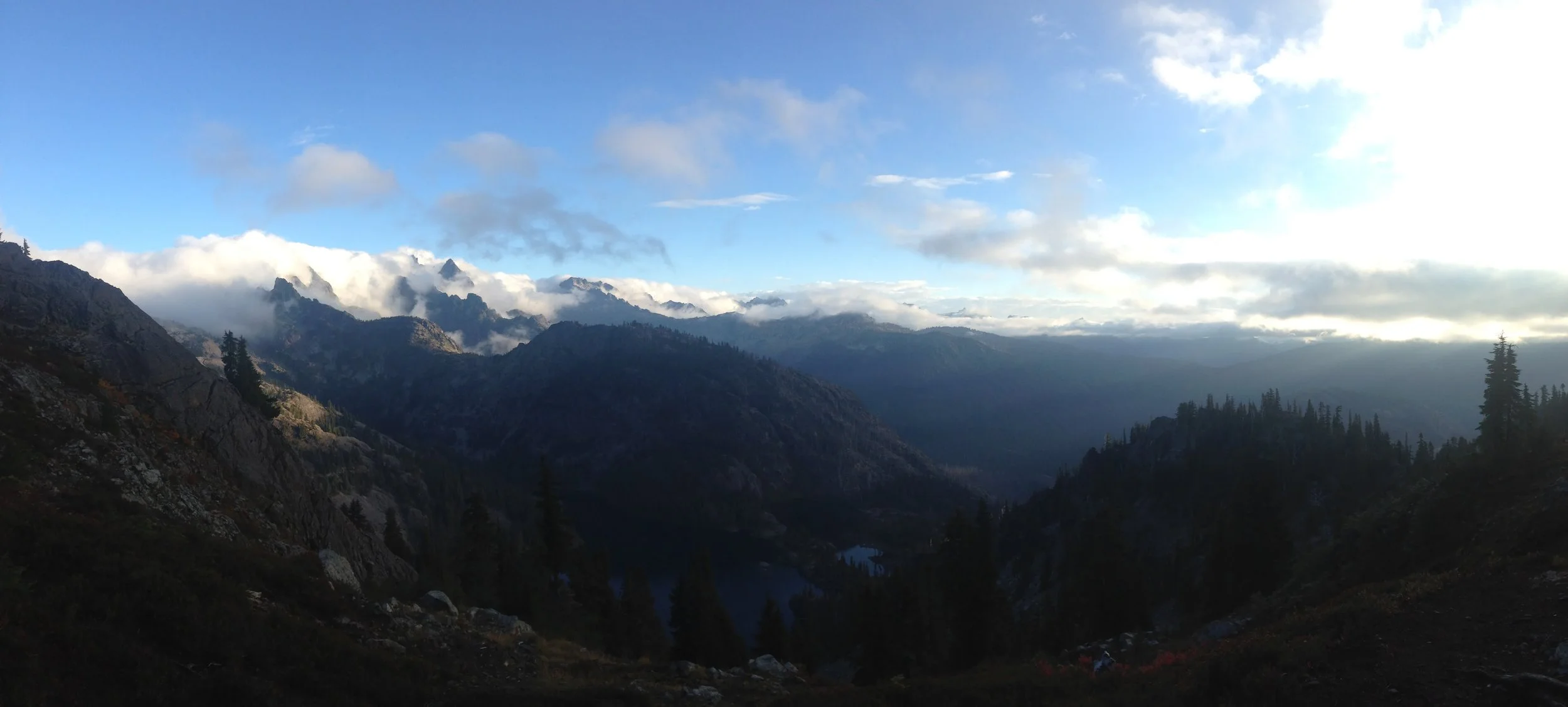
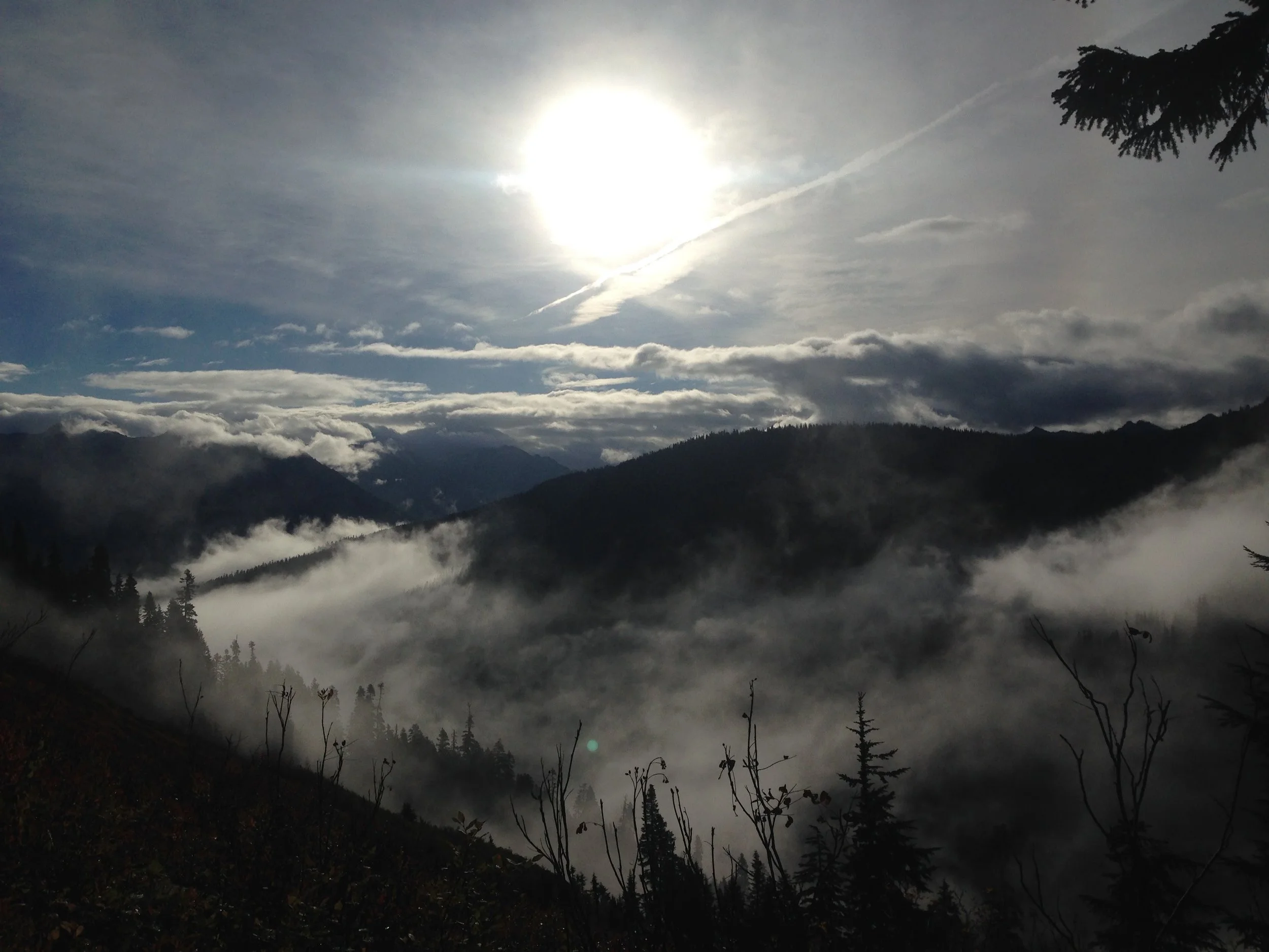
I wake up and it smells like there is some campfire around but it seems that this still is yesterday's forest fire. Does that mean that it has not been successfully extinguished?
As I walk further up and get a few into the valley, it is completely covered with clouds. Or is that smoke? Or a mix of both?
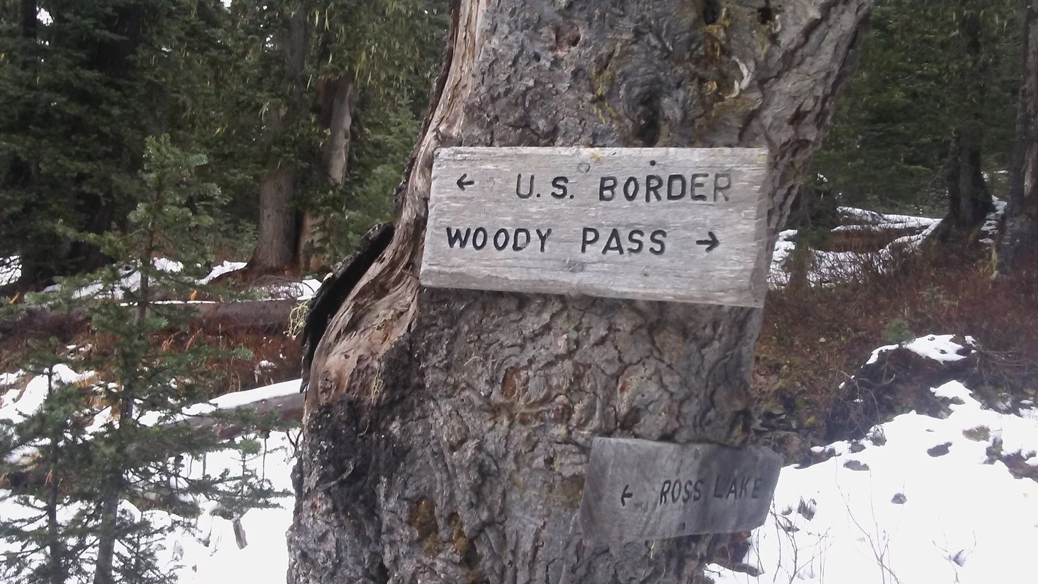
After my morning break at 10.30, I start flying: only 9 miles left to the California-Oregon-border!

I reach the border (which is basically a sign nailed onto a tree) at 3.30 p.m. I check the register and see that Listen & Squirrel had passed about a week ago. That's so funny to see because I had completely forgotten about them and then this morning I was wondering if they were still on trail.
Initially, I wanted to have lunch right there but there is not much space to sit so I walk a bit further up the trail until I find a nice spot below a tree. There are two or three yellow jackets but I think they will not be a problem. One is repeatedly flying under my skirt though and I take extra care not to close my legs but at one point it stings me in the back of my upper leg.
There are no campsites indicated in guthocks for the next few miles but I find a spot after a ridge with two other northbound hikers around 7.30 p.m.
As the sun goes down, the sky turns into a mix of purple-dark-pink-grey due to the fire in the other valley.
DAY 118 (August 29) | Running into town
To Callahan lodge/Ashland
18 Miles
DAY 119 (August 30) | Zero-day Ashland
0 miles

Ashland to Crater Lake
The temperature was significantly different too compared to previous days and especially compared to NorCal. During my first break I realized that for the first time I was not looking for …
DAY 120 (August 31)
To Little Hyatt Reservoir Outlet
21.9 miles
DAY 121 (September 1) | All flat
To South Brown Mountain Shelter
21.1 miles
Started walking at 6.30. It was a flat and easy walk and I had done 10 miles by 10.30.
The temperature was significantly different too compared to previous days and especially compared to NorCal. During my first break, I realized that for the first time, I was not looking for shade but rather for a sunny spot to sit.
Felt quite tired all day although I had slept well last night, guess I just did not get enough sleep while in Ashland.
Around 6 pm, I got to the shelter where initially I only wanted to get water. A local biker who was there already made tea and offered me one too.
As I had been so tired all day, I felt that getting some more sleep tonight would not be a bad idea so I set up camp there. Jamie, Sydney, and Frogman with whom I had camped the night before arrived later.
DAY 122 (September 2)
To Tentsite Mile 1788
27.1 miles
It was pretty chilly last night and I was using my liner for the first time since the Sierra. The sky was covered with clouds and it looked like they were there to stay all day.
I started hiking in my puffy towards the next water source in 10 miles and when I arrived there at 10 am I saw Giggles sitting there to my surprise. We had a coffee together and then both hiked on. I felt cold pretty soon during that break although it was not very long. it's September and fall is about to arrive!
Luckily the sun came out later and I could use my solar charger again to charge my phone. Otherwise, I would not have had access to any kind of map as I left my paper maps in Ashland. Not a good idea!
DAY 123 (September 3) | Logs everywhere!
To Tentsite Mile 1813
25.2 miles

I started my day on the trail with a breakfast break, accompanied by Sunshine and Giggles. While we basked in the morning sun, I took the opportunity to dry my sleeping bag, which had collected some early morning dampness.
The trail ahead was relatively flat, but we encountered a considerable number of fallen trees obstructing our path, adding even more adventure to our journey. As I hiked, my mind wandered to the unpredictable Washington weather, which had been a topic of concern for many hikers on the trail.
A sudden realization hit me - my trusty hiking shoes had developed a hole already. In need of a replacement, I made plans to stop by REI in Bent at the next opportunity. Our day concluded with a decent campsite, six miles out of Mazama Village, where Giggles and I set up camp and shared a hearty dinner together.

DAY 124 (September 4)
Arriving at Mazama Village, where I had sent a resupply box, I made my way to the general store. To my pleasant surprise, I ran into Eric and Bill near the coffee machine. I decided to grab a cup of coffee and a generously sized cinnamon roll, and we headed outside to enjoy the sunshine. The air felt noticeably cooler compared to the days before.
Reaching Crater Lake in the afternoon, I just stood and stared. How can water be so stunningly blue?

Crater Lake to BLYC
Again pretty flat today and a fairly easy walk although there were another 2 junctions where I had doubts. My phone had run out of battery …
DAY 125 (September 7)
To Lower Rosary Lake
16 miles
Again pretty flat today and a fairly easy walk although there were another 2 junctions where I had doubts. My phone had run out of battery and I remembered from the water report that one of the water sources was at Diamond Lake which was indicated so the first one was easy, at the second Junction it said PCT to the left but my gut feeling told me it should be straight ahead. Also, there were more footprints in that direction. Hm? As the sun had come out I started charging my phone to be able to check in one of the apps but although charging was pretty fast I did not get any GPS signal. I went back to the junction and looking closer I saw an arrow on the ground pointing straight ahead. Bingo!
About two hours later I arrived at the Shelter Cove Resort. Giggles was there already, she had done an amazing 35 miles the previous day/night and had camped just right before the resort.
I pulled out my tent and sleeping bag to let it dry in the sun before getting a big cup of coffee (they had a real espresso machine and were also offering cappuccino!).
There were quite a few Nobos there that I hadn't seen since Casa de Luna: Mighty Mouse and Smart Bear and Stranger Ranger.
Spent the afternoon trying to check with Salomon for my shoes which started getting holes everywhere which was a bit of a challenge/hassle as there was no coverage and the WiFi was very weak. It took me various calls to find out that I had to send photos and the receipt for them to check for a warranty case. No quick solution seemed to be possible despite my insistence It seemed to me that the customer service person (who seemed to be from the UK) did not even know what the PCT was.
There was almost a little party going on late afternoon and more familiar faces had arrived (Koreans, Jammin, Fancy Pants, Jazzman, Blackout), I hiked out and made it back to the PCT and to a lake in about 6 miles.
DAY 126 (September 8)
To Tentsite Mile 1735
27.4 miles
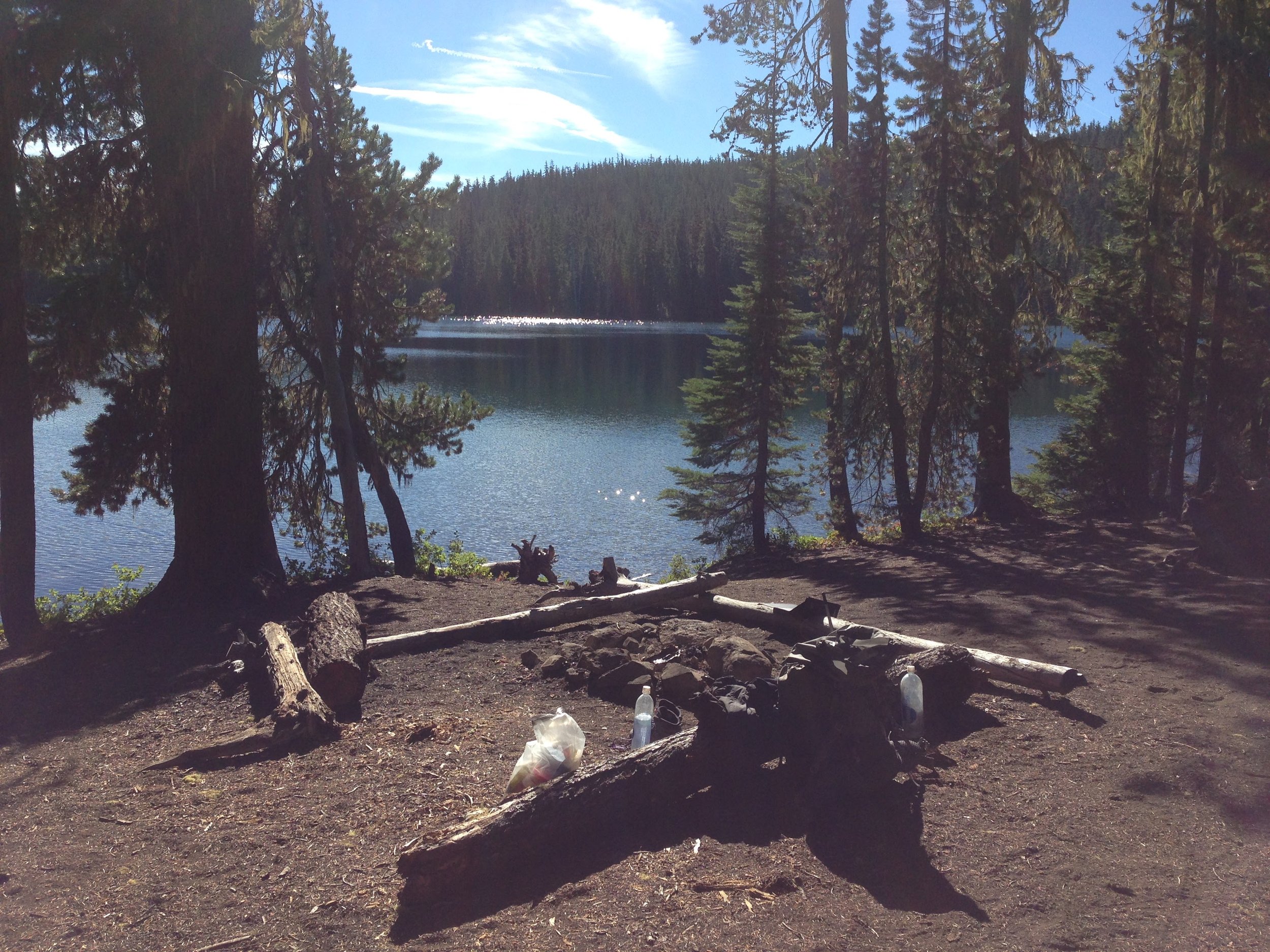
Listening to podcasts made my afternoon walk go by quite fast.
Got to a lovely lake and this was once more a moment where I wished I could stay for a day or so.
But Canada is calling …
DAY 127 (September 9)
To Hinton Creek, mile 1963
27.4 miles
The day warmed up quickly again. I had a bit of a hiccup missing a creek and got pretty thirsty climbing that hill. In the late afternoon, the scenery with those volcanic mountains in the distance was quite lovely. I think I might have spotted the Three Sisters. I decided to set up camp by a creek under a welcoming tree.
DAY 128 (September 10)
Beautiful but exhausting day
25.8 miles

Surprisingly, I slept really warm although I camped close to a creek and a meadow. The first hours of walking felt superslow and physically tired.
Walked through a great volcanic landscape and finally the 3 sisters came into sight.
During my breakfast break, I was chatting with a couple from Seattle about rain and weather conditions in Washington. Before leaving they gave me some of their snacks and their phone number in case I am going to need something once I am up there (it's actually only 300 miles away now).
The late afternoon was a long and tedious walk through a lava field and although the views were fascinating, I was happy when I finally arrived at camp at 7.45.
Looking forward to breakfast at the youth camp tomorrow where I am going to pick up a resupply box and use the shower and laundry. Haven't done that since Ashland!
DAY 129 (September 11)
To Big Lake Youth Camp
First class breakfast
I heard Jazzman make noise and when I looked at my phone it was 5.15. A bit early but I was awake anyway so why not pack and start walking?
It was an easy and fast walk to the camp. A sign “Welcome PCT hikers” greeted me at the entrance and somehow I was moved by that simple sign.
I walked into an area with various small houses but could not see anyone. When I arrived at a building called headquarters, I spotted a host that was showing Jazzman around. I joined the tour and then went to a building called “the lodge” where they serve the meals.
Looking around I saw Savannah whom I had seen last time close to Warner Springs! She is hiking alone now as her friend has left the trail in Truckee. Also Detour and Cheeto Burrito were there, don't remember where but I had seen them before.
The breakfast was great: croissants, muesli, all different kinds of milk, fruit salad, toast, coffee, different kinds of tea, chai.
I spend the rest of the day doing laundry, showering, doing errands on the Internet (especially trying to order new shoes and warmer gear for Washington), and talking to some volunteers working at the camp building/renovating the houses.
Sidney & Jamie, Jammin, and Man arrived, also Twilight whom I had not met before.


BLYC to Timberline Lodge
I had not slept really well. Not sure if that was because of the cold snowy air (Mt Jefferson was very close) or because my tent was set up on a …
DAY (September 14)
To Tentsite Mile 2055
23.9 miles
I did not sleep really well. Not sure if that was because of the cold snowy air (Mt Jefferson was very close) or because my tent was set up on a slight slope.
I made coffee and tea to warm up a bit. Looking at the label of my yogi tea bag it read “You are unlimited”. Yes!
For once, I was grateful that there was a climb in the morning as this would definitely heat me up. It was a bit rocky on the way down on the other side of the mountain and it almost felt a bit like being in the Sierra Nevada.
It was roughly 10 miles to Olallie Lake Resort where I planned to have coffee and a second (late) breakfast. I met quite a few people on the way and had some interesting conversations.
Arriving at the resort which is super close to the trail (5-minute walk) I ran into some weekend hikers who were about to go back home offering me some left over food: various mountain house meals, energy bars, tuna, etc. No need to top up at the store! Almost felt like Christmas in September. Now I can get to Cascade Locks
In the afternoon, talked to Disciple who is “jojoing”: he went northbound earlier this year and now is going southbound immediately after that. Wow!


Cascade Locks to White Pass
Took me a while to get ready to leave, there seemed to be more stuff in my pack but it was mainly food for the 150-mile stretch to white pass that made it so heavy …
September 20
To Tentsite 21.5
9.5 miles
Ordered socks, poncho and emergency blanket to white pass and send some emails. One to Sarah to announce I am getting close. Much faster in hotel desktop PC.
Went to breakfast with Rocky where I learned that she had done some interesting hikes (crossing the alps) and traveling (New Zealand) already.
Took me a while to get ready to leave, there seemed to be more stuff in my pack but it was mainly food for the 150 miles stretch to white pass that made it so heavy. I wanted to go waking but also envied Rocky little bit that she was done.
I think I started walking towards the bridge of the gods at 1pm. Crossing it was much less spectacular though than I thought. I t basically is a road bridge and there is no space for pedestrians so you walk where the cars drive. Not very comfy to stop and watch. Drivers are very friendly though, going slow and often waving at you.
Once in trail mainly went uphill, first just slightly, later pretty steep towards table mountain. At some point I unfortunately missed junction to a side trail to the summit from where there are supposed to be incredible views of the Columbia Robert and beyond.
September 21
To Trout Creek, mile 2174
20 miles
I slept very well and woke up late (7 a.m.). In my feet and ankles I can feel that I am carrying a heavier pack than usual yesterday.
I start walking at 8 am and it continues uphill. I walk for roughly an hour and suddenly start crying. Not sure why:
Again uphill and the never-ending torture?
Homesickness? In a way, I was ending Rocky yesterday as she could go home soon
Loneliness as no one around
It does not take long and the sadness is resolved by some kind of stubbornness. What is that kind of test/obstacle that life is putting in front of me again? Does it want me to surrender?
My thoughts are interrupted by some voices and I see two guys walking up the hill. I recognize the two cousins, Dr Knox and the Professor whom I have not seen since Belden. They rush by and I fillies while we are having a quick conversation about how it has been in the meantime.
My mood significantly improves after my second breakfast break. I walk immersed in my thoughts without even noticing that I am on a bigger climb.
Some time in the afternoon I talk to a guy heading south and we realize that we are both German. His name is Stefan and he has been flip-flopping a bit back and forth. While we stand the the sky suddenly friends dark and it looks like it is going to rain. I mention that the forecast predicted sun and clouds for the coming week but no rain, but Stefan says that the main characteristic of Washington weather is that it changes very rapidly.
September 22
To Sheep Lake (Mile 2197)
23 miles
Long climb after the first 5 miles that lasted more than 10 miles.
Surprise late afternoon: I approach a trailhead and suddenly hear “Rainbow do you want a beer?” Dr Knox and the professor hang out with a friend there. They offer me a beer, 2 spare ribs they have left over from an earlier barbecue and a brownie for dessert. That's what I call trail magic.
Both mention that Savanna had passed earlier, so she apparently passed me but is not too far ahead.
I walk another 2 miles to a lake after this yummy pre-dinner while the guys skip ahead 20 miles to catch up with some hiker friends.
September 23
To Trout Lake Creek
24 miles
Started walking at 6.30 but had to stop for half an hour as it started to rain. I repacked my pack: sleeping bag and down jacket in a dry bag and put on my rain gear. While doing that one southbounder rushed by with a poncho over her pack and head. Wish I had mine too already!
Passed by some weekend hikers and was happy not to be the only crazy person walking out there in the rain. One of them said that it was going to clear out again tomorrow. Good news!
Lunch break by a lake. Not as nice as out used to be. Felt really cold afterwards and finally put my rain gloves on.
Met Savanna shortly afterward and we then wandered through the train together. I complained about Washington and how boring it was and she was wondering if I would leave the trail soon. She said she would try to find something nice each day otherwise it would not make sense to be here. True.
At up camp width Savanna and Matt at 5.30 pm early but 24 miles for me already.
September 24 |Here comes the sun
To Kilian Creek
20.5 miles
Happy to see rays of sun touching top of the trees after the first climb. Trail magic just before Trout Lake Road.
Burnt area with lots of sun. Chance to dry wet clothing, sleeping bag and tent.
Some Northbounders I hadn't seen since Kennedy Meadows. They had flip-flopped from Truckee to Canada and are now walking south. We both were happy to see each other and after chatting for a while I wished them save travels.
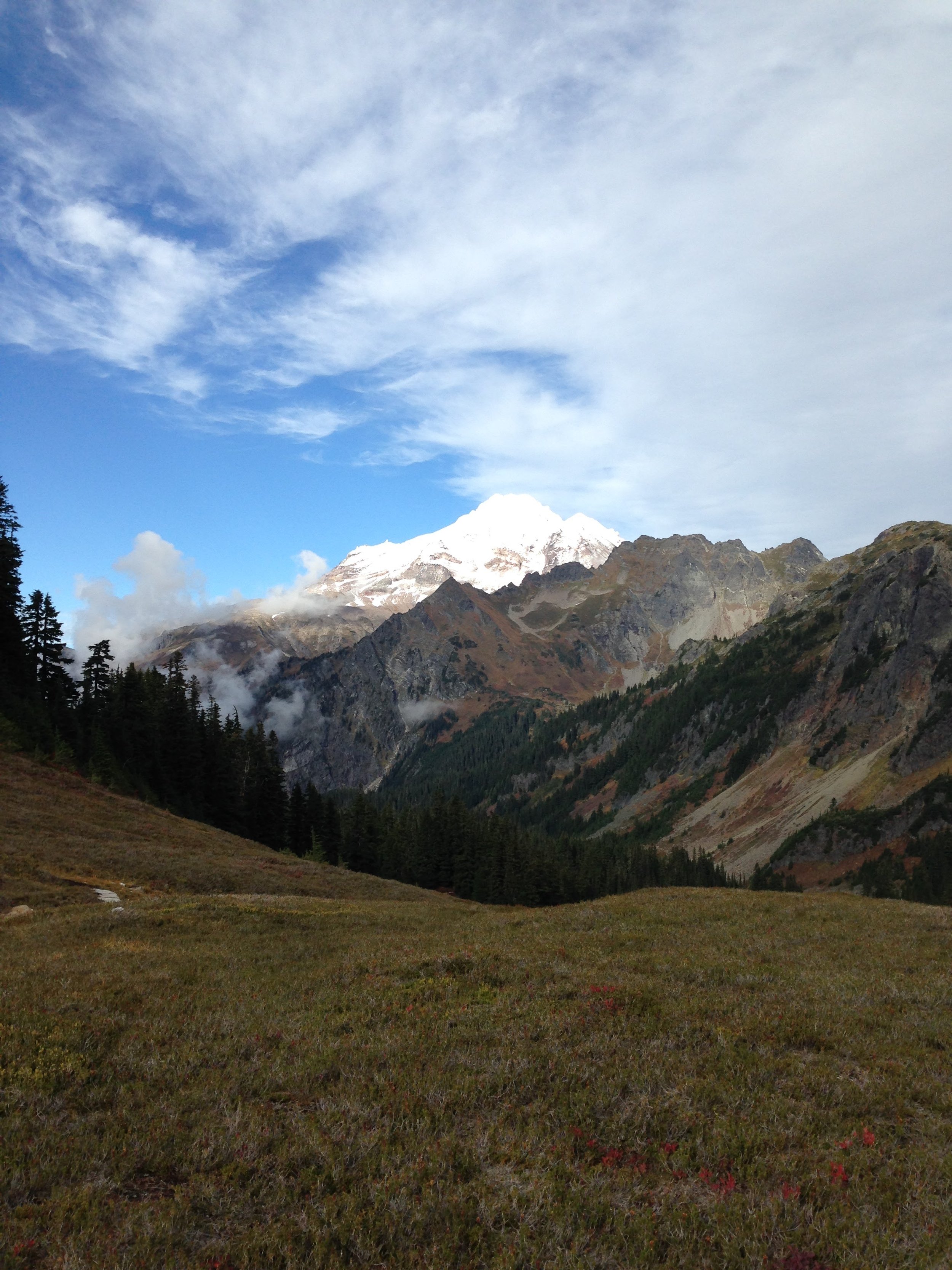
Beautiful views of Mt St Helens Mt Adams & Mt Rainier all afternoon.
September 25 | C,... Pass
To Tentsite Mile 2271
29.2 miles
Start at 6.15 with Zig Zag and Roadside. 13.5 miles by 11 am. Dinner with Zig-Zag and Roadside, we both have not seen Savanna today.
September 26 | Knives Edge
To Gillette Lake, mile 2290
19 miles
It's going to be a beautiful and fascinating day but it starts slow.
My legs feel very sore in the morning and although I am awake and hear the guys leave camp at 6 am I decide to have a late start today. The first two miles are slow although there are beautiful views already. The sun is out already and I put on my T-shirt. Looks like it's going to be a clear and sunny day.
I climb up Knifes Edge and I am absolutely fascinated by the views of Mt St. Helens, Mt Adams, and Mt Rainier. I remember why I am doing this trail! A real highlight so far in Washington which definitely makes my day. The trail continues on a ridge and at the highest point I just raise my hands and scream out of pure happiness. Feels so good to be on top of everything. The walk to the valley reminds me a lot about the Sierra Nevada: the trail, the creeks, the colors….
September 2 | white pass
To creek & Tentsite
14 miles
Easy two miles in the morning to the Knacker Barrel store at White Pass. I leave camp at 7 am and I arrive at the store just before it opens at 8 am. It is close to a ski area; it is cloudy so half of the mountain is covered with clouds. Almost looks like it would rain.
I have breakfast with a big coffee as soon as they open. Unfortunately, they do not have showers bit the lady says I might be able to check with some hikers who have rented a room in the lodge next door.
A few minutes later, Zigzag and Roadside enter the store. They have checked out already but I can convince the guy at the reception to give me the keys so I can take a shower. It's perfect as this also gives me the opportunity to unpack my boxes and reorganize my pack. I now have an emergency blanket, a poncho, and an additional warm pair of leggings. Some more weight but after my last recent experience I am convinced I need those.
Hiked out with Savanna at 3 pm. We had some interesting conversations about body and mind: When is the body tired and when is the mind? And when is the latter tricking us blaming it on the body?

White Pass to Stevens Pass
Found a nice spot with view of Mt Rainier for my coffee break. Happy that it was another sunny day despite being …
September 28
To Sheep Lake, mile 2323
18.5 miles
Slept in and started walking at 7.30. Felt slow today, the pack felt heavy and my legs felt sore.
Found a nice spot with a view of Mt Rainier for my coffee break. Happy that it was another sunny day despite being tired. Pared by a few beautiful lakes.
Chatted with some day hikers in the afternoon and they offered me some of their favorite German chocolate: Ritter Sport.
Savanna caught up just before Chinook Pass and we both set up camp at the very peaceful Sheep Lake at 5.45. Nice to be at camp early after yesterday’s late-night hike and too tired to move on.
Exchanged memories of the trail with Savanna, there are so many things happening in a short period of time that it is almost overwhelming, although walking might seem monotonous sometimes we see so many new places and meet so many people.
September 29
To Ulrich Cabin
20 miles
Sad as Savanna decided to take her time before leaving the trail. I was sad for the next few miles and thought that there were too many goodbyes on this trail. While I was standing there on the Dodge starting at Mt Rainier suddenly a female moose came into sight down by the lake.
Leapfrog with Ratatouille for a while but did not see him anymore the whole afternoon.
Stopped at the Ulrich Cabin around 5.15. Met Serenity and Napoleon and decided to stay. Push-up showed up and right before it was getting dark Savanna too although she had already set up her tent somewhere else before.
We all sat by the campfire talking until way after hiker midnight.
September 30
To mile 2368
24 miles
My night's sleep was on the chilly side, likely because I camped too close to a foggy meadow.
While on the trail, I had the pleasure of meeting a fellow hiker known as Real Dish.
The weather forecast didn't bring much optimism - rain was predicted for a week, starting tomorrow.
To cap off the day, I set up camp alongside PushUp and Savanna. It marked the last night on the trail for Savanna, who would be departing at Snoqualmie Pass.
October 1
To Snoqualmie Pass
22 miles
I wake up at 5 as I have to pee but stay in my sleeping bag until 6 am. It is very misty outside. I pack my stuff and put my rain gear on however as I leave my tent it does not look like rain at all. My hands are cold after packing out my tent and putting on my rain gloves does not really help. They seem to be a bit wet from yesterday when I slipped from a log while crossing a small stream - half of my pack landed in the water.
I get in a really bad mood and get angry at the trail. At some point I start crying: I just don't want this anymore, I want to go home. Some trail runners pass by a bit later. We chat a bit and one of them gives me one of his energy bars. They also mention that the weather seems to be less rainy than initially forecasted.
I do my coffee break and Savannah catches up. We continue walking together and it is good to talk to her about my sadness and thoughts about leaving the trail this morning.
At lunch, PushUp catches up and we all hike the remaining 13 miles to Snoqualmie Pass together. The last 5 or so miles are mostly downhill but the trail is full of roots and stones.
At 5 pm the ski lifts and pass come into sight. We take some photos with Savannah. She tries hard to smile in these photos. Once down there, we get a coffee and cookies from a cafe before heading over to the hotel.
I take a super long shower to get warm and it feels awesome. Before heading over to the store to order some pizza, we eat some snacks from Savannas Box and drink beers from a hiker who did some trail magic at the Chevron station.
Once back in the hotel, we watch a movie. We all enjoy this as it feels so “normal”, almost like at home.
October 2
To Tentsite Mile 2405
15 miles
I start the day with a hearty breakfast of pancakes. The breakfast spot was bustling with a significant number of fellow hikers, creating a lively atmosphere. The day takes an emotional turn as Savanna says her farewell, leaving me with some tears and a heavy heart.
After packing all my stuff, I team up with PushUp, covering a total of 15 miles today. Though we reach camp later than expected, the sense of happiness prevails. During the hike, I had a surprising encounter with an elk on the trail. We locked eyes for a moment before it sauntered off gracefully.
october 3
To Tentsite Mile 2428
23 miles
I enjoyed a restful and warm night's sleep, and although the morning was misty, it didn't seem like rain was in the forecast.
I embarked on a brisk walk, covering quite a few miles before taking a much-needed coffee break.
As I tuned in to an audiobook, a flood of memories from the beginning of my trail journey resurfaced. The nostalgia was so strong that I almost didn't notice I was ascending a substantial climb.
PushUp eventually caught up with me and provided a morale boost by saying, "just 3 more switchbacks."
We shared lunch at the summit, where we were rewarded with a scenic view overlooking the valley. After this, we faced a nine-mile descent, leading us to a cozy and sheltered campsite. Here, we enjoyed dinner by a campfire, followed by a daily stretching routine that I learned from PushUp.
With a sense of accomplishment, I reflected that I now had only 222 miles to go as of that day.
october 4
To Tentsite Mile 2451
23 miles
Earlier in the day, I faced a challenging ascent just two miles before reaching our campsite. It was a steep climb that nearly pushed me to my limits, but I soldiered on, taking it one step at a time. The silver lining was that the exertion kept me warm. Later in the evening, I met up with Fancy Pants in the dark, and both of us made our way to the camp where we found PushUp had already set up.
I prepared dinner while nestled in my sleeping bag, which was a cozy but slightly restless experience. Throughout the night, I struggled to get a good night's sleep, waking up every two hours. Sleeping on my side made me slightly chilly, and the constant chirping of the pikes provided a restless soundtrack to the night.
october 5
To Stevens Pass
11 miles
The morning brings a chilly surprise as the walls of my tent are frozen.
Despite the frosty start, I find myself in a good mood that morning.
I decide to sleep in a bit and enjoy a leisurely breakfast of coffee and a pop tart before tackling the task of packing up. The only downside is putting on damp pants and shoes, but the bright side is that the sun is shining, lifting my spirits. I hit the trail around 8:30 am.
By around 1 pm, I reach Stevens Pass. There, I cross paths with Share Bear and Mighty Mouse, who are preparing to head back on the trail. Fortunately, Tim kindly offers to give us a ride to the Dinsmores an hour later, which is a great stroke of luck!
Stevens Pass to Stehekin
Starts raining at night, get up at 6.30, start having breakfast, takes me ages to pack, others still sleeping in tent, PushUp says he …
October 6
Zeroing at Dinsmore Hiker Haven
I kicked off my day with a hearty breakfast in Skykomish. The town is only a short hitch away but a friend of the Dinsmores offered to take us there. The next stop is the local supermarket (of course!) where I picked up some essentials for the day.
Despite the picturesque setting, I was feeling a bit sick, so I decided to take it easy. I spent most of the day lounging around, watching movies, and recharging my batteries. It was a much-needed break.
When dinnertime rolled in: Surprise! Burger party! They hit the spot, filling my stomach and lifting my spirits.
Later in the day, I struck up a conversation with Chris, a friendly local who shared insights about the ever-changing weather patterns in Skykomish.
As the day drew to a close, a couple of more hikers rolled in, including Sabrina from Germany. We exchanged stories wondering if we had met before or where we might have just missed each other.
OCTOBER 7
Lady Jane Lake
10 miles
Our day began with an authentic Israeli breakfast prepared by PushUp (as authentic as can be in this corner of the world). We had plans to hitchhike, but luck was not on our side. In the end, Chris came to our rescue, offering us a ride that got us back to Stevens Pass.
Snooze Button was lingering at the restaurant at the pass. Stich was experiencing similar issues like i did the day before, and we both wondered if the nuts from the hiker box were to blame for our stomachaches.
PushUp, on the other hand, still had a sandwich to keep him going. Determined to make progress, I decided to hike out with three other fellow hikers, leaving PushUp behind with the assurance that he would catch up.
Our journey led us to camp at Lady Jane Lake, where we found a serene spot to set up for the night. Stitch had already pushed ahead, covering more ground. We were reunited with Bam at the campsite. I fell asleep immediately and had a warm night’s sleep.
OCTOBER 8
Lake Sally Ann
20 miles
Starts raining at night, get up at 6.30, start having breakfast, takes me ages to pack, others still sleeping in their tents, PushUp says he will wait out the rain but I have doubts that it is going to stop soon. I have a chat with Bam who thinks the same and is planning to head out soon too.
After roughly 30 minutes of walking, Stitch comes from the opposite direction. He says he is going home due to foot pain and cold, the trail is only puddles further ahead. I feel sorry and a bit puzzled at the same time and wish him good luck.
The rain ceases for some time during the morning but picks up heavily again in the afternoon. I don't really want to stop but at some point want to eat my sandwiches but no good shelter anywhere really. I sit below a tiny tree and try to protect myself with my poncho and umbrella. PushUp passes me and says he does not know where he is. It's 7 miles to the next campsite at a lake and 3 more miles to another less exposed one.
The rain comes down relentlessly and makes every step a challenge. I reach a creek crossing, now transformed into a river, with no option but to accept wet feet as I splash across. I almost run to that lake where I find PushUp inside his tent under some trees. He says it's windy and cold, not the best tent site. I struggle to find a spot that is protected and does not already have puddles of water. With all the wind and rain it is challenging to set up and by the time I get inside the floor is already slightly wet.
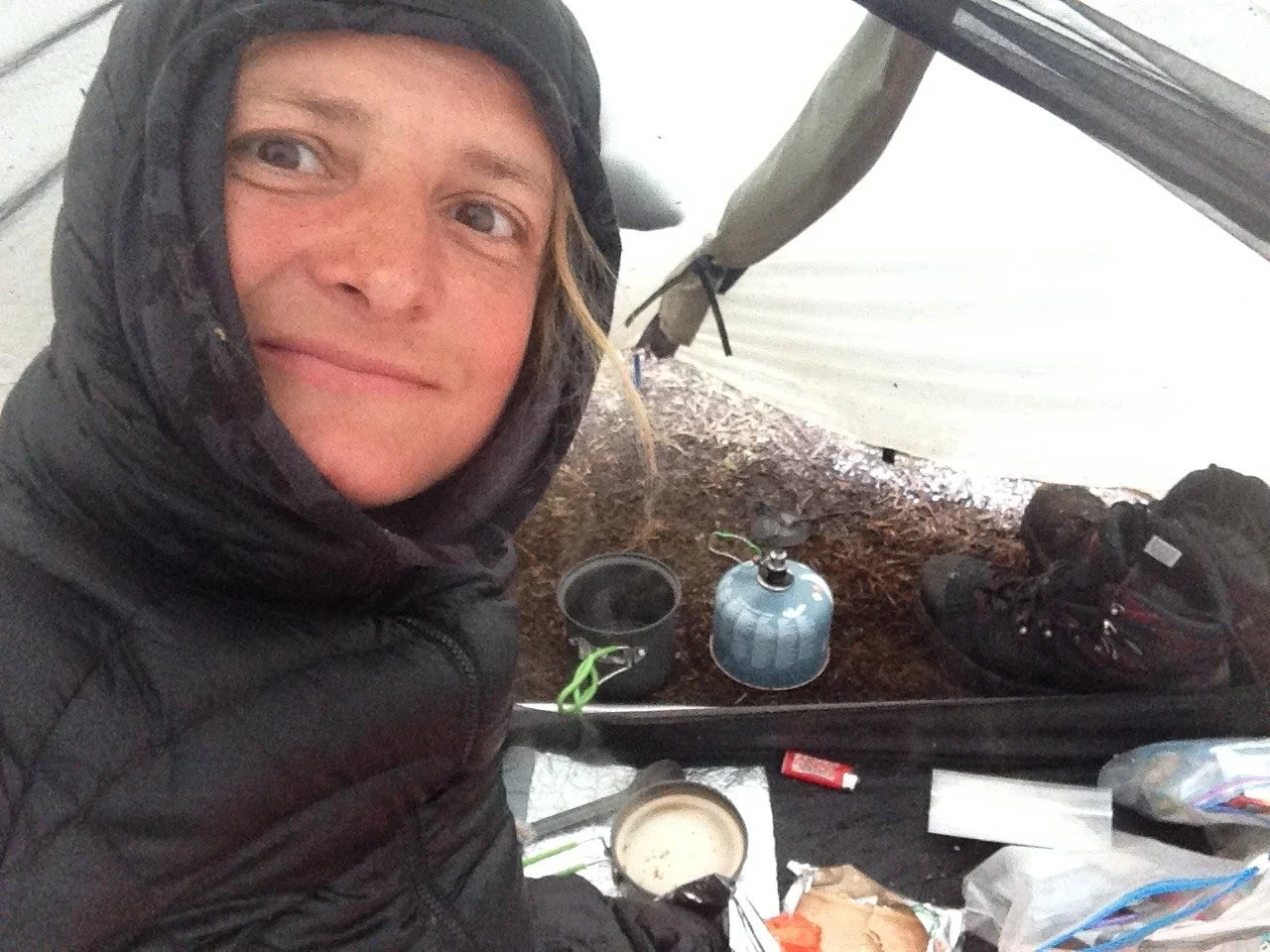
I quickly change into dry clothes and prepare dinner. To my surprise, the warmth from the meal makes me feel cozy quickly. Fatigue washes over me, and I drift into sleep until 2 a.m. when I awake and decide to jot down these notes. I sip water from my pot that I left outside to collect some water on this rain-soaked night.
OCTOBER 10
To Tentsite Mile 2512
No rain in the morning when I take out my earplugs. I get out of my tent to pee. Amazing views of a snow-covered mountain range! Looks like there might be sun out today.
I get water and check if PushUp is fine. I have just finished breakfast when someone suddenly shouts “Sun!”. I get dressed, put down my tent, and lay everything that is more or less wet in the sun to dry.
I start walking at 10 am and more awesome views of mountains coming up including some impressive Glacier peaks during my lunch break.
The descent to the valley is easy but I do not see PushUp at the spot where we planned to camp so I continue to the next river. It is quite a big and noisy one. Nobody is there either so I decide to walk up another 2.5 miles to a campsite at 5300ft elevation close to a stream. I get there by 7.30 pm sweating and have a good sleep after a yummy dinner I took from the Dinsmore’s hiker box.
OCTOBER 10
To Milk Creek (Mile 2522)
At night it starts drizzling and I wonder what is sliding down my tent walls … it is snow!
The walk in the snow in the morning is beautiful. I am the first one to put my footprints in the snow which means that PushUp must be behind. Where did I miss him? There is sun out but the higher I climb, the cloudier it gets and just before reaching the pass at 6,300ft it starts snowing again.
PushUp catches up on the way down. We opt for a quick break to have a warm drink but fingers are cold and numb that its almost impossible to use a lighter.
After evaluating with Pushup about what to do, I decide to set up tent at 4 pm near Milk Creek as the next tent site would be at 6,300ft after a 2,000 ft climb. There is snow most probably and it would be way colder than down here (and maybe windy too?).
Main discussion point: Do we have enough food? 47 miles to go to Stehekin.
Nice to have some more time in camp which I use to see if I can fix my tent zipper.
OCTOBER 11
To Miners Creek (Mile 2547)
24 miles
A steep climb up to 6500ft in the morning. Up there is a beautiful landscape covered in snow.
Fast pace following PushUp. Lunch by river. Afternoon longer but steady climb until reach camp. Bam also arrives later.
OCTOBER 12
To High Bridge Ranger Station
23 miles
A squirrel shouts at me in the morning while I collect water from the creek my breakfast.
Slept surprisingly warm although I was very cold when getting to camp last night. Doing sit ups seemed to have worked.
Beautiful walk in the snow in the morning.
Lunch at a giant rock in the sun with Bam. We take the chance to dry or sleeping bags, socks and shoes. All afternoon is a walk in the forest where it is dark and cold - although it's a sunny day - so I wear my gloves almost all day.
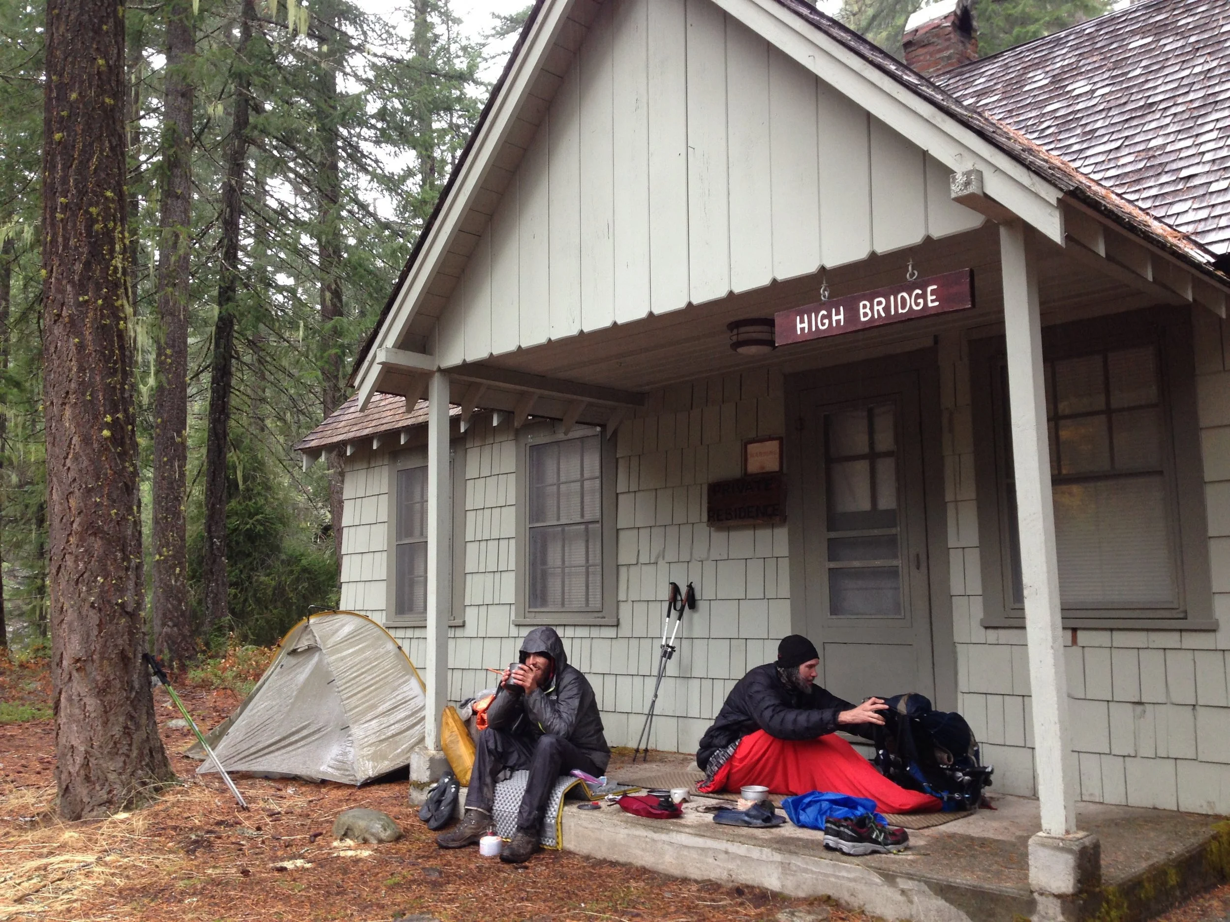
Afternoon passed very slowly and the miles to the Ranger Station seemed endless. I get there at 6pm. Bam and PushUp are already setting up their tents and so do I. I give some food to PushUp and make my dinner from all the left overs from the previous days which turns out to be a spicy ramen-mac&cheese-veggie-tuna-soup. Surprisingly good!
OCTOBER 13
Zeroing in Stehekin
0 miles
I slept with my ear plugs so I did not realize that it has started raining at night.
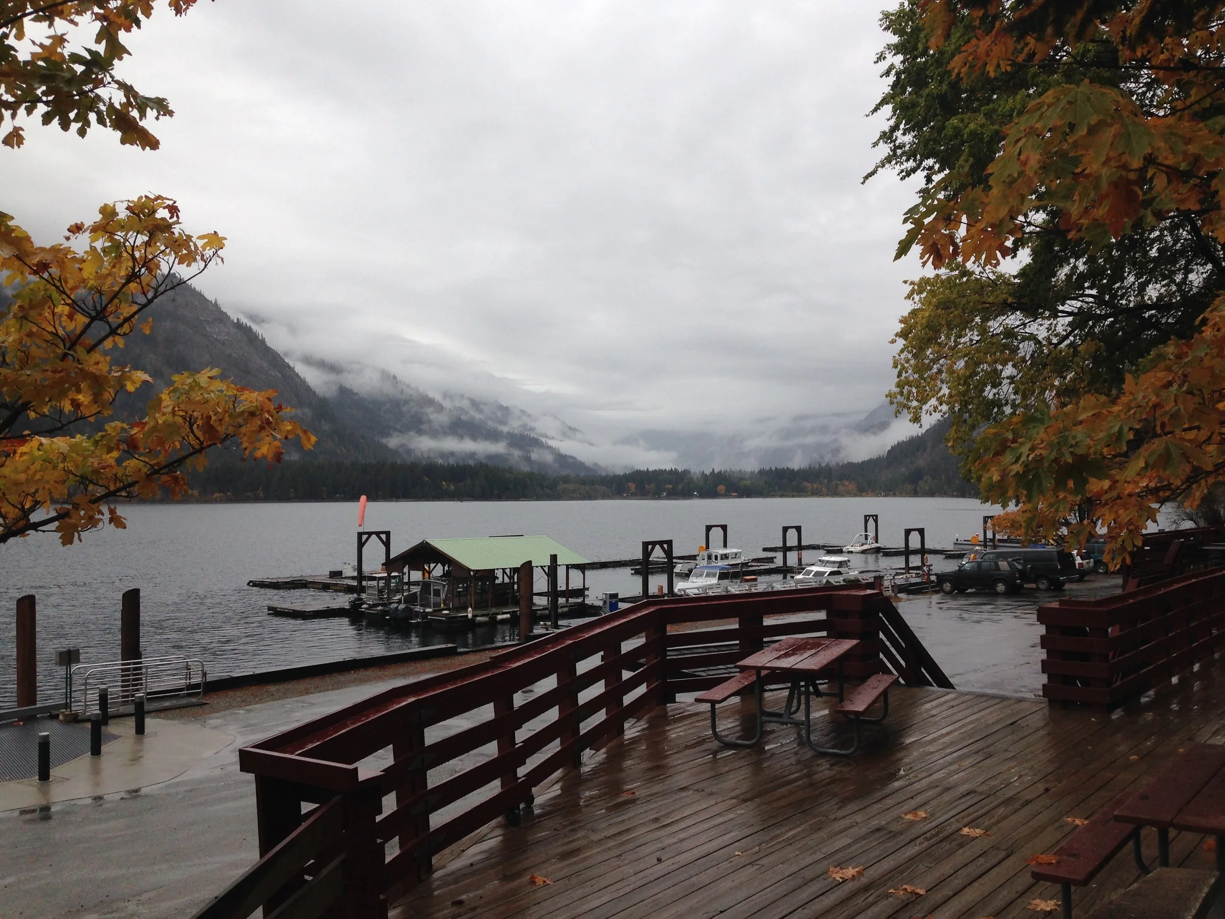
Not much left for breakfast, but hey, the famous Stehekin bakery is so close! We pack our stuff while it is still drizzeling and find shelter under the porch of the ranger station until the shuttle arrives. The long awaited stop at the bakery seems like paradise, yummy pastries, I even take a few pieces for the following days. Stehekin, a holiday resort by a nice lake, has a lovely location. Theres a few vacationers and hikers around but it all feels like end of season already.
Sunshine shows up later in the day and we let her sneak into our room which is pretty small but with some tetris puzzeling we find space for a sleeping pad between the beds. I am kinda worried when I see her foot which so swollen that I wonder how she made it here, not even talking about the last . But she is determined to finish.
The weather forecast is not promising, a snow storm is predicted for the north west. I am thinking about another zero day here despite the expensive rooms in the only lodge that is still open (and I am not even sure how long they are still open). PushUp advocates for walking to Rainy Pass (approx 20 miles) tomorrow and then wait out the storm at the trail angel place in Mazama. In case the weather turns bad already tmrw the only option to be sheltered would be some kind of abandoned hut somewhere on the way. I am doubting but it probably is our only option under these circumstances. It will be a day that I will most probably never forget …

Stehekin to Manning Park
Halfway in it starts raining. It is not raining hard but in combination with the current low temperatures it is mercilessly cold and a big test of everyones mental strength ..
October 14
To Rainy Pass
20 miles
The first shuttle back to the ranger station leaves at 9h30. The weather doesn’t look too bad, it’s cloudy and everything has an autumn-like feeling like the past week, maybe we are lucky today and the cold rain waits until tomorrow.
PushUp, a fast walker, sets the pace, and I do my best to follow.
Somewhere in a forest on the way, we see a kind of wooden house that looks closed which must be that possible shelter some people were talking about. I hardly notice it as we rush by so determined we are to get to Mazama.
Halfway It starts raining. It is not raining hard but together with the temperature it is mercilessly cold and a big test of one’s mental strength. Whenever I have to pee (and I have to pee quite a lot whenever it is cold), I ask PushUp to wait as following someone in these conditions is easier than walking alone. My hands are so cold and numb that I hardly manage to open the zipper of my rain pants before squatting down.
PushUp suggests that we walk a bit further to a bigger parking lot with toilets which would allow us to change our wet clothes. I am hesitating but there is not room for discussion in this situation and in the end its just another mile … just one mile. It seems to be
Once we get to the parking lot, PushUp sprints to the toilet signaling that is going to change there. Only now do I realize how desperate he is to get his wet clothes off. Apart from my frozen hands, I feel ok considering the circumstances. The rain poncho I am wearing over my rain jacket has probably saved me from getting soaked and freezing cold. Not many cars in the parking lot, so I head over to the road to put my thumb out. It’s still raining and a couple of cars pass by without stopping! How can they not stop with someone standing in the pouring rain? And it’s getting dark soon. I almost wanna jump on the street.
Already a little desperate, I notice that a day hiker is packing his stuff into his car. As he is coming towards the junction with the main road, I stop him knocking at his window. To my surprise, he opens the window - I must look very scary in my poncho waving with my trekking poles. Turns out that he is heading in the opposite direction. Oh no!
Sensing that this is might be our only chance to get a ride, I explain the situation and offer him money if he would drive us down to Mazama. When he agrees to take us for free I almost wanna hug him. “We have a ride”, I scream in the direction where I had last seen PushUp. It takes a while until he shows up but finally, we squeeze our wet packs and soaked rain jackets into the truck of the car and jump in. Only at this point, did I notice that PushUp must have been very close to hypothermia and that a hot shower is what we both need urgently.
October 15/16 | endless waiting
Zeroing in Mazama seems like heaven. Ravensong, a female PCT hiker legend, and now trail angel has built a lovely little shed for hikers with kitchen and washing facilities on the ground floor and a cozy sleeping area right below the roof.
Days are spent, eating, relaxing, and wandering to the closeby market and cafe back and forth.
The predicted storm brings further snow up in the mountains but turns out not to be as severe as the forecast had predicted. More hikers arrive the next day including Sunshine and Bam. They had started out later that day from Stehekin and found shelter in that hut in the forest where they had waited out the rain before heading out the next day in a fairly good weather window. So happy to see them!
September 17 | decision time
There are quite a few of us stuck at Mazama at this point. Maybe a dozen or so.
PushUp to my surprise decides to end his hike here and head down to California to meet his brother who is currently on vacation there. Less than 100 miles from the terminus!
For the rest of us, there are basically 3 options:
Continue on the PCT towards Hart’s Pass where due to snow conditions there could be avalanches.
Take an alternate route avoiding the avalanche-prone area by starting at a different trailhead leading back to the PCT roughly 8km before the border monument resulting in skipping roughly 50km of trail.
Take an alternate route along Ross Lake allowing a “continuous footpath” to Canada from Mazama without ending at the monument / northern terminus.
The group splits in two taking either of the alternates, me joining the one ending at the terminus.
Ravenson gives our group of 8 a ride to the trailhead, wishing us luck and asking us to let her know once we made it on the next day.
We walk into the night that day trying to reach a hut indicated by Ravensong. We walk through snow-covered forests, slight rain, and through creeks into the night. We are not always sure we are on the right track but with Ravensong’s indications and Sabrina’s excellent GPS-supported navigation skills, we eventually reach a vast open area in the middle of a forest. Is this the airfield close to the hut? I walk towards some trees to the left and discover a shed, a toilet, and then … a hut! As Ravensong already suspected, it is unfortunately closed, so we pitch our tents close by sheltered by the trees, enjoying our last supper in the light of our headlamps.
September 18 | The last push
As we embark on our final day on the trail, an overwhelming sense of joy fills the air. The last night in our tents!
We begin our day with loads of energy, and our spirits high. I make sure to fill my pockets with snacks, so I won't have to rummage through my pack during the day.
The hike goes smoothly until we reach a small mountain blanketed in snow, a path we need to traverse to rejoin the PCT. We find ourselves post-holing through snow, sinking knee-deep with every step. It becomes apparent that navigation is a different challenge when the trail is buried beneath the snow. The usual navigation app doesn't cover this stretch, but thanks to Sabrina, who has downloaded the map of the region, she guides us reliably. During the final climb, we maintain a bit of distance between us, just in case the snow starts shifting. Although it isn't an extensive ascent, it proves exhausting and we joyfully commemorate our survivor group with a photo at the top. The descent, however, poses a new challenge: Where is the trail? We know the PCT has to be close, but the steep terrain makes it hard to spot. We manage to slide down, holding onto trees, until we eventually sense the presence of the trail. Last pee stop at the junction!
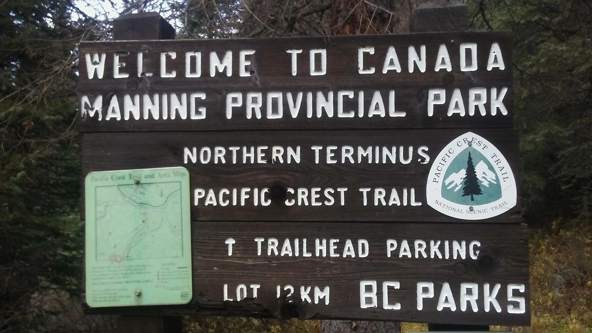
Along this long journey, I occasionally tried to imagine how the end would feel. And only thinking about it, I often was on the verge of tears. However, now as we near the monument: nothing. I am just curious how it looks like and how it might feel to get there. Am I thinking anything at all? Or just soaking up the moment?
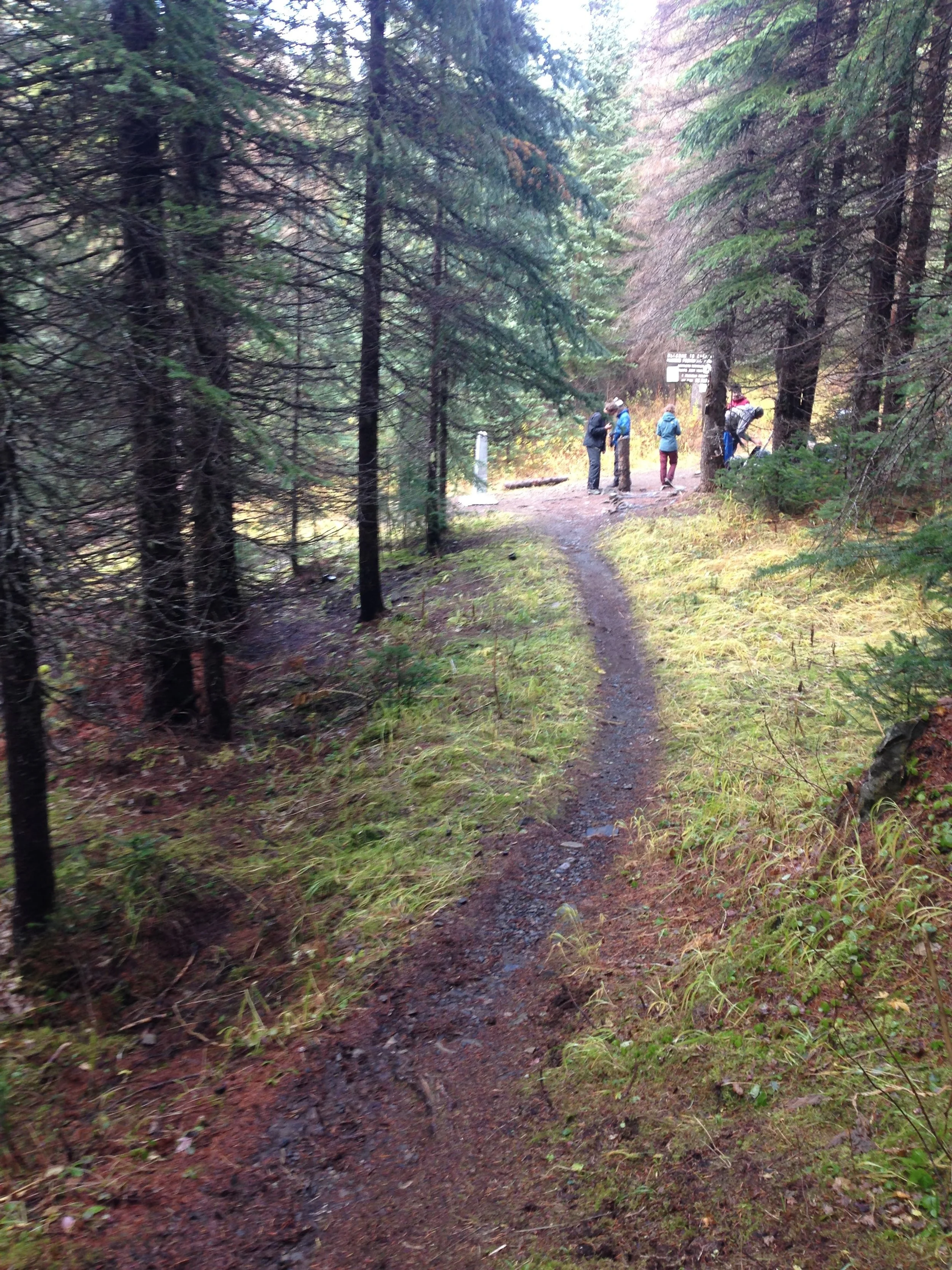
Roughly 1 kilometre before reaching the monument, our pace quickens. I am content to let others pass, for I'm not quite ready to rush the moment. I ponder how to savour the culmination of this epic journey. The trail winds through switchbacks, each one revealing the monument a bit more, and my fellow hikers can't contain their excitement, shouting with each turn. I, however, am absorbed in my own thoughts, my gaze focused on the path. It isn't until I reach the last switchback when I look up and there it is, almost a bit too fast …. THE monument a.k.a. the Northern Terminus of the Pacific Crest Trail ….