Campo to Mount Laguna
We started to head out of the trail angel house at 6pm after a delicious breakfast. Arriving at the southern terminus at around 7.45.
Day 1 (May 1)
To Lake Morena
20 miles
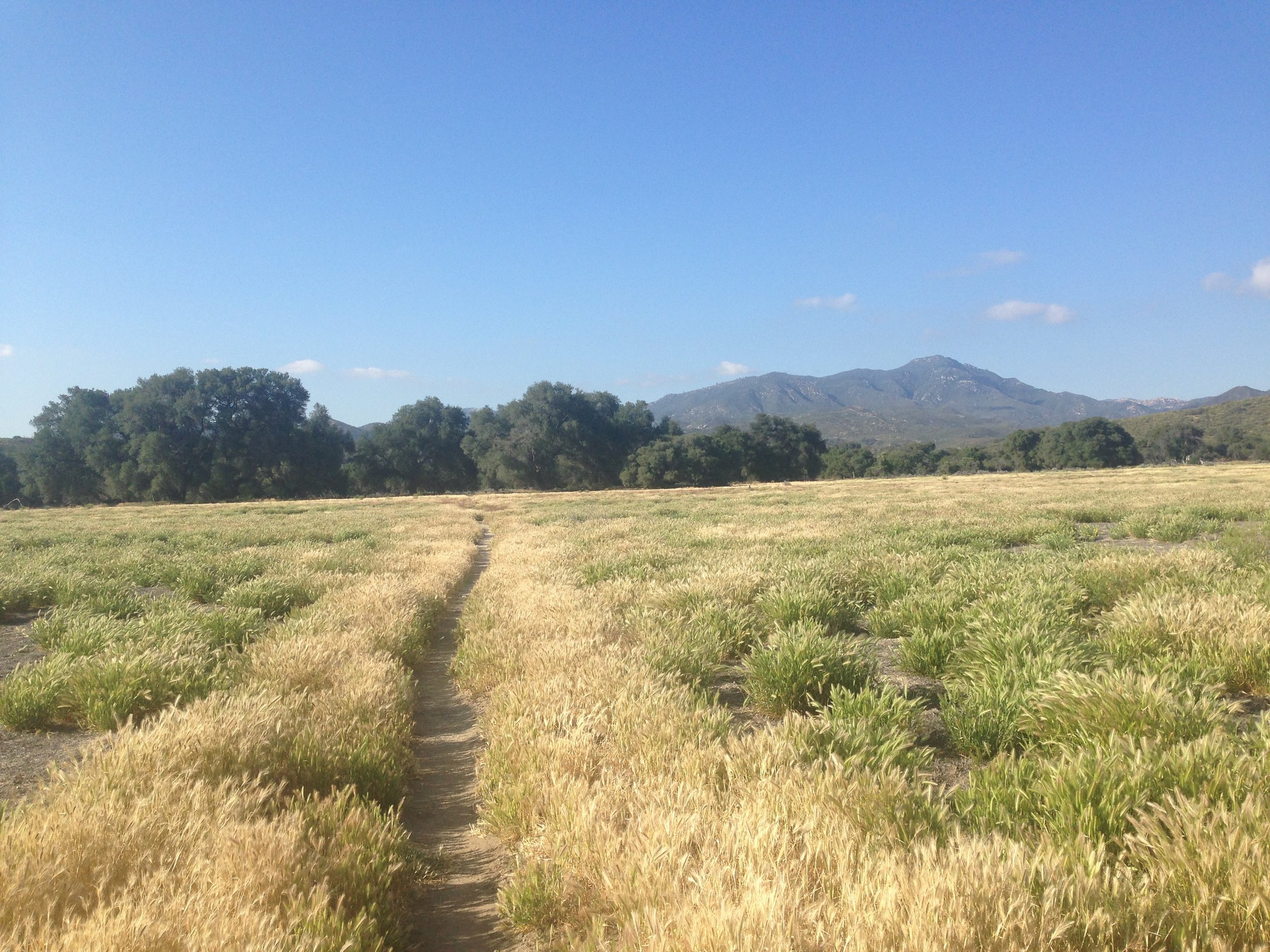
We started to head out of the trail angel house at 6 a.m. after a delicious breakfast. Arriving at the southern terminus at around 7h45. Started walking after a quick foto session with other hikers at around 8h30. It was a bit chilly that morning which was perfect for hiking.
Fairly easy walk until an ascent just before Lake Morena. Had to count steps to keep me entertained and quite a challenge in the heat. Felt good afterwards though. Met people from Frodo&Scout at camp and had some beers at the store. Great to have a shower (after one day of hiking only … lol). Almost too tired to cook in the dark but forced myself to eat some ramen.
Day 2 (May 2)
To Cibbets Campground
12 miles
My legs are really tired. I feel a bit more energized after some Gatorade. Very hot day. Met Sam and Johne from Frodos on the way and other people sitting in the shade during a break. Stayed with a group of 15 at Cibbets Campground.
Day 3 (May 3)
To Mount Laguna
11 miles
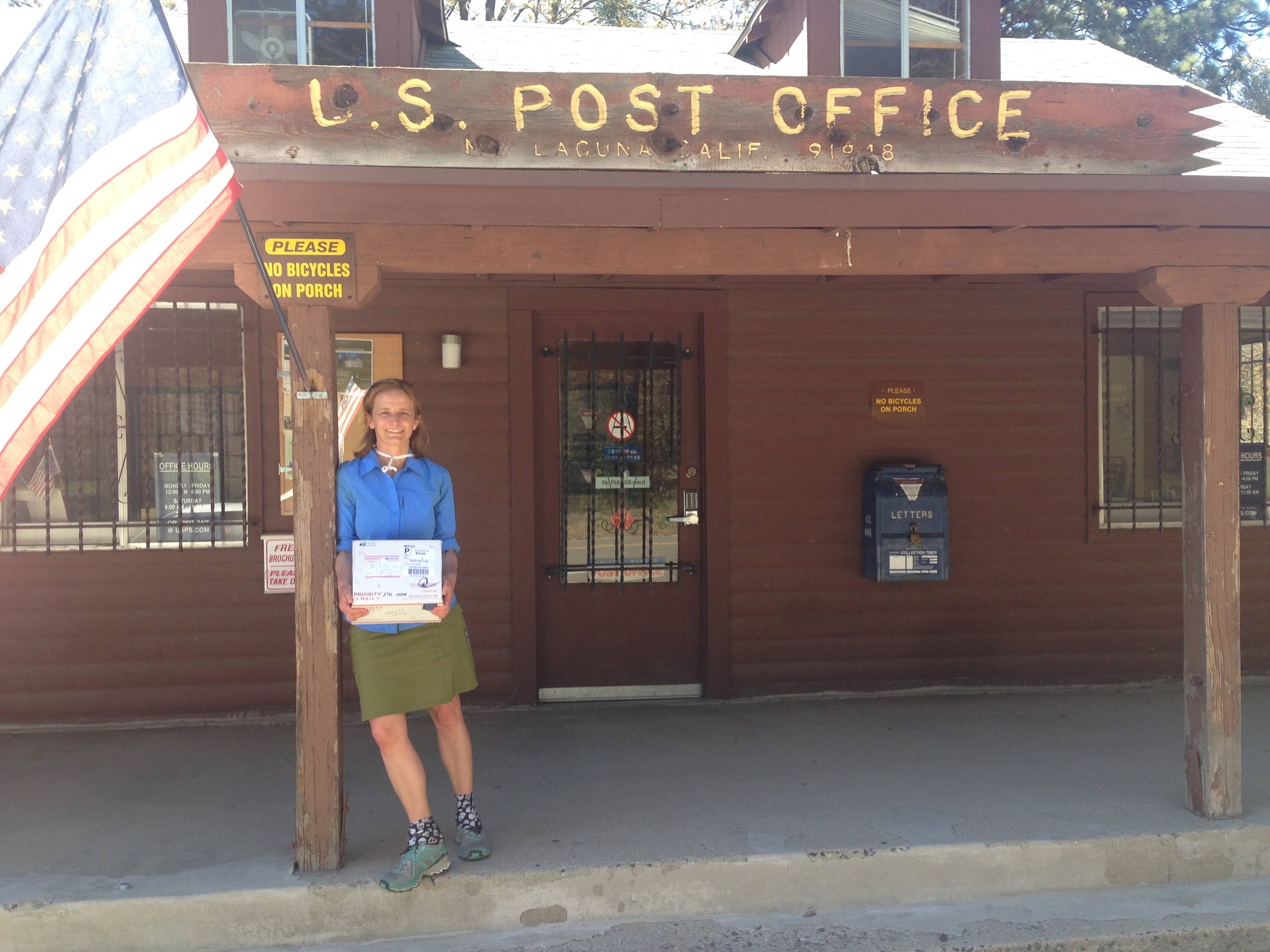
I hike alone for most of the day as the group moves slower. There was a guy explaining the world to everyone which I found quite exhausting. Enjoyed quietness alone and also wanted to learn how to navigate. Steep for the first part of the day but then a nice stretch in the forest with tons of birds before Mount Laguna. So beautiful! Enjoyed so much being in nature. Bought some socks, a rain cover, and a headlamp at the Mount Laguna Outfitter. Quite a few hikers were changing gear there. Picked up my first resupply package at the Post Office.
The lady there funnily remembered the “Bach” package. Others are shipping stuff home or dropping it off in the hiker box. Even food! I also wish I had not sent so much myself. Pack now heavy again :(
2 snake encounters in the afternoon. Almost stepped on one!
Mt. Laguna to Warner Springs
Heading out of camp at 10 am and walking alone for most of the morning. Tried to get water at a spigot but …
Day 4 (May 4)
To campsite in boulder field (mile 55.9)
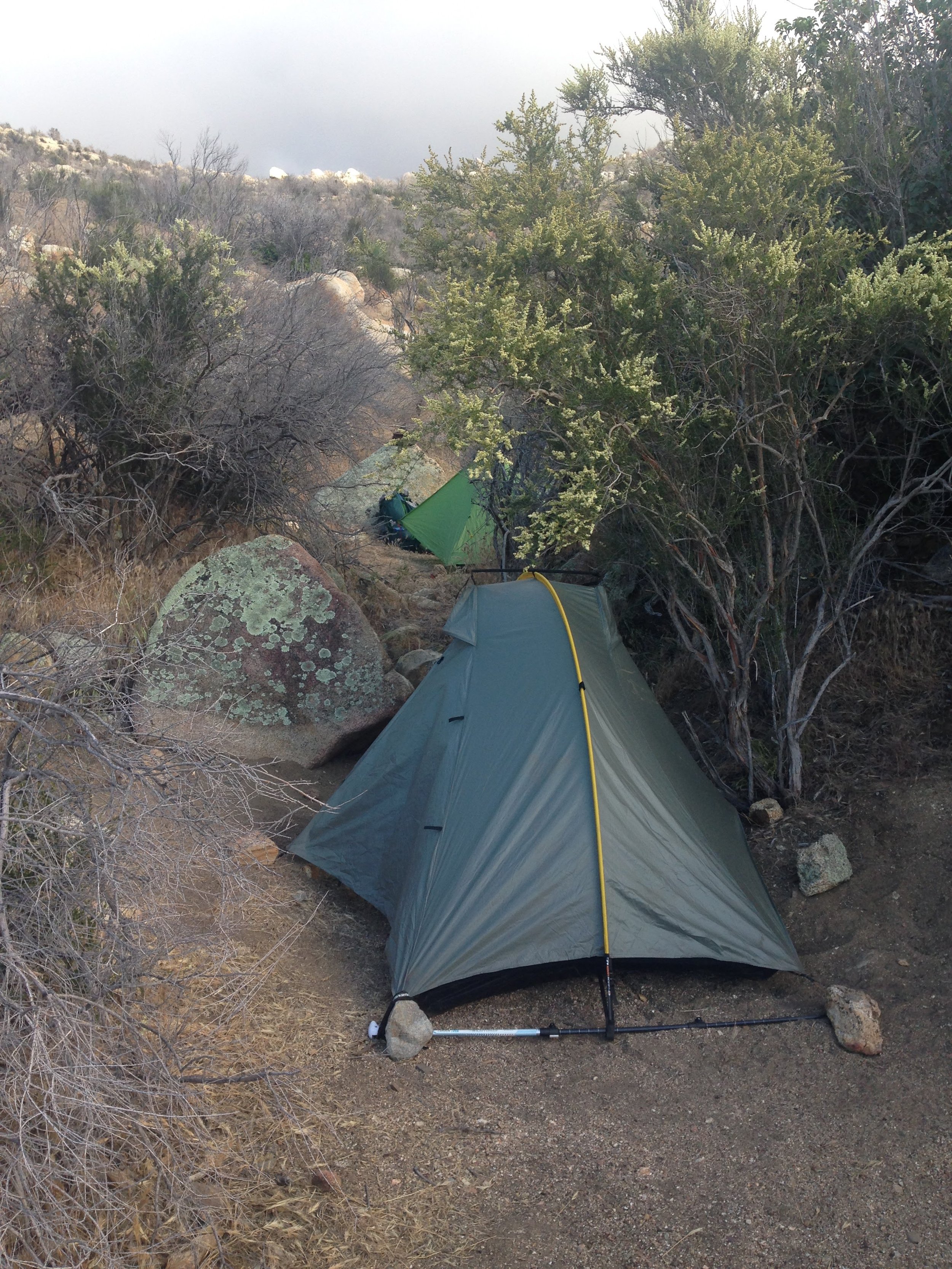
Late start today as I started writing my journal. Heading out of camp at 10 am and walking alone for most of the morning. Tried to get water at a spigot which turned out to be off. Damn, I had not checked the water report. I still had some water but asked some army guys where to find water. They gave me almost 1.5 liters as they said they had more than enough. The trail provides! Met Reto on the way and camped with 2 other girls at a nice spot between big boulders.
Day 5 (May 5)
To tent site at mile 71
15ish miles
Though tucked away between the boulders, it was still very windy all night but my tent held up pretty well. I slept without my puffy and did not feel cold though my sleeping bag felt a bit damp after putting up my tent last night which made me worry a bit. I put my rain jacket on top of my sleeping bag but that really made me sweat. The wind continued after leaving camp until about 2 p.m. when the clouds went away and revealed a clear and sunny sky. Together with Reto, we picked up Nick from England on the way. Took us quite a while to find a sheltered, cozy spot.
Dinner was “Tagliatelle with a delicate butter-flavoured sauce”. Yum!
Day 6 (May 6)
To Julian (mile 77)
It slightly started raining at night but clear skies when I woke up. After breakfast and packing most of my stuff, it started raining quite heavily again, so I decided to stay in my tent and write this here. When after another 45 minutes the rain did not cease, we packed and started walking. It stopped eventually, the air was pretty cold though. We met XC on the way and after calling the people of Stagecoach Campground who said that they do not have cabins anymore, we hitched into Julian.
Hard to get a room there. Finally, we took a king suite for $190 for the 3 of us. After having hamburgers at Carmen’s where we also had the chance to do our laundry for free, XC found 3 other hikers who wanted to share a room. The room price would be only $30 for each of us then. Nice! Felt good to have a shower and fresh clothes.
Day 7 (May 7)
Tentsite at 3rd Gate (Mile 91.2)
14 miles
After some emailing and a great lunch, I hitched out of Julian to Scissors Crossing with three other hikers around noon. 2 older, very cool ladies took us in their pickup truck. Reto stayed in Julian for a zero-day as his ankle was still swollen. I walked alone for the most part until I met Lauren with whom I camped at the so-called Third Gate with a few others.
Day 8 (May 8)
To campsite at mile 101.1
Got up late and had a slow breakfast. Treated my blisters which had been bothering me the day before. I was the last one walking out of camp at 9h30. Talked to several day hikers during the day and had lunch with Warren who had a bad ankle. Passed mile 100! Arriving at a water source, there was some cool trail magic provided by a nice guy called Minty Mike who had hiked the trail the year before. Beers, chips & hot dogs! Plus chairs!
Met Listen & Squirrel there and Kent and one of the Twisted Sisters. At 4 p.m., I decided to pitch my tent there as the next campground was still 8 miles to go.
Day 9 (May 9)
To Warner Springs (mile 103.5) and then to tent site at mile 114
13 miles
Gave German lessons with Jake at the campsite. Learned what poison ivy looks like. Passed Eagle Rock and some beautiful meadows. Lunch with David at Warner Springs Grill & Golf. Post Office to pick up 2nd resupply box. Repacking, emailing, charging and “bucket shower” at the Warner Springs Ressource Center. Left before hamburger party at 4pm. Camp at a small site by Agua Caliente Creek with Rose, David and Jack.
Warner Springs to Idyllwild
Lunch break below 2 giant rocks. Highlight in the afternoon: Burgers, soda & beer at “Mike’s Place”!
Day 10 (May 10)
To campground at mile 131.5
Hiking with David, interesting conversations about European and US politics. Found Reto again while he was taking a break. Continue hiking the three of us. Lunch break below 2 giant rocks. Went to “Mike’s Place” where we had hamburgers, soda & beer. Camp with Reto, Kurt and Jack a couple of miles further up the trail.
Day 11 (May 11)
To campground at mile 149
Incredibly hot today. I left camp at 7 am and felt like the temperature was already at 20 degrees Celcius. Hardly any shade. With Reto, we found two giant rocks to hide from the sun during lunch. Very hungry all day.
Exhausted walking in the heat. Maybe should eat more bars during the today. Camp close to PVC.
Day 12 (May 12)
Easy hike down to PVC. Great atmosphere with live music in the morning. Neil, the owner, loved my pack. Ordered pancakes “full stack" which were 3 huge ones. I saved one for breakfast the next day (with Nutella!).
Day 13 (May 13)
To Idyllwild
Got up early and was on trail by 6.30 am. After hiking for 15mins, I reached the next tentsite where Reto was about to pack his stuff. Walked to the fire closure and then the detour which consisted of a few switchbacks and a longer walk through a forest until we reached the highway. Hitched from there to Idyllwild. Went to post office and met Luna again, then walked to a campground where I saw a lot of familiar faces. Really cool atmosphere! Party at night.
Idyllwild to Big Bear
Woke up at around 5.30am as the first of the 3 of us. Our tentsite was at an altitude of 9001 feet / 2700 m. Walked to the edge of
DAY 15 | Mile 180.8 to Mile 193.6
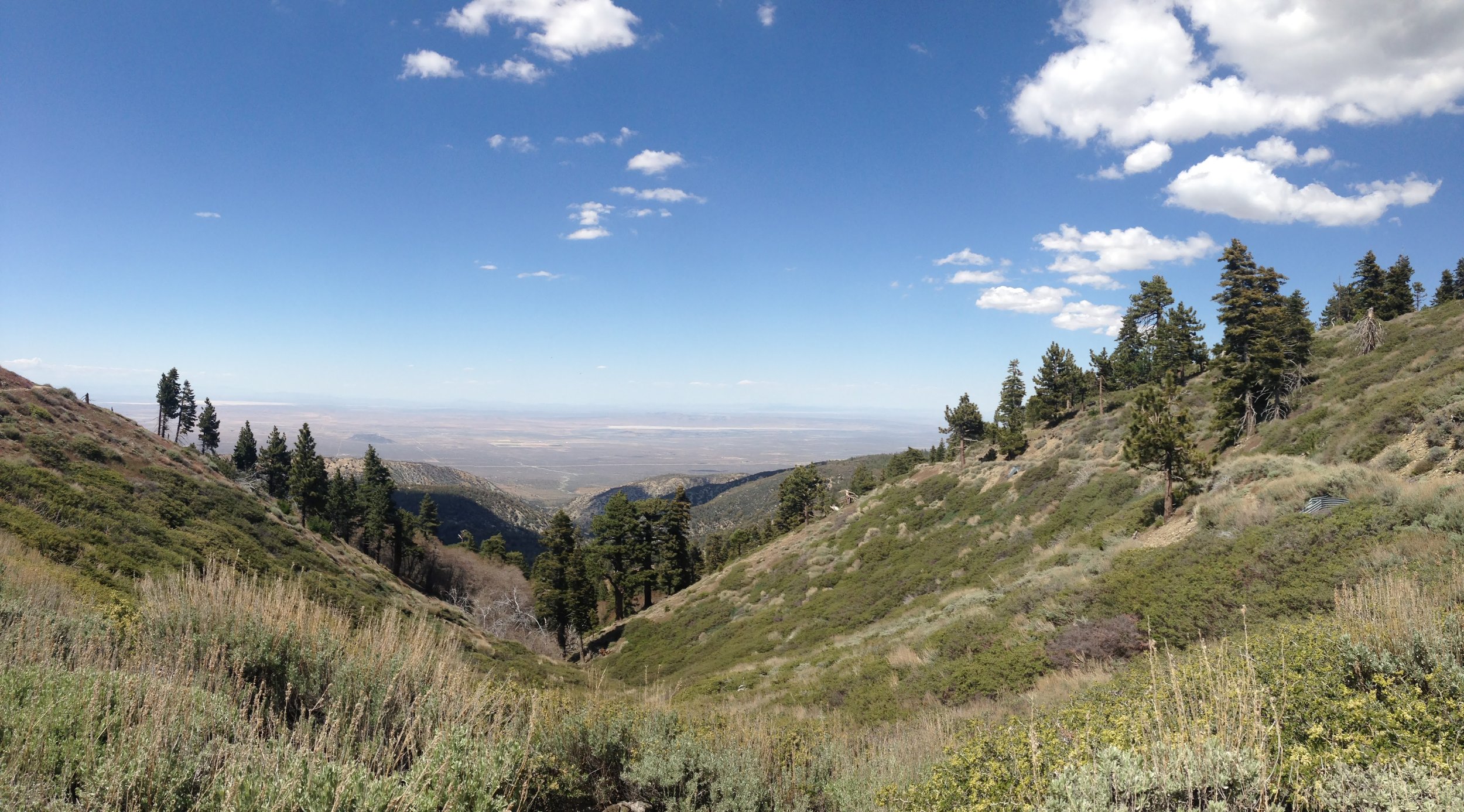
Woke up at around 5.30am as the first of the 3 of us. Our tentsite was at an altitude of 9001 feet / 2700 m. Walked to the edge of the mountain where there was an ocean of clouds below covering the valley. Beautiful views while the sun was rising.
We walked approx. 5 miles to a spring to fill up water which was crystal clear but freezing cold when filtering it. We continued after our lunch break without going up Mt. San Jacinto peak. Despite that we still had to climb some steep ascents during the early afternoon.
Arriving at the trailhead there suddenly was trail magic again! A very nice couple had decided to make hamburgers and offer freshly squeezed orange juice at the trailhead on a Sunday afternoon. We continued another 3.3 miles before setting up camp.
DAY 16 | To Ziggy & the Bear (Mile 210.8)
All morning descending the mountain we had to climb the day before.
DAY 17 | To Mile 229.4
Got up at 5 am as we wanted to head out early at 6 am. Giggles was planning to come with me and Suds but in the end decided to head out later.
We walked through a beautiful valley along a river almost all day. Both hungry at 4pm, we started to cook "dinner" at nice tentsite, decided to stay there and set up camp right here.
DAY 18 | Campsite to Onyx Summit
We walked through partly burned area that looked like after a bomb attack. We hike into the night and had beautiful views down at Palm Springs that was all illuminated.
At 10 pm we finally set up camp just before onyx summit.
DAY 19 | Onyx Summit to Big Bear Hostel
Trail magic just after Onyx Summit from big bear hostel: sofa and lots of cookies and other supplies. Met Liz and Re from Australia again on trail. Hiked to highway 18 (more cookies there) and quite fast got a hitch into town with a Mexican guy. Checked in at Big Bear Hostel for one night, the weekend would be closed due to a private event. Great dinner at an Indian restaurant (something different!) but very tired. Shared room with snowman and woman from Oakland.
Wrightwood to Agua Dulce
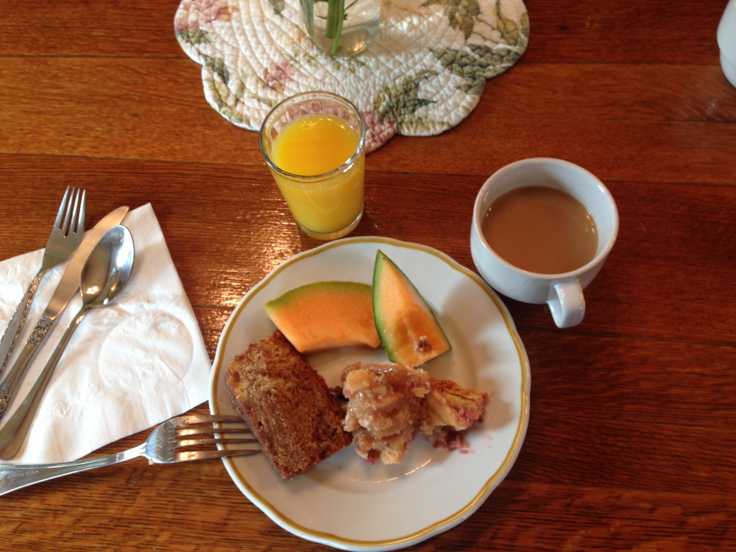
Enjoyed the morning at Joan's house. There was freshly brewed coffee, granola, and fresh fruit ready for me. I added some bagels I had left over from the day before.
DAY 27 | To Tentsite Mile 379.5
Enjoyed the morning at Joan's house. There was freshly brewed coffee, granola and fresh fruit ready for me. I added some bagels I had left over from the day before.
As windshields in the mountain hardware store were sold out and my MYOG shield made out of aluminium paper was screwed already, I built a new one.
After a very relaxing morning, I finally left the house to get a hitch up to Inspiration Point. Took only 10 minutes until I was picked up.
Walking was quite easy, maybe because of the temperature, maybe because my feet were relaxed. I soon reached Mt. Baden Powell which was a very steep ascent for almost 4.5 miles.
I reached the intersection of the summit around 6.30 pm and decided to walk up after speaking to a Mexican guy who said it’s just a mile and that he would go up too. Beautiful view over the mountains in the twilight.
After coming down, I walked another 2 miles until I saw a campsite with 2 tents and decided to pitch my tent there too.
DAY 28 | To Cooper Canyon Camp (Mile 395.2)
Met Shiloh at the tent site in the morning. Filled water at Little Jimmy Spring.
A lot of day hikers and scout groups for Memorial Day weekend.
Detour around frog closure via Highway 2 and Burkhard Trail (approx 5km). It involved road walking on the highway, a lot of motorbike and car racing. After reaching the campground, I headed up Burkhard trail until meeting the PCT again and climbed a steep bit up to Cooper Canyon Campground.
Day 29
To mile 415
19.9 Miles
Poison Ivy?
Got up at 5 am and was on trail with Shiloh at 6 am. Quickly grabbed my bagel but had no time for coffee. Sun was crawling up the mountain while we climbed the first small hill after leaving the campground.
Shortly after we crossed the 400-mile mark and after roughly 5 miles we reached Camp Glennwood where we had planned to get water.
The camp is basically a small house that can be used by Boy Scouts. Some hikers including Uturn, Hawthorn and Snowman had camped there and apparently, there was some trail magic the night before with beer and hotdogs provided by Brad who spent time at the house to do some repairs that day. It was his birthday and we had a nice chat. The camp/house formerly was a school for the children of the workers who once built the closeby highway 2.
Due to our early start today, by 11.30 am when we stopped for a lunch break we had already done 10 miles. Nice!
Early afternoon we heard and saw a rattlesnake below a big rock. Apparently, it was disturbed by another hiker that sat on top.
As we continued my ankle suddenly started to hurt. Took a quick break but then continued to the campground for another 5 miles together with Siloh. This was the furthest I could go today as my foot urgently needed a rest. Not sure how I managed but maybe the fact that we were walking through a beautiful canyon helped. To my surprise when arriving at the tent site, we still had almost done 20 miles.
Lipstick joined a bit later and we all prepared our dinners together.
The tent site is located on a ridge with beautiful views but it might get windy there tonight. Just had to re-adjust the tent lines and put some heavier stones on top of the stakes while I was writing this. Very cosy though inside as the sun had already heated it up from outside.
And I finally got my trail name today: Rainbow (related to my tarptent rainbow).
Day 30
To North Fork Ranger Station (Mile 436)
21 Miles
Woke up at night and had to go for a pee. Once I had stepped outside I saw in the distance down the hill the lights of a bigger city (Pasadena?). We were actually not so far away from civilisation as I thought.
Short walk to next stop at Mill Creek Fire Station to fill up water.
Met Freya from Hamburg and again Hawkeye, Seabiscuit and Lipstick. Had to take quite a bit of water as the next water would be in roughly 29 miles.
A lot of sun all day and barely any clouds! Luckily after a first steep ascent, we walked through a stretch of wood which provided quite good shade.
Day 31
To Acton KOA (Mile 444.3)
8 Miles
Started hiking at 7.15. It became very warm very early but my feet felt quite good and by 7.30 am I had arrived at the Acton KOA campground.
Maybe the urge for a shower and laundry had pushed me. That morning I did not even want to put on my shirt so smelly was it. Fortunately, I found my third pair of socks that I had not worn so far.
Immediately had a soda.
Figured out that I had shopped my box to the Acton post office instead of the campground.
After taking a shower and laundry, I tried to hitch to the town of Acton (about 4 miles from the CG) which worked quite well as one car had just given a ride to another hiker but had to go back to town.
Day 32
To Agua Dulce/Hiker Heaven
Started hiking at 5:45 to avoid the heat for the 10 miles to Agua Dulce. The first 4 to 5 miles were ascending and luckily that was during the first 2 hours when the sun was not so intense yet although it was almost needless to put my puffy on in the morning as I had to take it off after 20 minutes of hiking already. Time was passing fast and all in all, it was less exhausting than I had expected. Walked through a really nice canyon with giant strangely formed rocks after crossing the Highway 14 tunnel. Thought that if I had hiked at night it would have been cool to camp under one of those giant rocks.
Walk into Agua Dulce was quite easy and once I reached "downtown" (which basically consists of 2 restaurants and a supermarket, at least that is what it seemed), I immediately saw familiar faces at the breakfast place. Met again Yoda and Warren who I had not seen for a few days and Hawkeye who had started hiking out of Acton KOA around the same time as myself.
Agua Dulce to Tehachapi
Chilled morning at Hiker Heaven. I had signed up for a ride to REI at 10 a.m. the day before and just before heading out I saw …
DAY 33 (June 2)
To Tentsite Mile 471.7
5 miles
Chilled morning at Hiker Heaven. I signed up for a ride to REI at 10 a.m. the day before and just before heading out, I saw Giggles! Great surprise and really cool. We had not seen each other since Ziggy & the Bear.
The ride to REI was a 30-minute drive. The driver was a funny person explaining fun facts about Agua Dulce. It is named like that as its water contains small amounts of Arsene which is not dangerous for humans but gives the water a slight sweet taste.
Primarily went to REI to get a GPS device for emergency situations such as Spot or Delorme. Surprisingly staff was not very helpful in choosing either one so I needed to check Spot's website and call from
store to get more info on subscription plans. As I wanted such a device primarily for emergency situations and not for tracking routes via GPS I chose Spot which was way less expensive (even with a subscription). Dessert (German) told me earlier that there is cheap insurance to avoid rescue costs which I took as well in the end.
Back at Hiker Heaven, I spent the afternoon setting up the device and packing my stuff.
Together with Giggles and a bunch of people (maybe 20 in total), we took the shuttle to "downtown Agua Dulce" and walked all the way to the trailhead from there on the road while some others took the shuttle directly there. when we started walking it was close to 20h already and the sun started going down. Once we got to the trailhead, it was time to get out our headlamps and we reached the trail after another 19-minute walk on a dirt road.
I really enjoyed the nighthike. The temperature was perfect for walking (still 25 degrees Celsius) and my feet felt really fresh. Saw quite a few cute mice with some sort of feathered tail hopping across the trail.
Giggles fell behind a fell behind and while I was waiting I saw that a few hikers had already set up their tents close by. Once Giggles arrived she said that she felt a bit tired and preferred to set up camp right there as there was quite a big open space. I would have walked a couple of miles more as I felt really good but decided to join for the good company.
This was to be my first night cowboy camping and it was an amazing experience. The sky was packed with stars and around us, nature seemed to be getting awake with so many birds, cigars, and other animals starting a big concert. The ground was soft, dry, and warm and I fell asleep pretty fast. Woke up a few times to marvel again at the sky and the awakened wildlife around us.
DAY 34 (June 3)
To Casa de Luna/The Andersons
Giggles decided suddenly to return to recover missed miles between the Agua Dulce grocery store and the small kiosk/convenience store
Hiked till 11.30 and could bear with heat surprisingly well. found shade below a bigger bush which slowly disappeared so I decided to walk 3 more miles at 2 pm to get to a shaded campground. Met Pickles there, took a nap, and continued hiking at around 4h30/5 pm with only half a liter of water left and still 6 miles to go.
Mentally exhausting.
Arrived very thirsty at the ranger station around 19h where I took 2 liters of water and drank 1 right away. Some people would camp there close to the ranger station and I was tempted to do so too but decided to continue although the sun was going down already. With my headlamp on I walked down the road following indications from a Dutch guy to the supermarket in Green Valley. Once there I saw some hikers who could tell me the way to Casa de Luna.
There were quite a few people (mainly the crowd that had headed out of hiker heaven the day before) and luckily there were still enough leftovers from Teri Anderson's famous taco salad.
DAY 35 (June 4)
Zero day at Casa de Luna
0 Miles
Laundry, relaxing on the sofas & taking a shower. Child atmosphere smarmy hikers left around noon for some restaurant further up on trail in order to hike out later from there and save some of the road walking due to the closure.
I initially had planned to hike out late afternoon but decided otherwise as I did not want to walk the road alone at night. Giggles arrived sometime in the afternoon and hung out too but took a chance to get a ride to the Ranger Station to camp there and be closer to the trail around 8 pm.
DAY 36 (June 5)
To Upper Shake CG (Mile 493.4)
Detour around powerhouse closure. Got up at 4 am. Started walking at 5 am
Walked back to the ranger station to pick up another liter of water. Met Giggles who was about to start breakfast and had a coffee with her. We started walking on the road for about 2 miles and then turned to Lake Elisabeth Rd. Around 9.30 and after roughly 6-8 miles we arrived at the Rock Inn a restaurant. Despite the hour, we decided to have breakfast (unfortunately would be hotter once we had finished).
Interestingly, we passed by a place where apparently ostrich races would take place. We took a quick look and although we stayed quite a bit away from the fence, two ostriches approached rapidly and made some weird movements in front of us.
Around lunchtime, we decided to take a nap below a shaded tree which looked like a perfect place to have a siesta: with branches reaching almost to the bottom providing shade all around and protecting from views from outside.
DAY 37 (June 6)
To Tentsite Mile 510.9
Giggles left early that day as her bladder had leaked that night and she wanted to get to the next water asap.
I felt a bit tired of hiking that day and also a bit homesick. Plus the were a lot of annoying flies driving me nuts.
Long lunch break in the grass from 1.30 to 4.30 pm close by a water cistern.
Late afternoon I passed by the cosy horse trail CG but decided to walk a bit further until 7 pm. I finally set up my tent at a small tent site by a dry spring. My feet were hurting: one with a blister, the other one's shin muscle tense which hurts especially downhill. Was very hot that night but impossible to let the tent open as a lot of bugs/flies around. Slept very well despite the heat.
DAY 38 (June 7)
Wandering the Aquaduct
To Hikertown/Highway 138 (morning) / To approx. Mile 527 (night)
The alarm went off at 4.20 am but I felt cosy in my tent so I stayed a bit more. Had breakfast after cleaning and taping the new skin of my blister and discovered that cold coffee with milk powder is delicious too … at least when on trail and when it is warm already in the morning. Too lazy to get out (and clean) the stove again, just wanted to get going while still having my beloved coffee :)
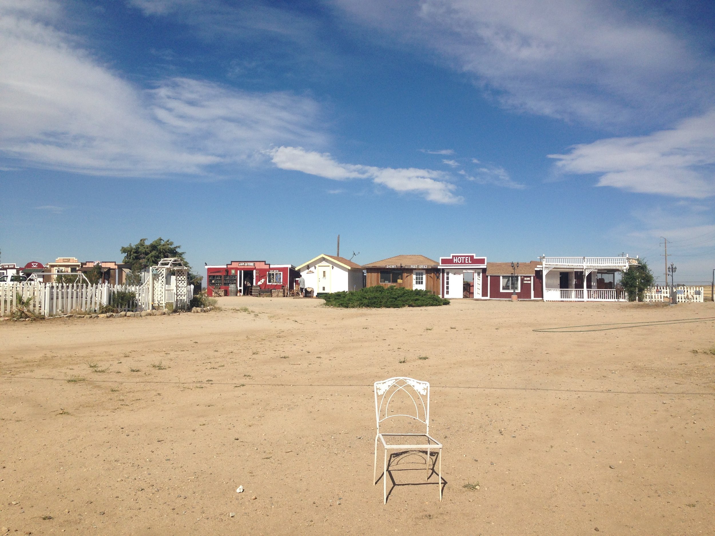
Finally took off at 6.20 am. The walk to Hikertown was quite easy, with no big ups and downs, no stones, just flat ground, arrived there around 9.30. A bit of a bizarre place but cool at the same time. Especially as I did not see anyone in the first place. The whole scenery looked like a town in a cowboy movie where it’s hot and everyone hangs out in the bar. Really bizarre!
Giggles and Legs had spent the night there camping. Good finds when checking hiker boxes. Needed to stock up a bit as I had eaten more than expected the last few days since picking up my box in Acton. Especially running out of snacks/bars and tortillas/bread for lunch (and wet wipes!)
Had a chat with people already there and when Bob, the owner, showed up had a ride to the small shop/bar about 4 miles away. Got a burger and my groceries and hung out in the airconditioned room with Pritica, Neon, Hawaii, and another hiker couple.
After going back to Hikertown did laundry, showered, and tried to relax despite the heat. I was not tired enough to sleep though (or afraid that I was getting even more tired when sleeping).
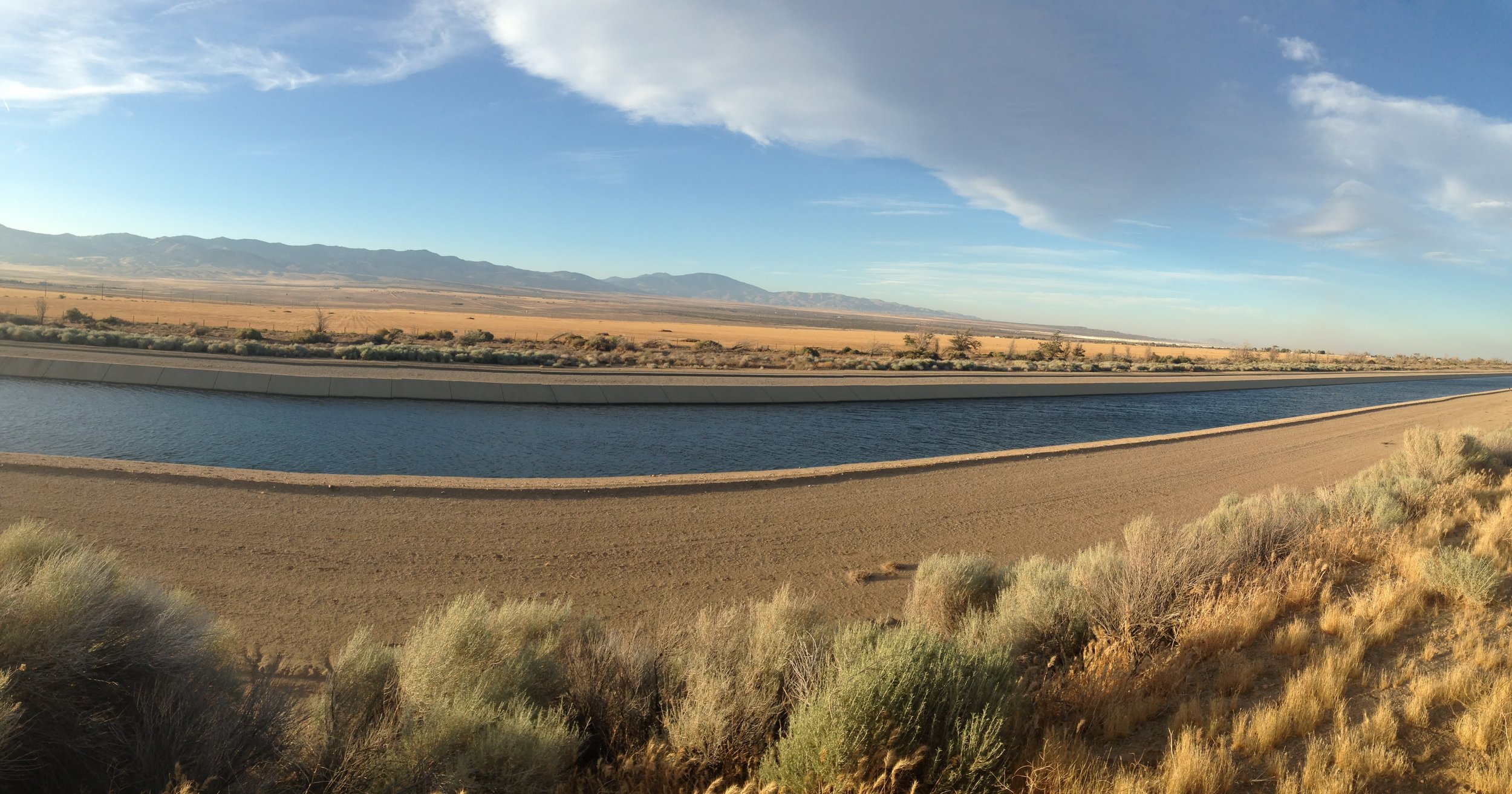
People started out hiking at 6 pm and with Giggles we left at 7 pm. The temperature and air were perfect for walking and it was a great feeling walking along the aqueduct with open water.
The trail made a turn and then ran parallel to the "old" closed aqueduct pipeline. When we walked alongside some properties I recalled that I had read some hiker's comment somewhere that there may be stray dogs in that area. Shortly after mentioning that to Giggles some dogs came running from the property we were just passing by. Luckily there was a fence so not much of a worry. Once we continued they suddenly appeared again and the small dog could pass through a hole below the fence. He was barking at us and almost seemed more scared of us than we were of him. Shortly after that though the bigger dog managed to get through the fence which scared the both of us quite a bit. Luckily he did not come down to the road and just ran alongside the property.
Once it got dark we continued hiking without headlamps for quite a bit as it was not that dark despite the new moon. At around 10 pm My feet started to get sore and I just did not feel like walking anymore. I was looking for some spot to pitch my tent and finally set it up behind some bushes. Giggles decided to take a break and a quick nap but still wanted to continue. My tent held up perfectly against the wind and with the help of my earplugs, I eventually fell asleep despite the still prevailing warmth.
DAY 39 (June 8): Under the bridge
To Tylerhorse Canyon
Took Ibuprofen for pain in my lower shin bone that had already started the night before.
I had a slight pain all the way to Cottonwood Creek & Faucet (approximately 7 miles away from where I had camped) but nothing that would keep me from walking. Also, the sunrise and morning were stunning so I did not pay too much attention to it. The way to the faucet took a bit longer than expected (either due to me taking too many photos or due to walking slower). When I got there the only people left there was the young couple I had met at Hikertown before. They were filling up water and left shortly after (heading to Tylerhorse as well).
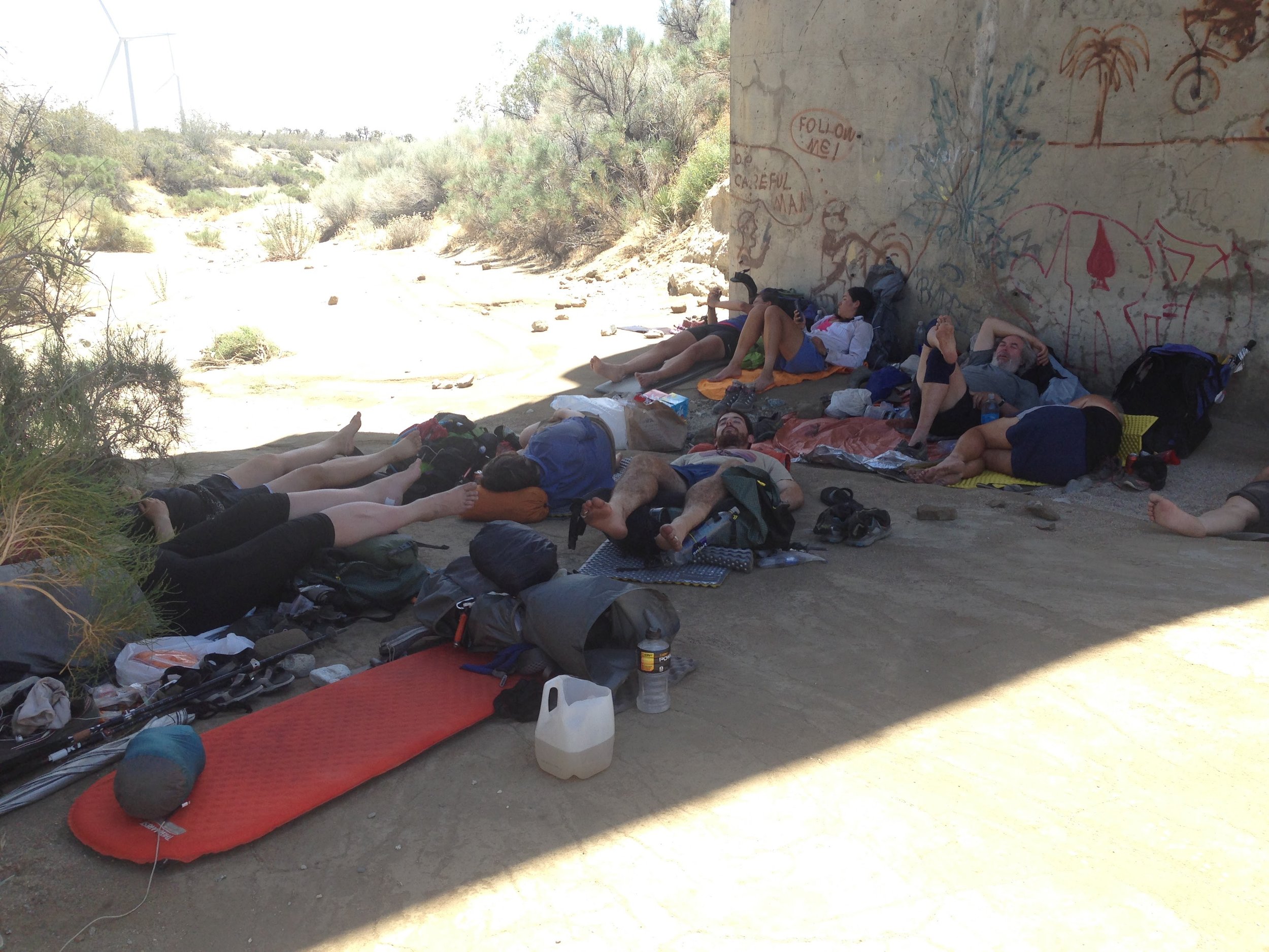
I filled up my bottles, had a snack and when I was about to leave Buttonizer and Tortoise arrived. We briefly talked and they headed down to a shady spot below the bridge. I crossed the latter and realized that the pain had gotten worse and that I would not be able to make the 7 Miles to the next water in that state; not in a reasonable time or not at all. I turned around and joined the two others below the bridge. Tortoise (a former triathlon runner) gave some good tips on how to deal with it (ibuprofen, massage, ice, and most importantly rest) and before leaving gave me some of their Ibuprofen tablets (I thankfully took them although as a reserve but had already taken the maximum dose of 600mg that morning).
The thought that I had to spend my whole afternoon below the bridge, unable to join the others at the next water spot where we planned to wait out the heat left me a bit disappointed at first. I went up to the faucet again, grabbed and filled a water container, headed down to the shade again, and started wrapping a wet towel around my foot to let it then rest on my backpack.
Not long after that a hiker arrived and bit by bit the space under the bridge filled up with some 15 people who had either hiked out from Hikertown at night or had camped somewhere in between. I met some hikers I had seen somewhere before and finally had some good company.
To our surprise, a guy arrived with sodas, fruit, and burritos! Trail magic!
After this little feast, everyone tried to take a nap. Not easy though with the heavy winds that suddenly started blowing, swirling gravel all around. I kept on switching between wrapping a cold towel around my foot and massaging it in the hope that it to get better and to be able to hike out late afternoon to Tylerhorse Canyon campground.
Some hikers started heading out as early as 3.30 pm (understandably as it got uncomfortable with all the wind and sand) but I felt it was way too hot still. I finally left at 5.30 anxious about how my foot would feel. It was not pain-free but ok to walk. Unfortunately, I accidentally got off trail shortly after leaving. I only realized it when I suddenly saw a footpath going up a hill wondering where it would lead too. Apparently, I was not the only one missing a turn. Once back on track walking became very exhausting as the trail basically crossed the wind farm. Heavy winds from ahead almost made it impossible to walk; at least it did not feel like moving forward.
At some point, two girls that I knew from hanging out under the bridge passed me and suddenly I was wondering why I did not use my tracking poles to support my foot! Instantly had the feeling walking became easier, not only for the support but also as it gave some kind of a rhythm to my walk.
DAY 40 (June 9)
To Tehachapi
17 miles
Woke up a few times at night and was still tired in the morning. Could not figure out a comfortable position with my leg on top of my backpack. Always felt like sleeping on the side but refrained from doing so in the hope that putting my leg up would help reduce my ankle's swelling.
Most people had already left camp, just saw Allegra arriving and filling up water by the spring. Once I started walking I felt it was still better than the day before. Also, it was a lot of uphill in the morning which is easier on the ankle than downhill.
Took a short break after the first major ascent and Benchy caught up. We walked together and stopped for a longer lunch break around 11.30 and Allegra joint for a while shortly after.
I walked the remaining 8 miles alone (Benchy left a bit earlier) in 3.5 hours which is not too bad taking into account my foot issue. When reaching the highway there suddenly was Legend (a "famous" trail angel) distributing Oreo cookies to everyone arriving. Together with Benchy and Bourbon, I hopped into a young lady’s car who gave us a ride to Tehachapi.
I checked in at the Santa Fe Motel where - after taking a shower - I rested my foot on a big bag of ice on the bed.
Tehachapi to Walker Pass
I am determined to hike out with Matthew “Mixed Rice” today! After yesterday’s 8-mile-test-hike I think I can give it a try.
DAY 44 (June 14) | Crazy winds
Highway 58/Camden Road to Tentsite Mile 572.9
7.7 miles
I am determined to hike out with Matthew “Mixed Rice” today! After yesterday’s 8-mile-test-hike I think I can give it a try. Sitting around will not help me to find out.
We decided to take it slow though with a decent breakfast at the bakery while both doing some emailing and other “errands” on the Internet.
At 3.45 pm we finally took the bus to Highway 58/Camden Road. The trail followed the highway for quite a bit until started heading up a mountain range (we would have to climb 3.000 feet that day). It was already windy when we were at the bottom and became even stronger with every step we moved uphill.
We both held on to our telling poles, literally stemming against the wind in order not to be blown off the mountain. At one turn we both sat down as it became absolutely crazy, however, decided that there was no other way than moving on.
Once we were even further up, the trail led to the other side of the mountain - still windy but less extreme - where we found a relatively protected campsite amid some trees.
DAY 45 (June 15) | This foot is made for walking
To Mile 590
17.1 miles
Took some Ibuprofen in the morning just in case. Walking seemed ok with my foot, especially after the first 2 miles where we entered some kind of valley where it seemed that someone had suddenly switched off the "wind button".
All good until suddenly a part of my pole broke. Damn, I thought I urgently need it as a support! Of course with that in mind, I started stumbling a few times from that point on. Not sure if that was really due to walking with just one pole or if my brain was just panicking. Just before I reached the water source where Mixed Rice was waiting, I came up with the idea to simply extend the length of the broken pole! Why has this thought taken me so long?
At the spring, we learned that there are now 2 reliable water caches within the 40-mile stretch without any water source.
Great news! I had already developed strategies in my head on how to manage this. I decided that 8 liters would be the max. amount I would want to carry (a heavy burden already under normal circumstances left alone with a bad ankle) which meant doing 20 miles a day and most probably some night hiking for it to be sufficient.
So no need for 8 liters at once and 20-mile days. What a relief! Who is that (trail?) angel who heard my prayers and installed those water caches?
After lunch, we decided to check out the campsite within 5 miles but it was completely unprotected from the wind, so no option for tenting. I felt my foot already and thought that the next site in 5 miles would be tough to get to. Luckily, we found a semi-protected spot at a pipe gate after 2 miles and decided to setup camp there.
Day 46 (June 16) | Bye bye wind turbines
To Mile 604
14 miles
It was daylight already when I woke up. Hidden inside my sleeping bag including my head and pillow I literally missed the sunrise. Mixed Rice who was about to prepare his oatmeal said it would be totally fine to leave around 7am-ish so no hurry. I had a cinnamon bagel with Philadelphia cheese and honey I had picked from a hiker box together with a cold coffee (can't bother heating water, it's perfect cold too). Yummy, what a superb breakfast!
When we left at 7.20 it was windy and quite chilly and I was hoping that this was the last time we would see wind turbines. Just about 2 miles later it looked like my wish would be fulfilled: We entered a very nice forest area.
The ground was super soft and within no time we had done 10 miles. We decided to have lunch before the next water source in 3 miles and found a cozy and peaceful spot in the grass between the trees.
After lunch the water we had left was scarce, so we headed with big steps to Robin Bird Spring, however not without taking the obligatory photo when passing mile 600 of course.
Once there we heard new rumors: apparently up to 300 hikers are currently piling up in Kennedy Meadows waiting for the snow to melt. Some sort of a refugee camp with a waiting list for taking a shower of up to 2 days and overflowing toilets. Not very exciting prospects!
We reviewed options of taking a break in some town somewhat on the way before and Ed mentioned Ridgecrest. It is quite a bit off trail (37 miles?) but there is a bus from Walker Pass and it systems to have affordable accommodation and good shopping options (Walmart) compared to other mountain towns.
Continued for some 2 miles and found a cozy spot (no wind and soft ground) in the woods at mile 603.9.
DAY 47 (June 17) | Lazy afternoon
To water cache at Kelso Road at 615.9
12 miles
Yesterday at the spring, Peanuts mentioned a heat wave coming with temperatures rising slowly up to 106F/45C until Monday. The good news: hikers in Kennedy Meadows will start moving as snow melts, the bad news: This heat will hit us just when we have to pass the upcoming stretch with very little water (42 miles not taking into account water caches).
The campsite was so cosy and after the news about KM we were not in a hurry at all, so we had a long sleep and breakfast and did not leave camp before 8.30.
Landers Meadow Spring, a beautiful area with many trees, grass, and shade was only 5 miles away. “Bavarian”, a German section hiker, was already there and quite down when he learned that resupply options at KM are very limited. We talked about different other options but he still seemed not happy. I realized at that point being on the trail for so long, not many things can puzzle me anymore really. In the end “the trail provides” and everything works out somehow.
We had lunch and spent the whole afternoon there. Carey, a local trail angel, arrived providing us with fruit (melon and cherries, yummy), cookies, and wet wipes. We talked for quite a while about how it is living up here in the mountains and that she would like to have some kind of hiker heaven up here before she headed off on her ATV.
We left the spring at 6 pm and walked another 7 miles to the water cache at Kelso Road where we filled up water - I decided that 6 liters must be enough for the upcoming 36-mile stretch - and set up camp directly there.
DAY 48 (June 18) | The Joshua Tree
To campsite mile 635
18 miles
My alarm was set to 4 am as we wanted to be on trail by 5 am to be able to make 10 miles by 10 am before another large lunch break/siesta to avoid the heat. The forecast had predicted some crispy 91F/33F.
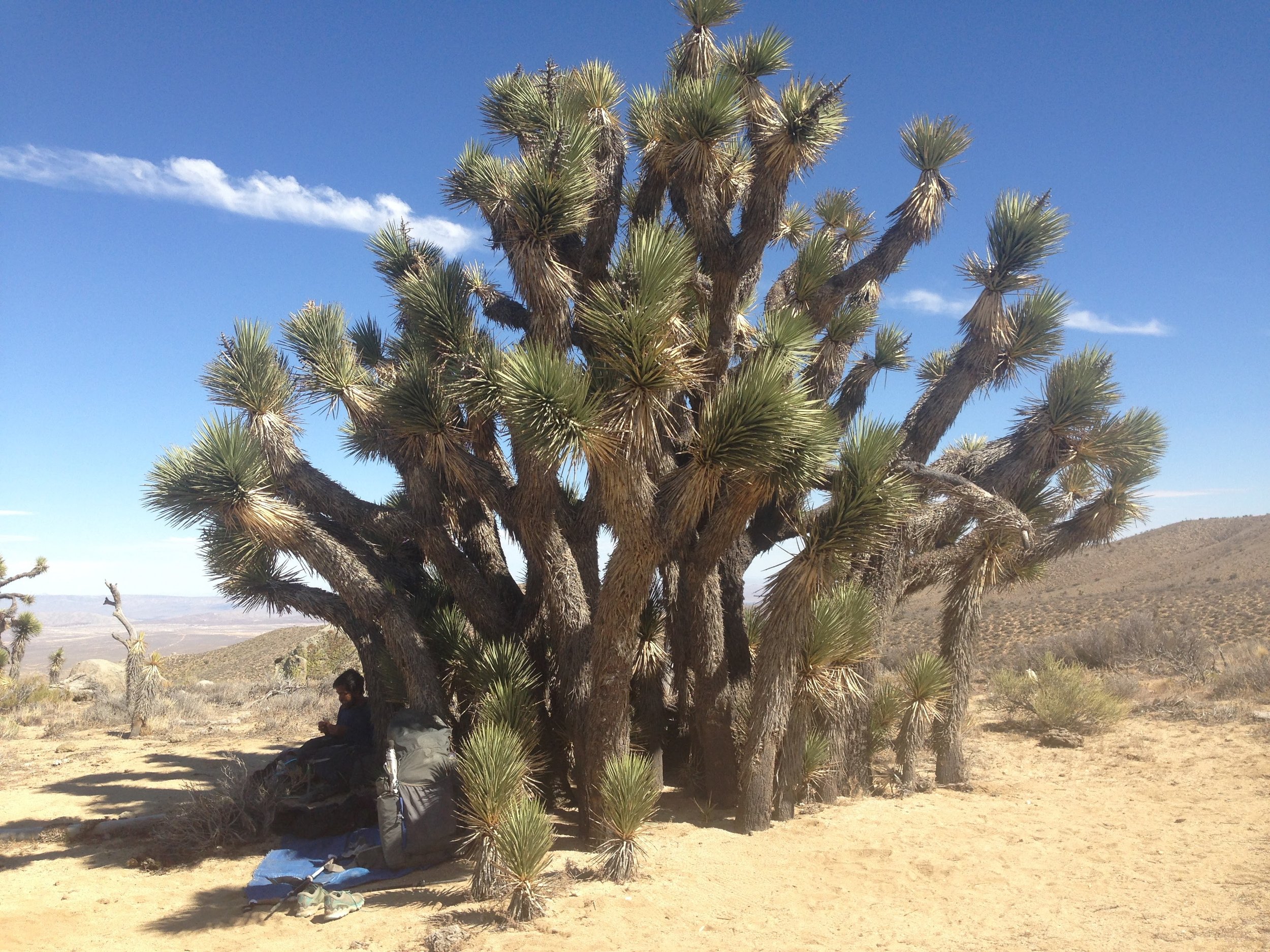
I was happy to start walking into the sunrise but soon got into a slightly bad mood as there was a slight climb and my body felt somewhat tired. Seemed as if the engine was not reaching momentum and every step was an effort in itself. At some point realized though that my foot does not hurt anymore even without painkillers and I suddenly felt very happy and grateful. Lunch and shade under Joshua tree.
It was still 5 miles to a possible water cache and as always it took me a while to get going after lunch. The first stretch was quite a bit uphill, very sandy, and without shade, in short, a bit exhausting.
I was hoping/praying that there would be water at the cache to have some extra water for cooking dinner and I also dreamed about a little trail magic although this had already happened the day before. I had run out of energy bars so worth chocolate would be great. When I finally arrived at Bird Spring, I saw Mixed Rice already kneeling in front of a box: it was full of Snickers bars, peanut butter, tortillas, and - hard to believe: Nutella!! OMG, my dreams had come true!
After devouring some of these treats and filling up on water, we literally ran up the hill. Despite an elevation gain of 1500 feet, we reached the campsite at the top (5 miles) by 9.30 pm.
DAY 49 (June 19) | Clouds
To Walker Pass CG
13 miles
We started walking at 5 am with a beautiful sunrise. I had put on my wind jacket but took it off after 20 minutes as the air was warm already. It would be mostly downhill or flat today and surprisingly the trail descended into a forest-like area with lots of shade and soft ground to walk on for at least 5 miles before turning into a dryer area again. By 10 am it was hot already and stopped for a break below some trees.
When I wake up from a little map after lunch, quite a few clouds are covering the sky. I discuss with Mixed Rice whether I should continue walking: in the end, it will be only 6 miles to the campground at Walker Pass and I would prefer hanging out there instead of here.
It is an easy walk with beautiful views. Once we get to the campground, we met Lighter Bomb, 5 o’clock, and two Mexican girls there. Shortly after Giggles and GDub arrive too coming back from a shopping trip to Lake Isabella. They all would head out shortly while both Mixed Rice and I decided to camp here.
DAY 50 (June 20) | New shoes
0 miles
Walker Pass to Kennedy Meadows
First time I was listening to music while hiking today. Loved it! The time just flew by …
Day 51 | June 21 | Into the Night
Tentsite Mile 656
4 Miles
DAY 52 | June 22 | Bored
To Tentsite Mile 676
19.9 miles
Today was the first time I was listening to music while hiking. Loved it! The time just flew by.
I set up camp by myself about 4 miles before the next water source. The tent site mentioned on Guthocks was quite windy, but I managed to find a cozy, sheltered spot.
Day 53 | June 23
To South Fork Kern River (M698)
22.1 miles
Alarm at 4 a.m. but could not get up. Very tired still, woke up various times; either because of the wind or fantasizing about a bear stealing food.
Walked out of camp at 6.30 and once I arrived at the spring in 5 miles at 8 am everybody there had gone. It was quite warm already when I started a quite steep ascent. I tried to keep a steady pace while listening to the sound of Depeche Mode’s 101 album I had not listened to for ages.
I my motivation to get up there was to have lunch once I got to past the top. Once I was there though there suddenly was no shady spot anymore! I continued to walk until 1 pm in the heat until I came to a road crossing where I climbed up to a shady tree to have a tortilla sandwich and a big nap.
At 4 pm I walked on and met Danila, Jörg on the way with whom I camped by the Kern River eventually. KM was still 5 miles away and the river was a cozy spot to spend the night.
DAY 54 | June 24 : Hello Kennedy Meadows
Arrived at the Kennedy Meadows general store at 9 am where everyone arriving is greeted by all hikers there with a big applause.
The store was just about to open and quite a few people were already hanging around on the terrace.
Once the store opened I got some fresh fruit and coffee. I met Neon again who was stuck at KM with the same ankle/shin problem I had at Tehachapi.
