GPT 32 | Cerro Castillo (Las Horquetas)
24 February 2024
“Are you carrying an insulated tent?” asks the lady beside me on the early morning bus.
“I have a good sleeping bag,” I reply, not wanting to explain that insulated tents don't really exist. She’s another kind soul worried about me walking alone on a well-maintained track called “Las Horquetas” in Cerro Castillo National Park.
Despite its popularity, I don't see anyone else until I reach the first campsite, not counting the ranger at the park entrance.
It's too early to set up camp there, but a few tents are already pitched, and the only person around is a guy standing in the middle of the trail, staring at his phone. He has a light pack and looks a bit worn out. A thru-hiker, perhaps? He starts walking quickly, and I only catch up when he stops to take a photo.
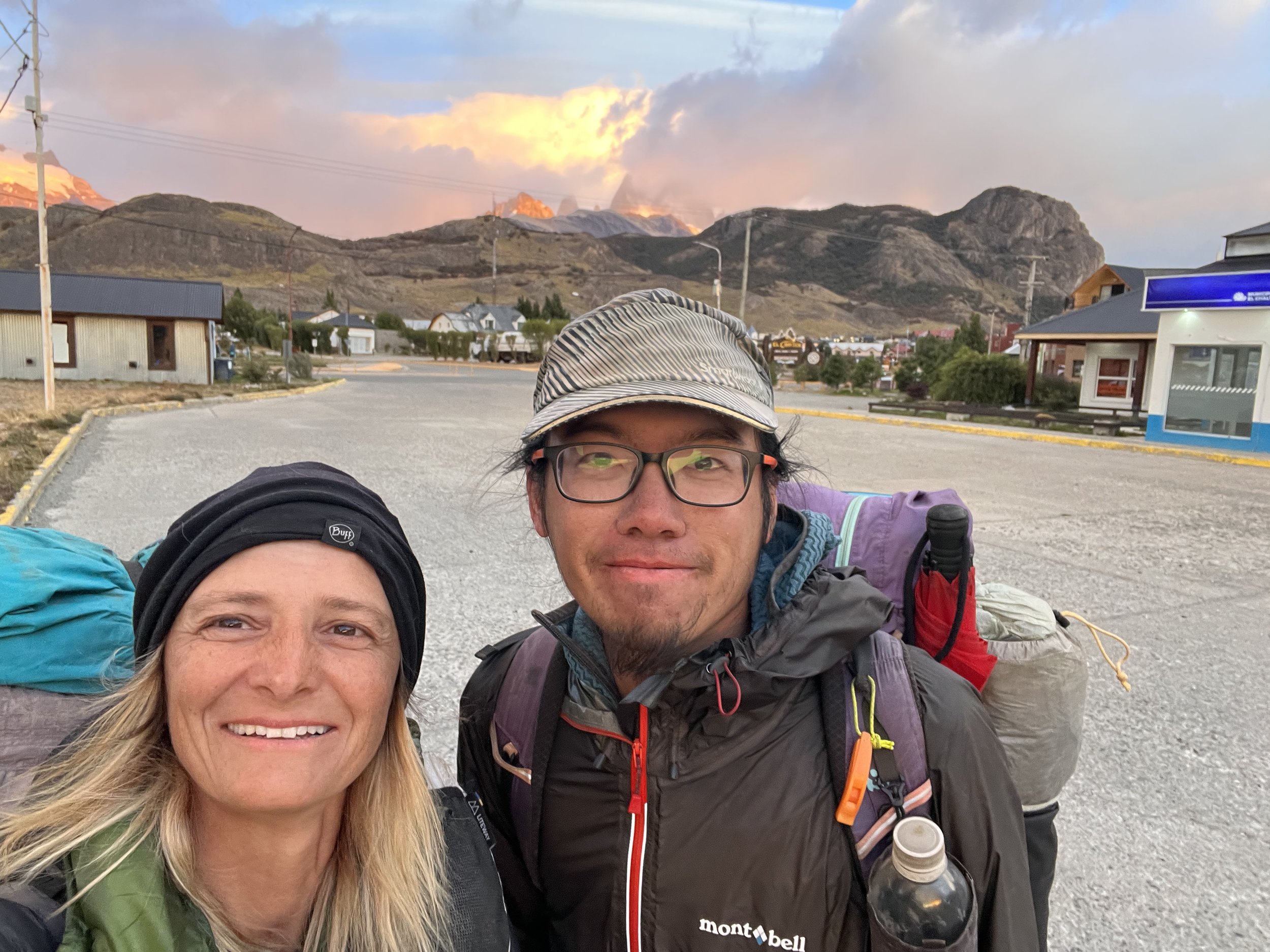
“Hi!” I say. “Hi. Are you a GPT hiker?” he replies.
“Yes!” We’re both surprised and curious since neither of us has seen another thru hiker in a long time. We continue together over the pass. Although we camp in different spots—he prefers a small lake tucked away in the bushes while I stick to a flat area close to the trail—we agree to walk together the next day. It's sweet to have some company again!
25 FEBRUARY 2024
The scenery is stunning for most of the day. Glaciers, waterfalls, and the breathtaking Laguna Castillo. It is cloudy in the early morning and I'm so lucky that the sun comes out just as I'm having my delayed breakfast by the lagoon. Sunlight transforms the colors dramatically!
Once we reach the entrance of the national park, there is a group just before us reaching the ranger station and we manage to sneak out without paying. Just to find out thought that its very unlikely to find a ride into Villa Castillo.
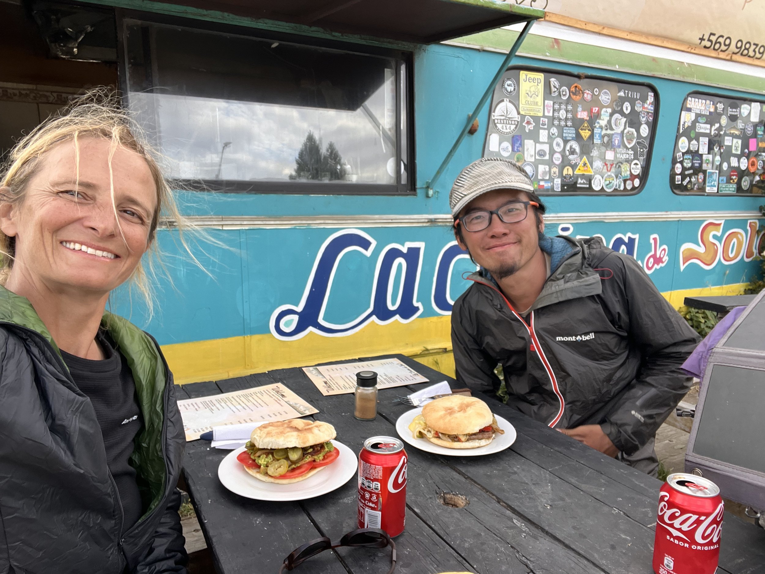
Pure happiness after a rather boring walk on a gravel road for 8 kilometers: There is a food truck right beside the Carretera Austral selling homemade, non-standard burgers. Food first!
Next on the list is accommodation. Nordic Backpackers is a combination of a campground and hostel. We opt for a dorm, and later in the evening, a bikepacker joins us. I immediately find it much easier to understand his Spanish. Turns out he’s from Barcelona!
GPT35 | Parque Patagonia
Chile Chico
26 February 2024
My tent is a bit wet in the morning. “Did it rain last night?” I ask Lilian.
“Are you joking?” he replies. Apparently, it rained quite a bit in the early morning hours. Since I wear earplugs when camping on official campgrounds to avoid being woken up by snoring, I didn’t notice a thing. We both head to the supermarket early to resupply for GPT section 35.
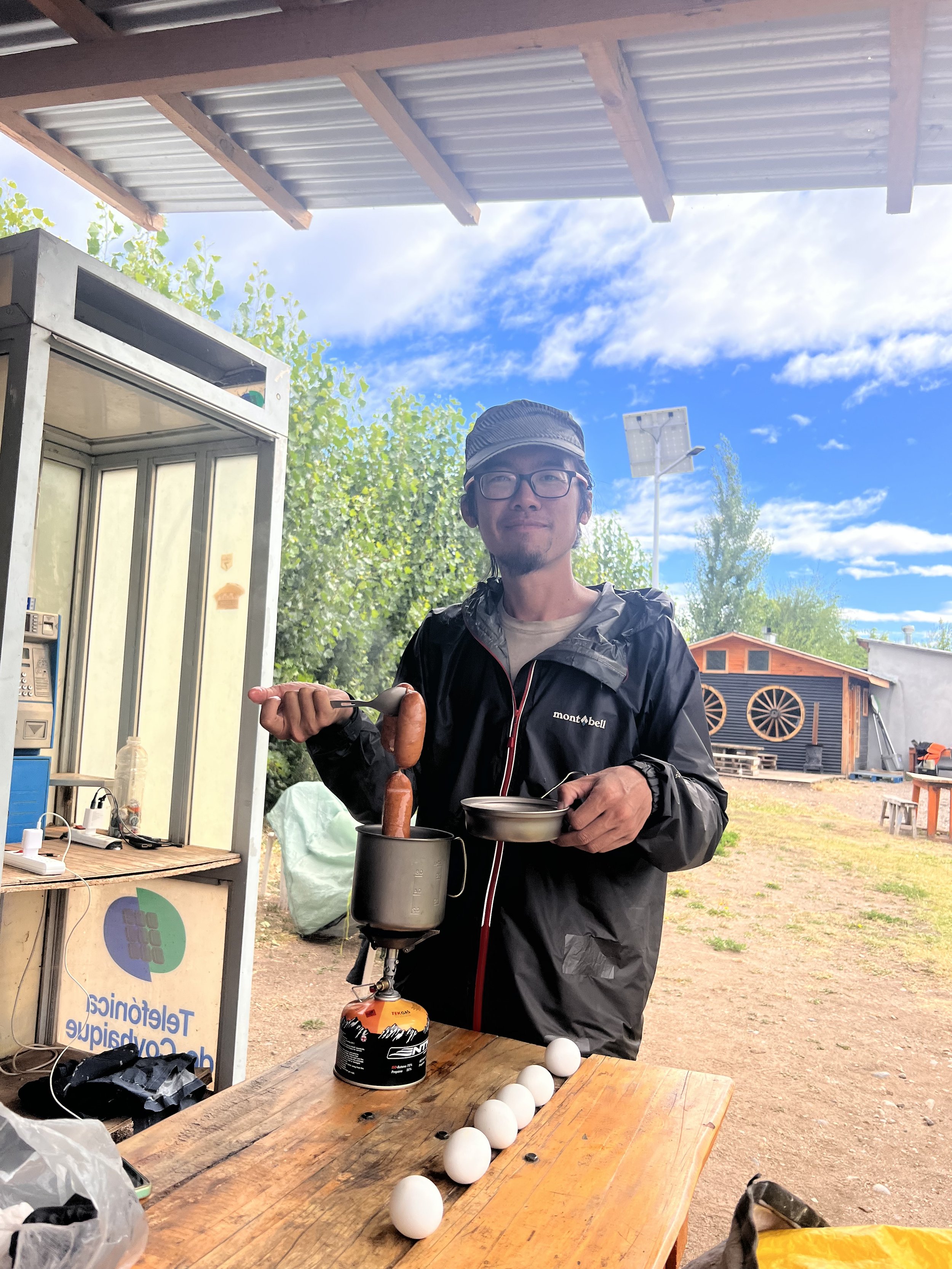
Recently, I discovered that eggs are a great source of protein on the trail, so I boil a pack of six in the campground’s kitchen area to take with me. I couldn’t find Nutella in the supermarket, so the eggs will also serve as my breakfast for the next part of the trail.
Another prep task: having a big lunch before heading out. I opt for a large salad with tomatoes, tuna, avocado, and more to satisfy my cravings for veggies, fruit and fresh stuff. Plus a giant yogurt!
Heading out for GPT section 35
27 February 2024
Heading out at midday, we’re not lucky finding a ride to the trailhead, which is about 8 km away. After chatting with a person in a shop, he offers to “make an Uber” and take us for 10,000 CPL (about 10 euros). It's a bit expensive, but since no one accepted our official Uber request, we decide to take our chances.
Unfortunately, there’s a misunderstanding about how far he would take us, and we feel a bit ripped off as we still have to walk 3 km on the road. I’m a bit angry, but Lilian says, “Just forget it.” It still bothers me as we walk up to a pass during a sunny afternoon. However, the walk is nice, and eventually, I let it go.
A safari on a windy plateau
28 February 2024 | 15°C
The previous evening, while lying in my tent, I heard a few animal noises but couldn’t figure out what they were. Definitely not the horses grazing nearby—perhaps cows or sheep in the distance?
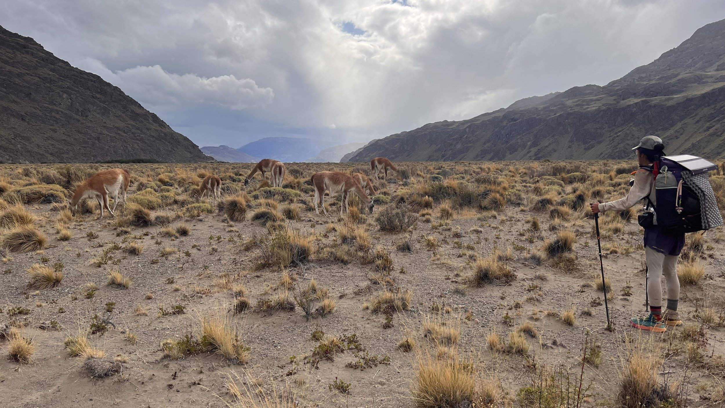
In the morning, it turns out the sounds were from a species I hadn’t seen before: guanacos, which look very similar to llamas. We spot the first ones on the way up to the pass. One of them, usually the last in line, seems to act as a guardian, warning the others when we come closer. It’s such a funny sound. 😀
Once we cross the pass, we see dozens of them. They always seem to be a step ahead, almost as if they know where we're going. It feels like being on a safari—we also spot flamingos by a lake, horses, rabbits, geese, and other birds.
If only there wasn’t that never-ending, strong wind! It lasts for many kilometers until we start descending. What a relief!
The afternoon is spent navigating cross-country, frequently checking our GPS to ensure we're heading in the right direction. By early evening, we hit the road, but there isn’t a single vehicle in sight—no ride to the entry of the national park today.
Luckily, we find a sheltered spot surrounded by trees. I wash my feet in the river and sleep like a baby.
Fifty shades of blue
29 February 2024 | 19°C
We are at the road by 7:30 a.m., hoping someone might be heading to the next town. Unfortunately, there isn’t a car in sight for miles, so we start walking the 12 km to the park entrance. We wonder about the ranger—doesn’t he drive to work?
By 9:45, we reach the park entrance. It’s 17,000 CLP for both camping and entrance. Phew!
Which lake is bluer? Lake Jenimeni is stunning with its various shades of blue, making it hard to move on. The shore of the lake is so inviting, perfect for sitting and staring at the water, if only the wind weren’t so strong.
We stroll along the “beach” to Lago Esmeralda and then Lago Azul. Its waters are so intensely turquoise that they seem unreal. We feel lucky the sun is out, allowing us to fully enjoy this natural beauty.
Lilian is ahead, and I lose sight of him once I reach the river. I look around but can’t see anyone. Did he speed so far ahead? I hear a bird whistle but see no one, so I continue through the windy valley to the next campsite. It’s nicely wind-protected and hidden in a small forest with a shelter for eating and a toilet. But no one is there.
Half an hour later, as I’m pitching my tent, I hear another whistling sound. Interesting bird, I think. Suddenly, Lilian walks into the campsite with a whistle in his mouth. 😂
Valle Hermoso & Casa de Piedra
1 March 2024 | 19°C
The weather forecast predicts rain and possibly snow this evening. Should we walk the 30 km to Casa de Piedra, a refuge?
Our morning trek takes us through a long valley over a stony riverbed with dozens of river crossings—thankfully, all easy. The sun touches the mountain tops but doesn’t reach the valley, which remains windy and cloudy.
Despite the stones, we make good progress since the terrain is pretty flat. Then, despite the forecast, the sun comes out in the afternoon! We feel so lucky.
Walking down to Casa de Piedra feels like traversing fields of gold, with dry grass stretching as far as the eye can see. As we reach the bottom of the hills, a vast valley opens up to the west: Valle Chacabuco.
It’s quite windy on the valley floor, and we pick up our pace to reach the campground, especially as dark clouds seem to follow us. But then we have to stop: a handful of guanacos are right beside the trail. They seem used to humans and don’t run away, so we take a little photo shoot.
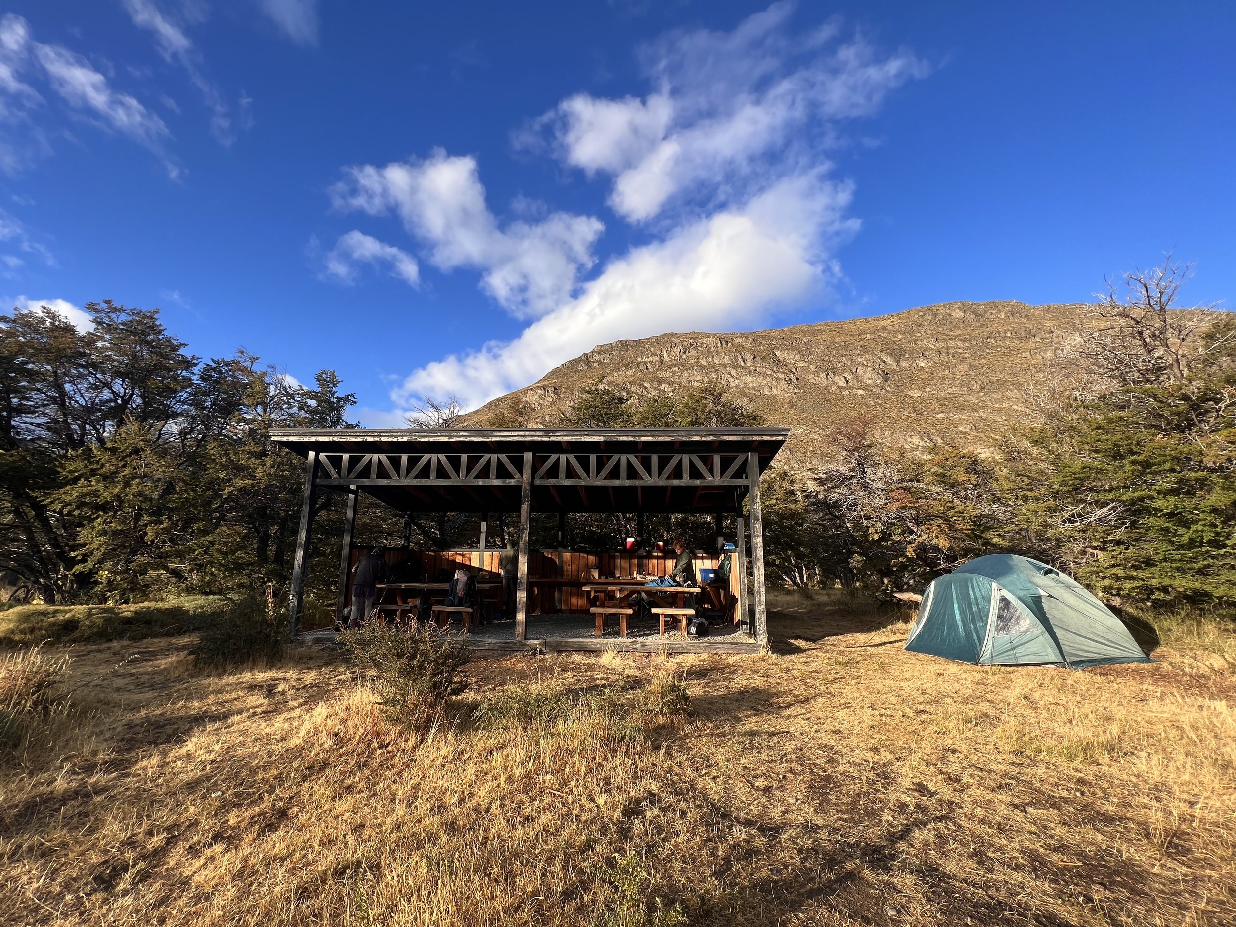
Casa de Piedra turns out to be a campground with several shelters for cooking and lounging, plus hot showers, toilets, and a common room inside the stone house.
After a 30 km day, we’re happy to have made it here. We eat our dinners in the sheltered area outside, watching the rain pour down in the valley we just came from.
Lago Gutiérrez & a cold night
2 March 2024 | 6°C
We weren’t sure about the weather the previous night, but as I peek out of my tent in the morning, it looks much better than expected. Even a few rays of sunshine!
Surprise, surprise—on my way to the toilet, I see snow on the surrounding mountain tops! It looks like someone has sprinkled powdered sugar on them.
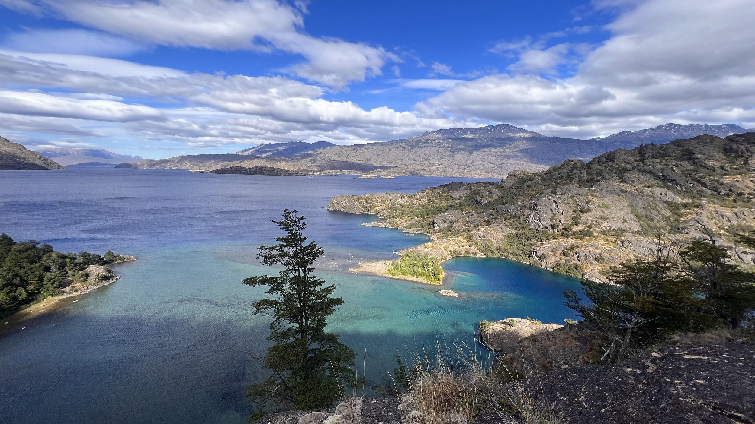
Lago Gutierrez is the next lake coming up. Though I thought I had seen enough lakes, this one shimmers in a deep blue under the morning sun. Another amazing Patagonian morning, complete with the familiar winds.
The walk is nice, but later in the afternoon, I start feeling exhausted. I have a bit of a cold—my nose is running and my throat is itchy. It seems like the wind of the past days has taken its toll. It’s hard to decide which layers to wear; it’s a constant battle between sweating and getting cold. During an additional afternoon break, I make a big pot of hot tea and take a power nap. I’m really tired.
“Would you like to camp here?” Lilian asks during our break.
“No, let’s go at least to the next lake so we have a chance to make it to town tomorrow,” I reply.
Despite a hearty dinner, I sleep cold that night and wake up several times. It seems like my body doesn’t have enough energy to produce heat. 😥
Lago Cochrane
2 March 2024 | 7°C
Despite sleeping cold and waking up early, I look forward to my morning coffee.
The morning involves a bit of up and down until we hit a track packed by a 4WD. Easy walking, yeah! We're so excited that we accidentally get off the trail. No constant checking of the GPS!
Though this route is longer, we decide to stay on it as it eventually leads us back to the regular GPT route. I’m tired of drinking cold water, so whenever we take a break, I pull out my stove for a cup of tea, hoping it’s good for my throat.
We take a late lunch break at the largest lake of this section: Lago Cochrane.
As if to say, "I am the most beautiful of all the lakes," it shimmers in different colors, from dark blue to turquoise, as we walk alongside it to the other end.
It's a warm afternoon, feeling like a summer holiday by the beach. Another great day on the trail!
GPT39 | Monte Fitz Roy
El Chaltén No 1: A Windy Welcome
9 March 2024 | 3°C
When I open my eyes in the overnight bus, I see a huge lake outside my window—Lago Viedma. It’s 7:30 a.m., and we must be very close to El Chaltén already. Although the Mountains around the town are hidden behind some big clouds, I am quite moved and excited once I hop off the bus.
Our objective here is to hike El Circuito de Huemules, which is also Section 40 of the Greater Patagonian Trail, while we wait for a good weather window for a multi-day glacier tour on the Chilean side.
At the visitor center, we learn that it’s going to be very windy for the next few days. This isn’t ideal for the four-day trek that includes two passes, one of which is called Paso del Viento (Windy Pass). Also, the views aren’t great, and we feel it’s a pity to just “rush through” for the sake of having done it.
Let’s wait until tomorrow and see.
There are other treks around, and as the weather changes rapidly here, there might be another chance in a couple of days. Will Cerro Torre or Mount Fitz Roy come out of their cloudy hideaway?
Monte Fitz Roy First Try: A Windy Morning and Hidden Views
11 March 2024 | 4°C
Heavy wind gusts in the morning destroy my emergency blanket, which I used during the night to protect my sleeping bag from rain or snow potentially blowing into my little cave. I am still protected and quite warm, but a few droplets sneak around the corner—not a big deal.
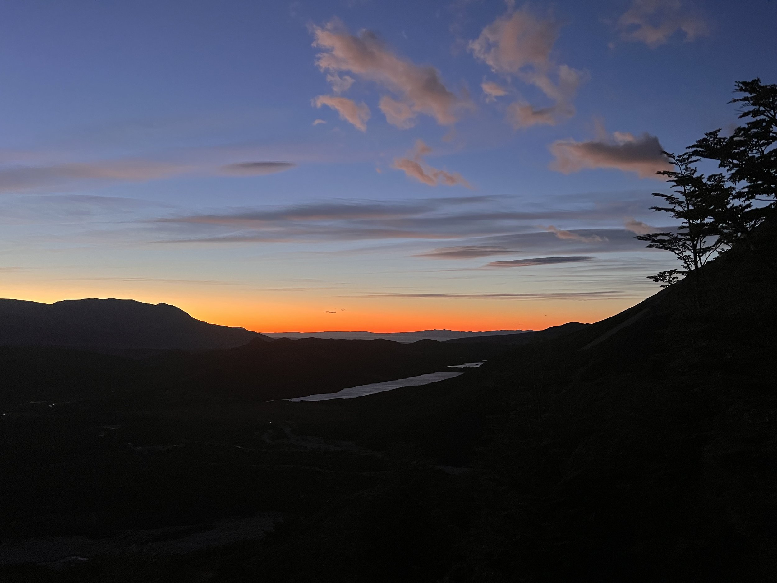
The very first light of the day reveals some shades—the mountain range just in front of me. Magic happens just before the sun rises: the mountains and the glacier are suddenly painted in a shimmering golden color! I have never seen anything like this before.
I make my coffee and breakfast while watching nature’s TV, when someone behind me starts picking up stones, wondering why there is a tent draped over them. “Hola!” I shout. Someone comes around. “Hola. Oh, I was wondering what this is. Sorry.” A group of three is heading up to climb one of the mountains; they say that there is a good weather window in the afternoon.
At 9 a.m., my hiking buddy Lilian, who camped closer to the lake, shows up. “Very windy last night,” he says. Though he pitched his tent in a protected spot behind a big rock, he had to additionally secure his tent with big rocks as the wind direction changed at night.
We both head up to Laguna de Los Tres cross country (no trail). It’s a rather steep climb, but I quite like it as we gain elevation very quickly. No one is in sight until we reach the lagoon, where several people are already walking around. It’s a pretty busy place, but Monte Fitz Roy doesn’t show up—it’s hiding behind the clouds 🥲.
When heading down, a lot of people are walking up. They seem to know that today is a good chance to see the popular mountain. We only realize this a couple of hours later during our lunch break. The clouds move, and move ….. and suddenly the sky is clear. Bummer! We just see the mountain tip from where we are at this point.
A stunning sunrise at Monte Fitz Roy
12 March 2024
My alarm clock rings at 6 a.m. I’m still in a dream and don’t understand what’s happening. Oh yes, I wanted to head up to Monte Fitz Roy for sunrise. Should I really do it or stay in my cozy sleeping bag? I snooze, and ten minutes later, the alarm goes off again. “Come on, get up,” I tell myself. I quickly get dressed, pack some snacks and my sleeping bag, and head out.
Until that point, I thought I might be the only one, but as soon as I look towards the mountain, I not only see a clear sky and the faint image of a mountain but also many little lights along the trail up to the lagoon. It seems a lot of people had the same idea! I start walking quickly, suddenly feeling like I am late. After just 1 km, I have to take off my midlayer as I start sweating already. It’s 400 meters of elevation gain, roughly one hour according to a sign.
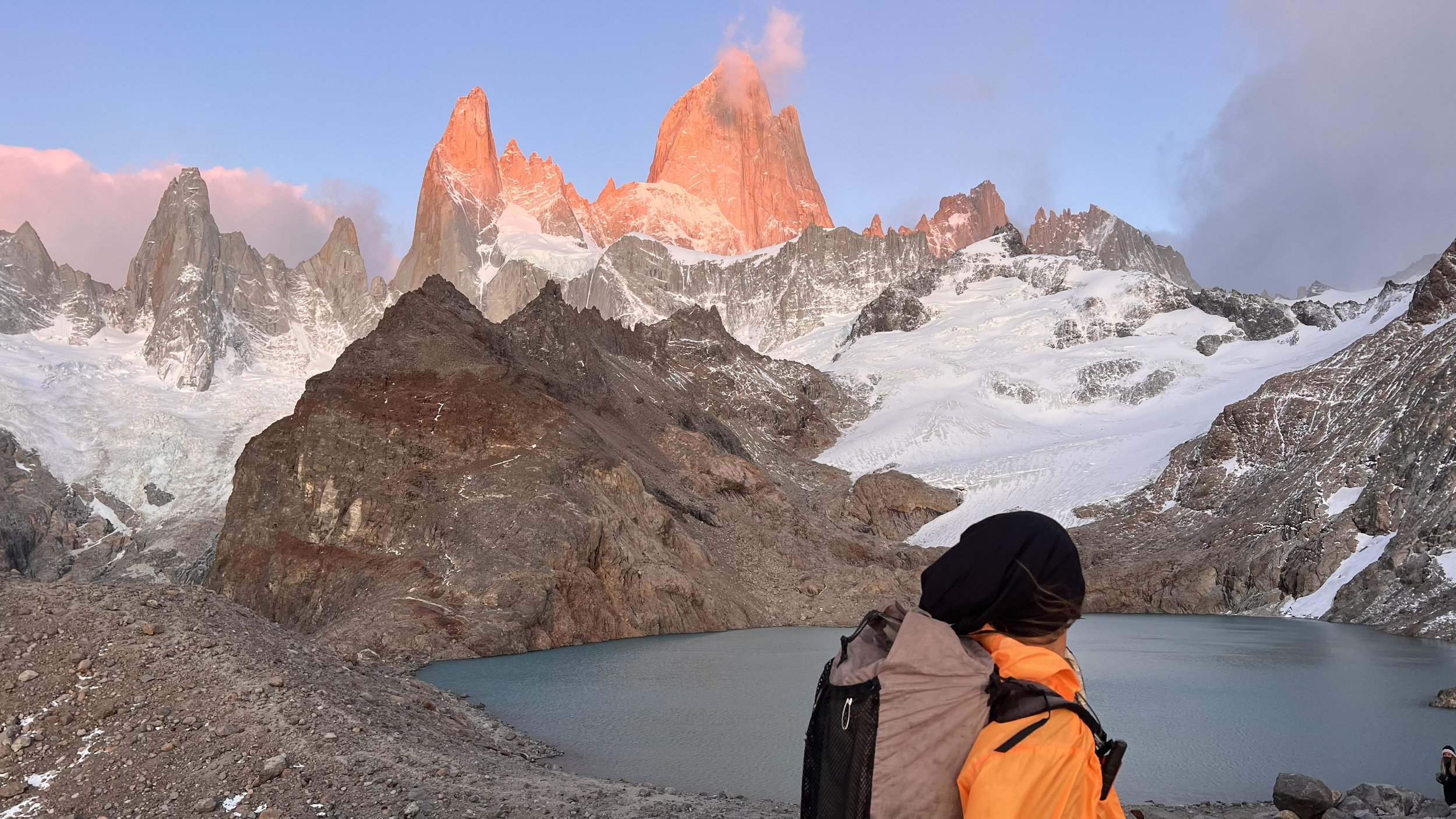
Forty-five minutes later, I am very happy and moved as suddenly the mountain that has been hiding in the clouds for the last three days majestically appears in front of me: Monte Fitz Roy. It’s incredibly windy up at the lagoon. I quickly take some photos with another guy before I look for a protected spot behind some rocks.
Good thing I brought my sleeping bag. I wear it like a coat, allowing me to sit and watch the colors on the mountain turn from red to yellow and then white as the sun completely appears. What a fantastic moment. I stay a bit longer until my feet and hands are very cold, then quickly start moving downwards again. What a morning!
El Chaltén No. 2: Gear Repairs, Cake and Tea
13 March 2024 | 1°C
Rain and snow are what the weather gods have in store for the next couple of days.
Checking in with our guide for the glacier tour doesn't bring better news either—the good weather window has moved back as well.
We’re stuck in El Chaltén! It's not a cheap place, but it's also not the worst place to hang out for a day.
I use the time to patch up my tent. Using it as a wind shield has created some tiny holes—oh no! Luckily, my hiking buddy Lilian carries a big strip of DCF repair tape. It’s a bit of tedious work, but I hope I found them all.
My reward in the afternoon: a huge piece of cake and an enormous pot of tea in a lovely café.
Let’s wait, see, and drink tea!
GPT44 | Glacier Perito Moreno
El Calafate
15 March 2024
We still have some time to kill before we can start our glacier tour, but the weather in the El Chaltén area is predicted to be rainy and extremely windy for the next few days.
I’ve been considering heading over to El Calafate. While I’m not too keen on the super touristy spots, the Perito Moreno Glacier is so close now, and we really have nothing else to do. Should we give it a try?
When I first mention it to Lilian, he thinks it's too much of a hassle. However, after spending a day waiting out the rain in El Chaltén, he also starts considering it. We check out bus options and carefully plan our return trip to ensure we make it back in time for our guide meeting in three days.
It's a 3-hour bus ride to El Calafate. Although the journey primarily takes us around Lago Viedma with expansive pampa stretching as far as the eye can see, I spot numerous guanacos grazing along the way and, for the first time, see condors gliding in the sky.
Upon arriving in El Calafate, we look into buses to Perito Moreno and discover that the fare is 40 euros per person. This doesn’t even include the entrance fee to the national park, which is an additional cost! We wonder if it’s really worth it. I check prices at various bus company counters while Lilian searches online, but the price is the same everywhere.
Feeling it’s a bit of a rip-off, we decide to head downtown. On the way, we pass a car rental company. Renting a car for the two of us might be a better option. The price is just under 80 euros, but we would still need to factor in insurance and gas.
Exhausted, we go for lunch to mull over our options. It’s not wise to make a decision on an empty stomach. With free Wi-Fi in the restaurant—since I only have a Chilean SIM card—I check online. I find an offer for roughly 60 euros, including full insurance cover. That’s more like it!
Perito Moreno
16 March 2024
It’s great to have the flexibility of a car, so we set our alarms to make the most of the day. The weather is a bit cloudy with a chance of rain, but it’s our only opportunity today.
There’s very little traffic once we leave El Calafate. The ride is captivating, with Lago Viedma shimmering blue on one side and a mountain range on the other. The road is mostly flat and straight, cutting through the pampa. Although we’re driving a small, slightly old Ford, I soon forget the 80-kilometer speed limit.
It takes us 1.5 hours to reach the parking lot. The overcast skies turn out to be an advantage, as there are fewer people and plenty of opportunities to stand and stare. When the sun finally breaks through, it causes massive chunks of ice to calve off the glacier and crash into the water. Absolutely fascinating! I’m so glad we came!
GPT38 | Glaciar Chico / Campo de Hielo Sur
Candelario Mansilla
18 March 2024
It’s time to head towards Chile again, as the good weather window for the glacier tour is finally approaching. Leo, our guide, wants us to be in Candelario Mansilla by March 18th. It’s a small settlement with just a few houses belonging to the same family and several carabineros working at the border checkpoint.
To get there, we take a tourist bus to Lago Desierto (for which we have to buy a return ticket, as one-way is not possible). Unsure when we’ll have electricity again, we stop at a restaurant by the lake for a coffee and to fully charge our phones (in addition to our already charged power banks).
The walk along the lake is not as scenic as we expected. It’s a bit boring but also protects us from the slight rain and snow. The sky is cloudy and gray, with only a few leaves starting to turn yellow and red.
At 8 p.m., we finally reach the Argentinian border checkpoint, which has a campground tucked away in the trees. We head over to the building, hoping to complete our paperwork, but a friendly border official tells us we’re 15 minutes late and all the systems are shut down already (we learn the next day that it’s just a paper book). Oh well. We pitch our tents and fall asleep after our late dinners.
At exactly 9 a.m., we knock on the door of the Gendarmeria. The paperwork is done quickly, and we head on towards Chile. The actual border is just 5 km away, with the Chilean border checkpoint another 15 km beyond that.
It starts raining on the way down to Candelario. Suddenly, we see a tractor, some bikes, and people pushing a trailer. Someone has given a family of bike packers a ride. We immediately sense that this is our ride to Candelario! I ask the man in the poncho if he can take us. The trailer’s axle is broken, he replies, but we can sit on either side of the tractor if we want. No problem for us!
The trail provides! It’s a very bumpy ride for approximately 12 km, and our butts will hurt the next day, but we are extremely happy about this unexpected taxi ride that saves us from a long, boring walk on a gravel road.
Embarking to Glaciar Chico and Refugio Pantoja
20 March 2024
“Cast off!” We finally embark on our journey. Our guide’s boat, Tempano, named after the Spanish word for “iceberg,” is ready. We put on our life vests and load our gear—ice axes, crampons, snowshoes, and backpacks—into the boat. We then start speeding across Lago O’Higgins. The wind picks up as we approach the glacier, and big chunks of ice float in the water. Fascinating!
After only 30 minutes, we reach the base of Glacier Chico. We drag Tempano out of the water, secure it properly, and begin our trek on the glacier.
The first refuge is only 8 km away. "Not much," thinks the thru-hiker. But it soon dawns on us that walking on a glacier is a completely different game. Navigating the massive crevasses is key—it feels more like traversing a giant labyrinth than following a trail. 🤪
Enjoying the Views at Piedras Rojas
21 March 2024
We reach the next refuge around 1pm. After a small climb up some rocky terrain, it comes into view only as we are almost standing in front of it. It’s another white dome with a metal structure and a thick plastic covering at the bottom.
The scenery is breathtaking with awesome views over the glacier. Time for a quick break and a round of mate.
It feels way too early to stop, but the next refuge is another 8 kilometers away, which in this terrain means another 5 to 6 hours of walking with either crampons or snowshoes, according to our guides. It’s slightly uphill from here. Lilian would like to continue, but I am not so sure. I could do it, but would it be fun and allow us to enjoy the scenery? Will it be dark by the time we get to the next refuge? In the end, we decide to stay.
It's a lovely sunny day, and the setting is just perfect for taking some pictures. Lilian ventures a bit higher up the mountain while I lie on a huge red rock. These rocks are scattered all around and give the refuge its name, Piedras Rojas (Red Stones). The stones are warm, heated by the sun. If I close my eyes, it feels like I am lying on a beach.
Navigating the Glacier to Refugio Garcia Soto
22 March 2024 | 2°C
After a hearty breakfast prepared by our guides, we continue our trek through the glacier's labyrinth. The snow has picked up, giving us a chance to test our snowshoes, crunching through the fresh snow. We also practice walking as a rope team, staying connected to avoid any accidents.
Later in the day, as we already start our ascent to the refugio the familiar shapes of Monte Fitz Roy and Cerro Torre come into view. Leo points them out with a grin. Seeing these famous peaks from a new angle is a nice surprise.
From that point, it is just a short but steep climb to Refugio Garcia Soto. It stands out like an island in this vast snowy area, located on the Chilean side just a stone's throw away from the Argentinian border.
The refuge is a practical hut with a simple kitchen, a table, chairs, and a small dorm with bunk beds. It's basic, but it provides the warmth and comfort.
What to do on a bad Weather Day in the Mountains?
23/24 March 2024
Eat, sleep, drink tea, repeat. That’s the mantra on a bad weather day in the mountains. I find an entertaining German book in the little bookshelf where previous visitors have left some reading material. It seems more like a book someone would buy at an airport and take to the beach for "lightweight reading." How the heck did it get up here?
While we knew we would have one waiting day at Garcia Soto, we wake up to rain the next day as well. Walking in regular terrain is unpleasant but doable; it's a different game on an ice field where snow bridges are the only way to safely move forward. Are they still stable enough?
Leo sets a timeframe until 9 o’clock. If it doesn’t stop before then, we have to stay. Though it’s not very far—only 15km—it will be slow navigating around the crevasses, and we will need time to set up our camp before it gets dark. Unfortunately, the weather gods have no mercy today. While I decide to continue reading “my book,” the guys head out to Cerro Gorra Blanca (“White Hat”) just behind our hut as soon as the wind ceases a bit.
Interestingly, the skies clear up in the late afternoon, and Cerro Torre comes out of his white hideaway. The view from here is fascinating, but it would be even more breathtaking at Circo de los Altares ….
It would be great to get tomorrow and have the same views … We already “lost” one day, and our weather window to get there and back is shrinking. Fingers crossed!
Crossing the Crevasses to Circo de Los Altares
26 March 2024 ⁄ 2°C
“Grieta!” I shout and let myself fall into the snow. Both Lilian and Pipe behind me do the same. Leo, our guide leading the way, just sank a bit more than knee-deep into the snow. It’s not a big deal, but a live demonstration of why we’re all roped together, traversing what is essentially a hidden sea of crevasses.
We had already “practiced” walking as a rope team on the way up the glacier, but now it’s the real deal. Although I know the rope is my lifeline, I dislike being tethered, unable to walk at my own pace. Sigh!
We started early in the morning with our snowshoes on. The first 8 of the 15 kilometers from Refugio Garcia Soto to Circo de los Altares passed pretty quickly. But now, it’s getting super slow.
As the second in our rope team, I meticulously follow Leo’s tracks. Suddenly, the ground vanishes beneath my feet, and I’m floating in the air. Everyone in front and behind me drops to the ground. Half of my body is above the surface while the other half dangles in a small crevasse. Unable to find a foothold, Leo pulls me out, and we continue. Phew!
Did I misstep, or did a snow bridge collapse under my weight?
By 6 pm, we finally reach Circo de los Altares. The day before, Charly had described it as a magical place where towering peaks form a grand circle. Unfortunately, luck isn’t on our side today—the peaks are hidden in clouds. Bummer! Still, I can feel the enchantment of this place as we use our ice axes to carve out a flat spot for our expedition tent. Sleeping on ice tonight. Exciting! Will it be cold?
A long way back to the hut
27 March 2024
Despite the wind shaking our tent, it feels cozy inside. I slept well and didn't feel cold at all—one of my biggest fears hasn’t come true. Yeah! Pipe heats water for the morning mate as always, and we all have a quick breakfast before packing up.
“A sufrir,” says one of our guides as we start walking. Uh-oh. It’s cloudy, but no rain... yet? We've got the same 15 kilometers to trek back.
Snowshoes on, I start trotting behind Leo, trying to find a rhythm. It seems we’re on a better path than yesterday; at least it feels like we’re moving faster. There are ponds of water here and there, and I push away the thought of falling into one. Freeze to death immediately?
I start to feel desperate. It’s the same route back, and sometimes it feels like we’re not moving at all. Frustration and tears well up. But angry with what or whom? It is what it is. It’s just walking. It’s mountains and a lot of snow (and quite a few invisible crevasses). I look for stones or landmarks on the mountains to gauge our progress, but everything feels terribly slow. I feel very tired suddenly. Every step is an effort. Is it really my body or just my mind? It feels like the rope is constantly pulling me. Poor Leo, who is walking in front of me, I think. At the same time, I feel something pulling me back as well.
Leo seems to notice and suggests we switch positions. I am now second to last with just Leo behind me. I put on some music to distract and entertain myself.
At some point, I notice that everything gets easier. I have to slightly pick up the rope in front of me to avoid stepping on it. It seems I am walking faster than Lilian. Is it the music, the switch of positions, or the fact that the sun came out?
The refuge is still not in sight, but I can roughly guess where it is. How long will it be—another hour or more? The sun is out, but the wind has picked up as we start ascending. It’s blowing heavily from the side. I am getting cold, but I don’t want to stop and make everyone else stop to put on another layer. I just want to walk to the sound of the music.
And then suddenly, a familiar pole comes into sight. That’s where the refuge is! As soon as we take off our snowshoes, Charly, who stayed in the hut for maintenance work and cleaning, comes running towards us. “Congrats, you made it!” he shouts against the wind, “There’s food and tea inside”. Heaven! What a ride!
Racing Against the Weather Back to Lago O’Higgins
27 March 2024
With windy and rainy weather forecasted for the next couple of days, navigation on Lago O’Higgins will be impossible, so we need to return to our boat at the base of Glacier Chico today. The distance is roughly 24 kilometers, a stretch we had covered leisurely in 2 days on the way up.
It’s a clear morning, and we have an early start at 8 am. Monte Fitz Roy waves goodbye while Cerro Torre prefers to hide in the clouds. With a last, nostalgic glance, I almost feel a bit melancholic.
The scenery on the way down is equally impressive, with the southern Patagonian ice field just a short walk downhill from the refuge. I almost start running with my crampons on, but watching left and right and taking photos simultaneously proves a bad idea. I fall, and while the frozen ground is excellent for walking without sinking, it is rough on my hands, which start bleeding. Never mind; it doesn’t change my good mood.
Everything looks different today, with most of the snow we saw on the way up now melted. I take my crampons off when I feel confident in my hiking boots' grip. Unfortunately, one of my hiking poles breaks when I accidentally place it in a hole. It’s not a problem at this point, but I will miss it dearly later in the day.
We stop at Piedras Rojas for a brief break, but Leo soon encourages us to push on as we still have some distance to cover.
While strolling over the vast flat surface on top of the glacier called “the highway,” I wonder why he is pushing us so hard. Soon I learn why. As soon as the highway ends, the crevasses become huge, and we head to one side where we must climb over big rocks, followed by a section where we lower ourselves down with a rope.
At one point, we can already see Lago O’Higgins, but as always, the last mile feels the longest. It gets pretty steep towards the end, so I put my crampons back on. It’s too easy to slip when your feet are tired. Then, it’s quick: climbing up and down more rocks, and our boat comes into sight. It will get dark soon, and after some quick high fives, we all jump into the boat. So quickly, in fact, that I totally forgot to take a finisher picture!
Rio Condor
29 March 2024
We’re kind of stuck at Leo’s house by Rio Condor for a few days, as the wind is too strong to navigate the boat out of the relatively sheltered arm of Lago O’Higgins towards Candelario. Although it feels a bit like being stuck, it’s a welcome break after a week of trudging across ice and snow with crampons and snowshoes.
The property, accessible only by boat, sits atop a hill overlooking a stretch of the lake, right next to the mighty Rio Condor.
For the next two days, our walking is limited to Leo’s property—moving from the small family home to the outdoor toilet and a bit further to the Jurte, where the four of us (Lilian, Pipe, Charly, and I) are sleeping.
We enjoy delicious meals from the family garden, fresh eggs from the chickens, and goat meat that Leo bought from a settler on the way back from the glacier.
We sleep a lot, and I take the opportunity to repair some gear. My pack has taken a beating from crampons, a sharp ice axe, snowshoes, and sliding down rocks on the way back.
I also lost my gloves somewhere on the way back from the glacier. It’s a bit sad since I had just received them for my birthday. 🥲 “They got you through some reasonably cold and intense days,” says Lilian. True.
Thank you, gloves. I’ll miss you.
GPT67 | Dientes de Navarino
Puerto Williams
15 April 2024 | 17°C
As the plane rolls across the airfield, it’s only when it parks right in front of our gate that I realize this is the one taking me from Punta Arenas to Puerto Williams. I was expecting something much smaller, but this aircraft looks like it can hold at least 150 passengers. The plane is nearly full, and when I reach my seat, a man is already sitting in it. He seems to know he’s in the wrong spot and asks if I can take his seat, also by the window on the other side. I agree, figuring it might be easier for him to avoid squeezing out of the row.
Lucky me—although I miss seeing Punta Arenas during takeoff, I get a stunning view of the mountain ranges on Isla Navarino as we approach the island. Just a few patches of snow remain on the high peaks here and there. Perfect!
The “airport” at Puerto Williams is little more than a runway and a small airstrip. Everyone disembarks and waits outside as a vehicle with trailers arrives, carrying all the luggage.
Though the town looks quite close, Google Maps says it’s a 50-minute walk to the center, with the port in the way, forcing me to walk around it. I start walking, but after just 5 minutes, a minivan stops and offers me a ride. I gladly accept, chatting with some cheerful locals until they drop me off right in front of the hostel. No need to tell them which one—it’s the only one in town, and of course, they know the owner.
A friendly, energetic woman, greets me with a big hug. When I mention my hiking plans, she suggests I talk to the young couple inside who have just returned from a similar hike.
While they prepare pizza dough in the kitchen, they tell me it took them seven days instead of five to complete the Dientes Trail. A heavy snowstorm the previous week had them stuck in their tent for a day, and crossing some of the steeper passes in knee-deep snow was grueling. Ouch!
Now uncertain, I study the map again. From the plane, I barely saw any snow—has it melted, or did I miss something? I consider an alternative route through the valley and head to the carabineros (police station) to inform them of my plans. The young officer informs me that the trail is technically closed for the season and tries to steer me towards easier day hikes. But that’s not what I came here for. As I persist, he reluctantly hands me a form to document my itinerary, gear, and a waiver acknowledging I’m proceeding at my own risk. I can almost read his thoughts: “Stubborn, reckless tourists.”
Sendero Windhond
16 April 2024 | 12°C
I wake up on an almost flat sleeping pad—looks like my fix in Punta Arenas wasn’t as successful as I’d hoped.
The morning is off to a better start when the lovely owner of Refugio El Padrino insists I join her for breakfast. She even offers to give me a ride to the trailhead, which is a bit out of town. She drops me off on a forest road where a sign marks the beginning of the trail. The first few kilometers through the forest are relatively easy, but a bit tedious as the trail often disappears, requiring constant GPS checks.
Eventually, the forest ends, and I emerge into an open area with intriguing rock formations in the distance. A first glimpse of “Los Dientes”?
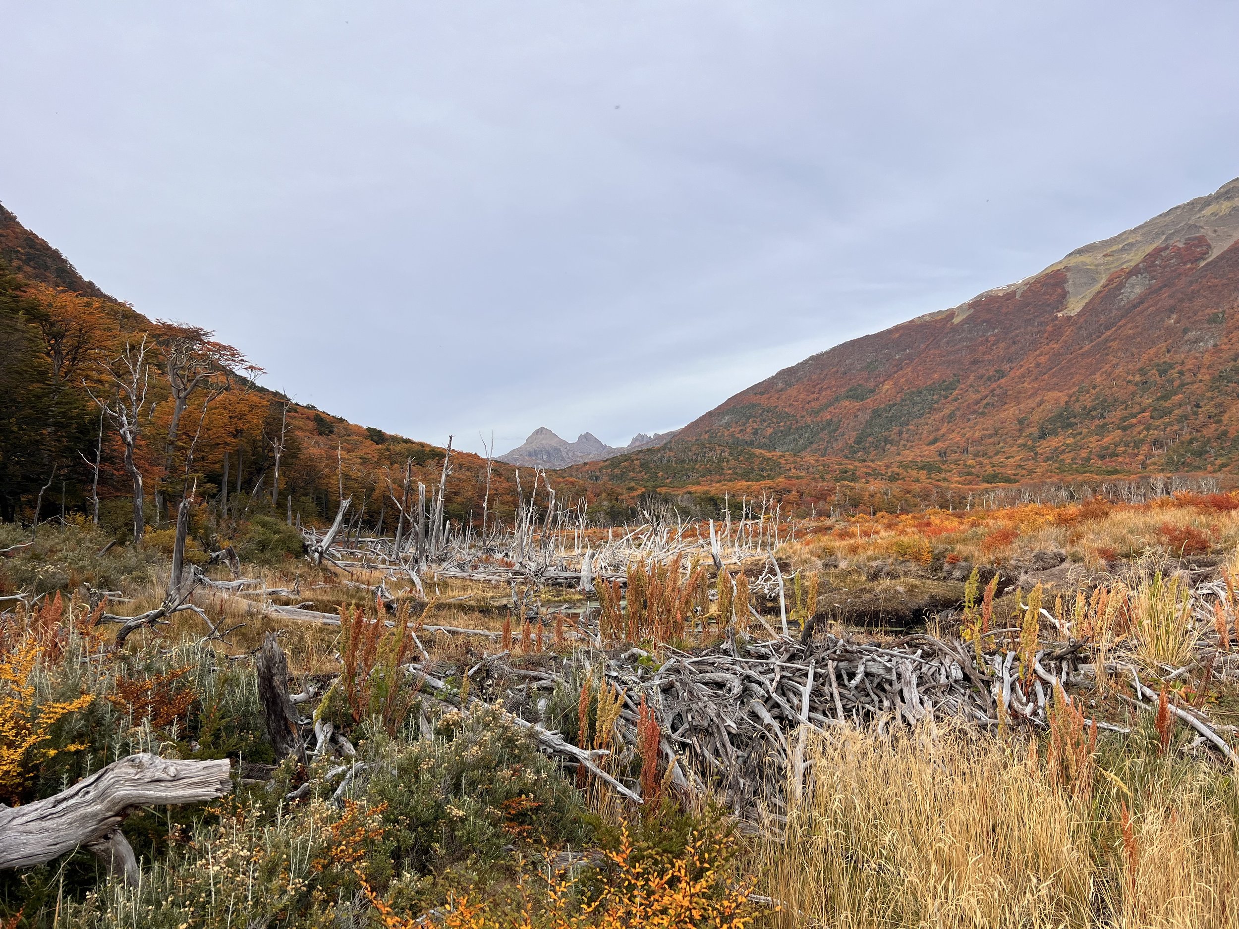
I knew wet feet were inevitable today, and the swampy terrain begins here. Beavers have left their mark on the landscape, creating ponds and fallen trees that turn the trail into an obstacle course. Despite the challenges, the walk is fascinating, with the vibrant autumn colors adding a touch of magic.
I stop for lunch by one of the first lakes. It looks like a natural lake, but upon closer inspection, I notice a pile of tree branches at one end. A beaver’s handiwork, perhaps?
Around 3 p.m., I reach the lake where I had initially planned to camp. It’s too early to stop, and walking has become easier on the so-called turbia. I wonder if I can still make it to Refugio Charles today.
As I continue, I find myself in a section of the forest where trees look like they’ve been felled by a giant axe. Was it a storm? A small trail leads straight into the water. Have beavers used these trees as raw material for their new home? Suddenly, I spot a beaver swimming in a small lake. Startled at first, I begin filming from a distance, but it doesn’t seem afraid at all, calmly swimming back and forth.
We watch each other for a while until it grows bored and swims to the other side to nibble on some grass. Though locals may see it as a pest, I find it quite charming. Here, it’s just a curious companion, bothering only a few hikers.
By 6 p.m., I find a flat, dry spot amidst the swampy surroundings and decide to stop for the night. Progress has been slow again, and I’m unsure if I’ll make it to Refugio Charles today. It will be dark by 7 p.m.
Dinner is couscous with veggie meat, cold-soaked—missing a few spices, so I toss in all the dry garlic I have left. It’s kinda okay. A few raindrops hit my tent, but nothing serious. I check the weather again and consider heading up to Monte Bettinelli instead of Lago Windhond tomorrow to enjoy the views and make it back to Puerto Williams before the rain kicks in two days.
As I turn off the light, the swampy, humid smell of my socks reminds me of today’s adventures.
At the Edge of the World: Monte Bettinelli and the Dientes Trail
17 April 2024 | 13°C
I’m heading up to Monte Bettinelli and the Dientes Trail! A quick look at the map shows the junction isn’t far. It’s a bit disappointing not to reach Refugio Charles, but I have to make the best of it.
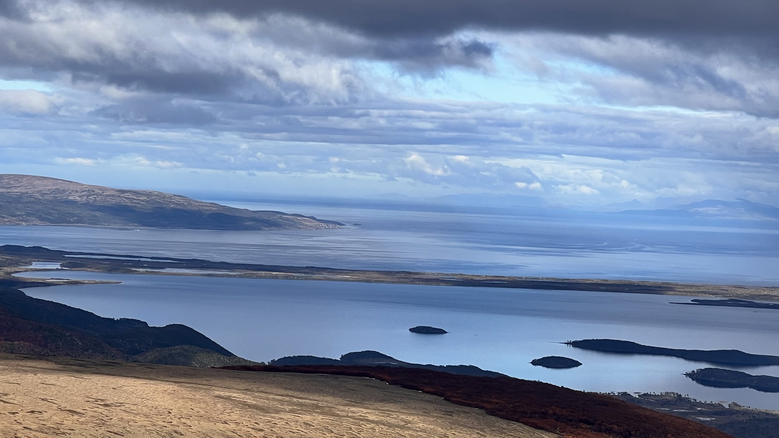
Suddenly, the forest opens up, and after crossing a small patch of lingering snow, I’m greeted by a vast, flat field of stones stretching out before me. My pace quickens immediately. A few peaks rise in the distance, but there’s no sign of the lake shown on the map. Where is the lake? And which one is Monte Bettinelli? Before I can figure that out, I turn around and am struck by the view. Lago Windhond and the bay with the same name come into sight.
I can’t stop staring and wish I could walk backward for the next few kilometers. I move forward, but every few steps, I stop, turn around, and snap another photo. I squint, trying to make out more islands in the distance. Could those be the Wollaston Islands? It must be. Though Isla Hornos and Cape Horn aren’t visible from here, the view feels magical. I’m so close to the southernmost islands before Antarctica.
Grateful for the clear weather, I feel a surge of excitement and end up missing the turn to Monte Bettinelli. Instead, I climb another hill and have to backtrack to find the right path.
Now I’m wondering: Do I have enough time to reach the plateau, or should I cut across further down? Can I still make it to Laguna El Salto, my planned camp spot for today? Will it be super windy up there? The idea of skipping the summit and heading straight to the valley is tempting, but I’m torn. I start walking down but quickly become frustrated with myself. “Hey, you’re so close to the summit, the weather’s good, and the walk on the rocks is probably easier than the swampy grass below. Stick to the trail!” I push on, and before I know it, I’m at the top, enjoying even more breathtaking views.
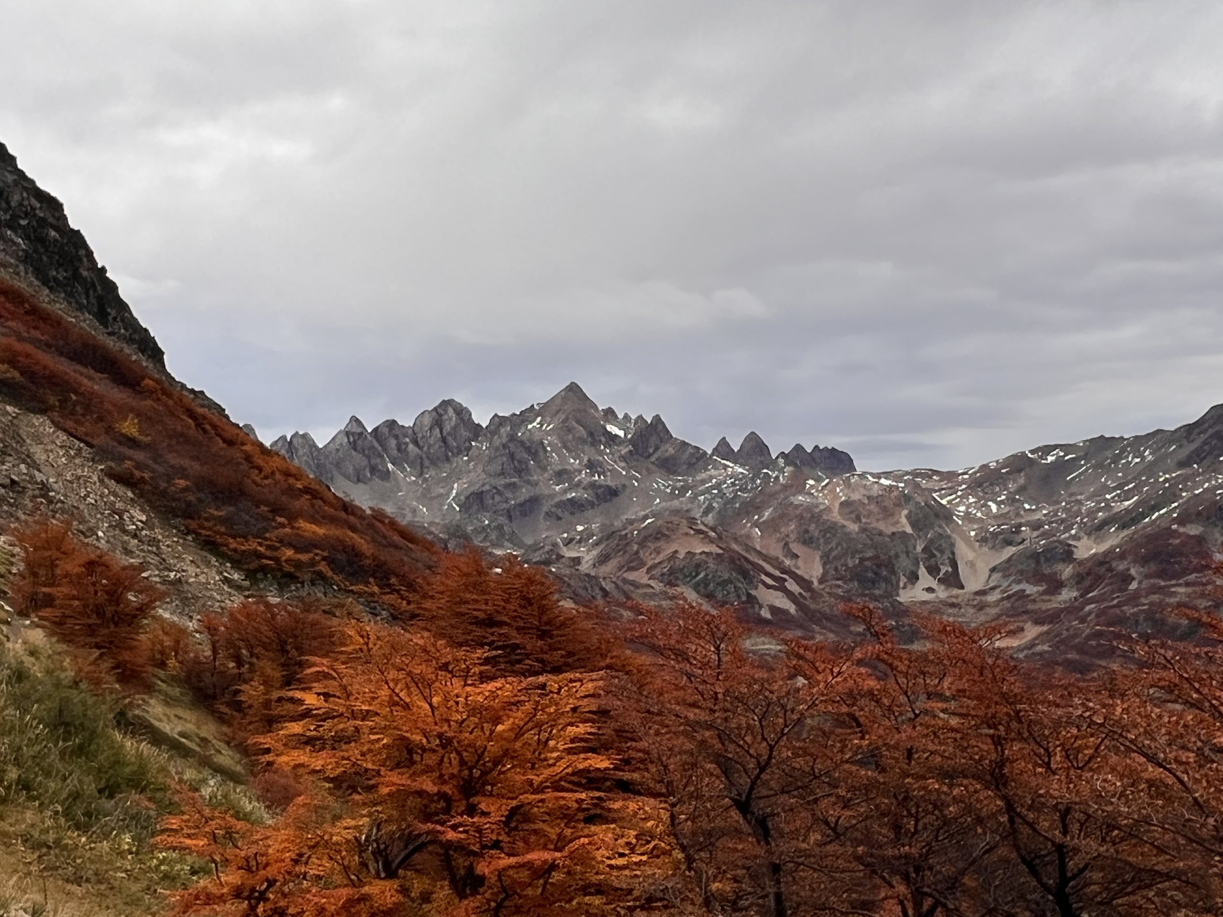
Now, I can see not only the south but also the impressive range of “Los Dientes de Navarino,” jagged like teeth that haven’t seen a dentist in a while. Running down the hill is easy across the stones, but once I hit the grassy terrain, I slow down—too easy to twist an ankle here.
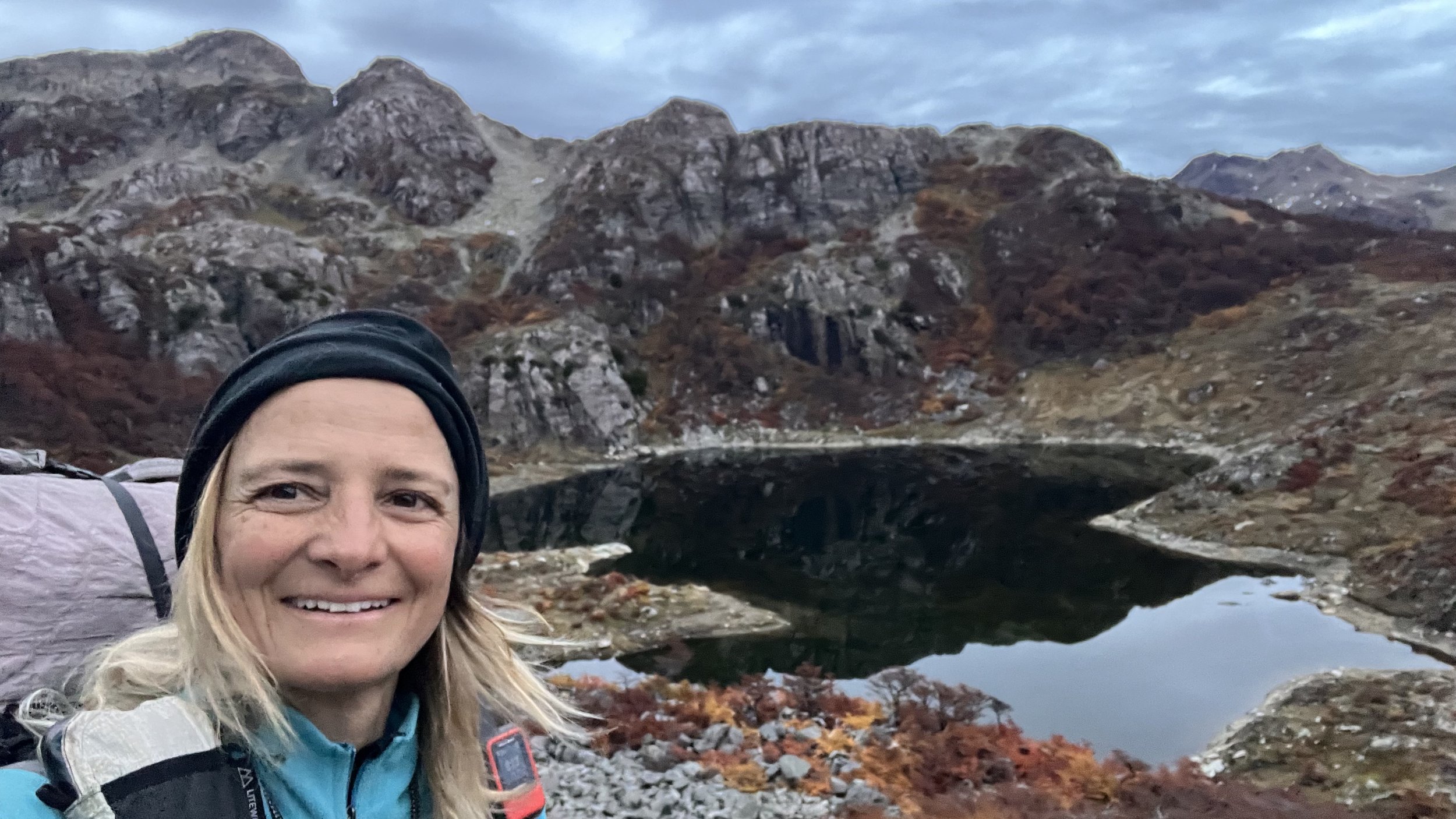
Just before reaching the junction with the Dientes Trail, I start to feel weak and tired. I realize I completely forgot to take a lunch break. With an inner urge to keep moving, I quickly down some peanuts for energy, but by the time I reach Laguna Los Dientes, I have to sit down for a longer rest. It’s a serene, secluded spot, and I’m the only one here. If only I could stay, but with rain expected tomorrow, it’s better to cover some more distance today.
The rest works wonders, and soon I’m back on the trail, making quick progress. Two more passes later, and Laguna del Salto comes into view. There are plenty of campsites around the shore, though most are wet, so I settle on a spot slightly higher up by some trees.
Is this my last night on the Greater Patagonian Trail?
The final Descent back to Puerto Williams
With a 60 percent chance of rain forecasted for 8 a.m., I planned to start early and reach Puerto Williams by lunchtime. But it’s hard to leave. Though there’s no sun this morning, the view of the Laguna El Salto and the Dientes, surrounded by more scattered lagoons and autumn-colored trees, is simply too beautiful to rush away from.
The trail ascends and then skirts along the mountainside. There are a few spots where the trail has washed away, and while this isn’t as steep as Paso Virginia, I’m glad I’m not doing this in heavy rain or snow.
As I continue, the Beagle Channel comes into view in the distance, and before I know it, I reach Cerro Bandera, a popular day hike from Puerto Williams, marked by a giant Chilean flag.
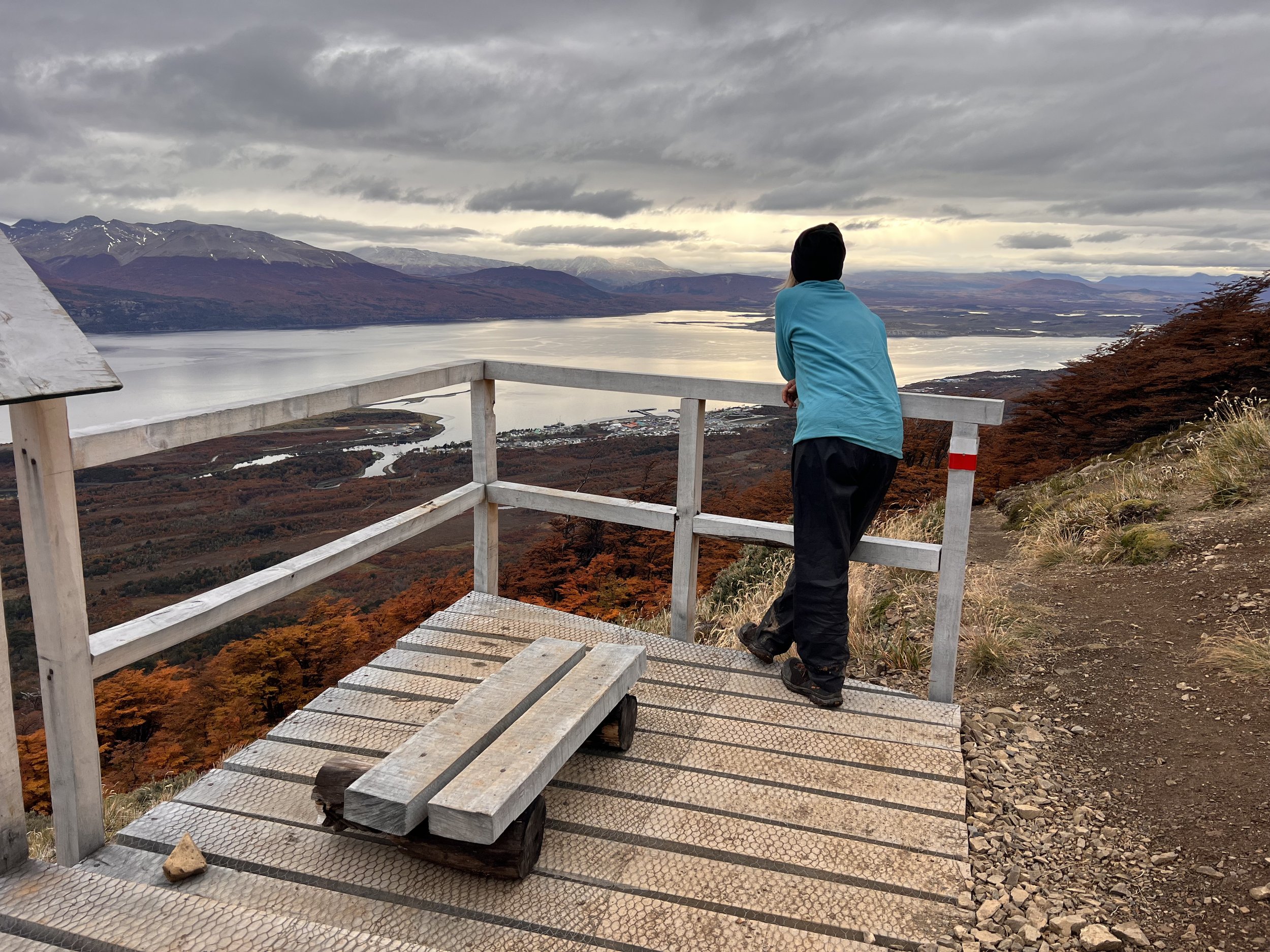
Though it’s all downhill from here, my progress is slow. I can’t help but stop and stare across the Beagle Channel. To the left, Ushuaia is visible in the distance, and to the far right, I can see Estancia Haberton on the Argentinian side. Just before the trail dips back into the trees, I spot someone running up the trail. A trail-running photographer? Or a photographing trail runner? Either way, it’s the first person I’ve seen since leaving Puerto Williams two days ago. But instead of striking up a conversation, I prefer to keep gazing across the Beagle Channel.
The clouds hang low, and I watch a ship leaving the port, wondering how sailors felt as they embarked from here toward Cape Horn or even farther. Or how the indigenous Yaghan once paddled across these waters in their small, kayak-like boats. It must have been freezing. Or maybe we’re just softer now?
As I finally make my way into town, I pass some school children who smile and greet me with a friendly “hello” in English. I guess I look like a tourist. :)


